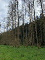
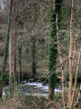
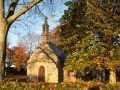
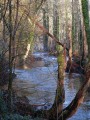
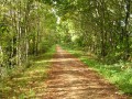
The banks of the Steïr and woodland from Menfouest Chapel

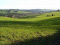
A return walk through unspoilt countryside along the Steïr, a tributary of the Odet, and then through the woods of this valley.
The route may take you across two bridges used by the TER train linking Quimper to Landerneau.
Along the route, you’ll find the Menfouest Chapel and Kergadou Manor.

Details

3725463
Creation:
Last update:
Last review:
  • Walking
    Activity: Walking
  • ↔
    Distance: 3.66 mi
  • ◔
    Average duration: 2h 00 
  • ▲
    Difficulty: Easy

  • ⚐
    Back to start: Yes
  • ↗
    Ascent: + 397 ft
  • ↘
    Descent: - 384 ft

  • ▲
    Highest point: 335 ft
  • ▼
    Lowest point: 102 ft
  • ⚐ Country: France
  • ⚐ City: Quimper (29000)
  • ⚑
    Start/End: N 48.056413° / W 4.100406°
  • ❏
    IGN map(s): Ref. 0518OT, 0519OT
  • Hour-by-hour weather

Photos

Description of the walk

_Access__: Leave Quimper via the D39 (north) and, at the Ty Pont Kerroué roundabout, take the Voie Romaine straight ahead for approximately 3.5 km. At the Garsabic junction, turn left (signposted ‘Chapelle de Menfouest’) and continue for about 1 km. Park on the left, opposite the chapel.

(S/E) Walk up the road, keeping the chapel on your left, and after about a hundred metres, turn right onto the Allée de Menfouest and follow this lane. Just before the tarmac path to a house ends, turn right onto a wide grassy track lined with a hedge of laurel. The path turns left and begins a long descent with a few slightly muddy sections. Continue to the River Steïr.

Carry on along a track that sometimes runs alongside the river and sometimes veers away from it. You’ll come to a crossroads.

(1) Carry straight on and pass under the railway bridge on the Quimper–Landerneau TER line. Follow the left bank of the Steïr along the edge of a meadow until you reach a footbridge to cross a small stream.

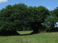
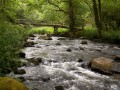
(2) Carry on along the river and notice an old oak tree that has seen many a tide come and go. You’ll come to a rustic footbridge made of two electricity poles, with a rope attached as a safety measure. This allows you to cross the river to see the Trogour waterfall on the opposite bank. Unfortunately, a fallen tree partially obscures the stream flowing from the waterfall. If you’re not sure-footed, don’t risk it.

(3) On the way back, turn right and follow the track as it moves slightly away from the river, which is lined with a beautiful row of poplars. You’ll come to another railway bridge and pass underneath it. Leave the riverbank and take the path which begins to climb. Pass an old, rusty gate and reach a crossroads.
Ignore the path on the left, turn right and begin a steep climb along a wide path that cuts through this wooded area. At the end, you’ll reach a road.

(4) Turn left and follow the road leading to the 16th-century Manoir de Kergadou, which is barely visible behind its high walls. Go round to the back (where it is more visible), then take the access road to the Kerbars farm on the left and arrive at the farm entrance (private road). Note two ponds and a fountain on the right-hand side, which are difficult to make out amongst the vegetation.

(5) Turn round and head back to the manor’s boundary wall, then follow the small road to the left which goes round it.

(4) Follow the route back in the opposite direction to the outward journey, going down and then back up the stream.

(1) After passing under the railway bridge, head back up the path you took on the way there. You’ll emerge onto Allée de Menfouest; at the road, turn left to return to the car park near the Menfouest Chapel (S/E).

Waypoints

  1. S/E : mi 0 - alt. 322 ft - Car park near Menfouest Chapel
  2. 1 : mi 0.68 - alt. 118 ft - Junction of the circular loop - Steïr (rivière)
  3. 2 : mi 0.79 - alt. 108 ft - Footbridge
  4. 3 : mi 0.95 - alt. 112 ft - Footbridge (electricity poles)
  5. 4 : mi 1.51 - alt. 253 ft - Kergadou Circular Loop
  6. 5 : mi 1.86 - alt. 226 ft - Fountain
  7. S/E : mi 3.66 - alt. 322 ft - Car park near Menfouest Chapel

Notes

There are no signposts on this route.
A well-shaded and quiet route.
Not always accessible in winter, depending on the river’s water level.

Worth a visit

Kergadou Manor
Menfouest Chapel. Please note: the fountain is on private land (signposted); ask the owner for permission (house just before the sign).

The banks of the Steïr: a quiet and peaceful spot.

Reviews and comments

3.7 / 5
Based on 4 reviews

Reliability of the description
3.8 / 5
Ease of following the route
3.5 / 5
Route interest
3.8 / 5
FredoS
FredoS

Overall rating : 3.7 / 5

Date of your route : Jul 02, 2023
Reliability of the description : ★★★★☆ Good
Ease of following the route : ★★★☆☆ Average
Route interest : ★★★★☆ Good
Very busy route : No

The lovely little chapel at Menfouest marks the start of the walk. . At point 3, you really must go and see the waterfall – it’s well worth a look – and the makeshift bridge isn’t all that difficult to cross. It’s true that at one point, even in summer, we got a bit bogged down, but it was nothing too serious.

Machine-translated

FLOCH
FLOCH ★

Hello,

It’s a shame you didn’t enjoy this walk – everyone has their own tastes depending on what they’re looking for.
Everything is disappointing: the simplicity of the description and how easy it is to follow the route. You didn’t get lost, though.
To say you need boots in the middle of summer – are you serious? Having done this route several times, I’ve never worn any.
A pair of trousers and good shoes are enough.

Your comment doesn’t reflect the two previous ones at all, one of which dates back to April.

Kind regards.

Machine-translated

Christiane RENAULT
Christiane RENAULT

Overall rating : 1 / 5

Date of your route : Jul 26, 2022
Reliability of the description : ★☆☆☆☆ Very disappointing
Ease of following the route : ★☆☆☆☆ Very disappointing
Route interest : ★☆☆☆☆ Very disappointing
Very busy route : No

A walk to avoid. We went there in the height of summer; it was impossible to get through – you’d need wellies. The path isn’t marked out; the farmer has to have cut the grass for you to get through. We turned back and set off again in the other direction; we managed to get a bit further, but it was a really rubbish walk.

Machine-translated

Cat29
Cat29
• Edited:

Overall rating : 5 / 5

Date of your route : Apr 05, 2021
Reliability of the description : ★★★★★ Very good
Ease of following the route : ★★★★★ Very good
Route interest : ★★★★★ Very good
Very busy route : No

A lovely, fairly challenging walk (with uphill and downhill sections) in the peaceful Steir Valley, amongst meadows and woods.
No cows this time between points 5 and 6, but they can be a problem when they’re around (no alternative route as the farm track is private).
You might, like us, be lucky enough to spot roe deer and ducks.

Machine-translated

Fanch29
Fanch29

Overall rating : 5 / 5

Date of your route : Sep 20, 2020
Reliability of the description : ★★★★★ Very good
Ease of following the route : ★★★★★ Very good
Route interest : ★★★★★ Very good
Very busy route : No

A lovely walk with a good description.
As for the waterfall, the fallen tree doesn’t stop you from getting close to the little waterfall. It’s a fun detour. Perhaps not suitable for children, though.
A shaded route. Good training for longer hikes (several ascents and descents).
Thank you!

Machine-translated

Other walks in the area

For more walks, use our search engine .

The GPS track and description are the property of this route's author. Please do not copy them without permission.