Route along the Aulne towpath via Vieux-Bourg

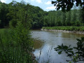
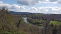
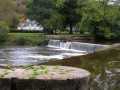
Stroll peacefully along the banks of the Aulne, following the towpath.
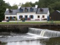
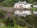
Views of the lock-keeper’s cottages on the opposite bank.
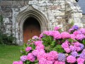
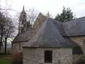
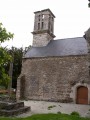
Pass through Vieux-Bourg and its Saint-They Church, the cradle of the parish of Lothey until 1846.

Details

n°144724
Creation:
Last update:
Last review:
  • Walking
    Activity: Walking
  • ↔
    Distance: 7.03 mi
  • ◔
    Average duration: 3h 30 
  • ▲
    Difficulty: Moderate

  • ⚐
    Back to start: Yes
  • ↗
    Ascent: + 312 ft
  • ↘
    Descent: - 331 ft

  • ▲
    Highest point: 292 ft
  • ▼
    Lowest point: 43 ft
  • ⚐ Country: France
  • ⚐ City: Lothey (29190)
  • ⚑
    Start/End: N 48.182445° / W 4.027574°
  • ❏
    IGN map(s): Ref. 0517OT, 0618OT
  • Hour-by-hour weather

Photos

Description of the walk

Car park: town hall car park.

Signposts marked in yellow and red

(S/E) Leave the car park on the right and head out of the village of Lothey via the Route du Vieux-Bourg, heading north.

(1) At the first junction (yellow signpost), turn left towards the large Kerével pig farm. Go round it on the left and, at the end of the farm, follow a hare trail. Continue along a widened sunken track that descends towards the towpath. You’ll soon hear the sound of water, signalling the first lock.

(2) Leave the towpath on your left (blue marker post) and continue to the right (yellow and red marker posts).

(3) Pass the Aulne Lock – one of the three you’ll come across on this route. The route follows the River Aulne for about 7 km. Throughout this section, you’ll notice a pretty flowering plant (July–August–September): the Himalayan balsam, which is unfortunately an invasive species that is difficult to eradicate.
Carry on and pass the second lock, the Guillec Lock.

(4) The river makes a wide bend to the right and is flanked by steep woodland.

(5) Reach the third lock, Tréziguidy Lock, and carry on, following a new bend, this time to the left. The trees form a very pleasant canopy. You’ll reach the end of the wooded section.

(6) At the first cultivated field (yellow and red signpost), turn right onto a stony path that climbs up along the edge of the woods. Note the ruins of an old dwelling on the right. Continue to the junction with the village road, which you follow to the left to reach the Old Village. You’ll come to the old Saint-They Chapel, which served as the parish church before the village was moved to Lothey by royal decree in 1846.

(7) Follow the road uphill to the right to leave the village. At the top of the hill, next to a ruin on the left and a house on the right (yellow and red signpost), turn off onto a farm track

(8) Follow this wide path until you reach a small road, which you then follow. Pass the road on your left, which ends at Poulhazec Farm.

(9) At the Y-junction, turn right, leaving the road leading to Kerliou Farm on your left.

(10) At the next village road, make a zigzag turn first left then right and continue along the farm track. (View of a row of wind turbines due west). Follow this grassy, descending track until you reach another village road.

(11) Turn left and follow this road, which initially descends.

(1) Then begin the final climb to reach the village of Lothey, a section you took at the start but which is now downhill (S/E).


Waypoints

  1. S/E : mi 0 - alt. 256 ft - Car park: town hall car park
  2. 1 : mi 0.22 - alt. 197 ft - Junction towards the Kerével pig farm
  3. 2 : mi 0.74 - alt. 56 ft - Towpath (marker)
  4. 3 : mi 0.79 - alt. 46 ft - Aulne Lock
  5. 4 : mi 1.99 - alt. 49 ft - Guillec Lock
  6. 5 : mi 3.78 - alt. 56 ft - Tréziguidy Lock
  7. 6 : mi 4.79 - alt. 59 ft - End of the riverside path
  8. 7 : mi 5.16 - alt. 105 ft - Old chapel in Vieux-Bourg
  9. 8 : mi 5.29 - alt. 157 ft - Farm track
  10. 9 : mi 5.99 - alt. 285 ft - Y-junction
  11. 10 : mi 6.25 - alt. 276 ft - Farm track opposite
  12. 11 : mi 6.53 - alt. 180 ft - Local road
  13. S/E : mi 7.03 - alt. 256 ft - Car park: town hall car park

Notes

Toilets at the car park at the start.
Signposts are placed at key points.
Best undertaken in fairly dry weather (risk of water spilling onto the towpath after a spell of rain).

You’ll inevitably have to walk round the large pig farm at the start to reach the towpath: if you have a sensitive sense of smell, you might want to give this a miss!

Worth a visit

Reviews and comments

4.4 / 5
Based on 11 reviews

Reliability of the description
4.6 / 5
Ease of following the route
4.8 / 5
Route interest
3.7 / 5
User 12033972

Overall rating : 5 / 5

Date of your route : Sep 03, 2026
Reliability of the description : ★★★★★ Very good
Ease of following the route : ★★★★★ Very good
Route interest : ★★★★★ Very good
Very busy route : No

CLG and PG.
Hike on 3 September 2026.
Used a GPS and a paper map.
Overcast, no wind, ideal temperature.
Set off at 9.30 am; returned to the starting point at 12.30 pm.
Access to the sunken path leading to the canal from Kerével Farm is extremely difficult. After crossing the farm from one end to the other, the GPS proved indispensable in helping us find the path’s entrance, which was hard to spot. The path is blocked by a red and white chain. Once we’d stepped over the chain, we still wondered whether we’d made the right decision. After a few metres through some wasteland, we managed, with some difficulty, to find the well-cleared path leading to the canal without any trouble.
From then on, the route is magnificent.
The towpath was cleared at the end of last June and presents no particular difficulty for walking.
However, nature is beginning to reclaim its territory.
We didn’t come across a single soul. The towpath itself was very quiet.
Autumn colours…
The wild beauty of the ‘old village’ and its church.
The final stretch takes us along farm tracks and leads us back to the village.
No picnic tables in the village centre.
A very lovely walk.
We’d like to take this opportunity to remember Jakez RIOU, one of our greatest writers in the Breton language, a native of Lothey, whose charm and poetry he so skilfully captured in his writing.

Machine-translated

FLOCH
FLOCH ★

Hello and thank you for your opinion.
It's true that this wilder route does not use the towpath, which is on the other bank.
As the title of the walk indicates, you are on the "counter towpath", which is not maintained like the towpath.
This is the only way to reach the Vieux Bourg site along the Nantes-Brest canal.
There are also walks along the towpath.
Yours faithfully

Machine-translated

Mike L.
Mike L.

Overall rating : 3.3 / 5

Date of your route : Jul 16, 2024
Reliability of the description : ★★★★☆ Good
Ease of following the route : ★★★★☆ Good
Route interest : ★★☆☆☆ Disappointing
Very busy route : No

The first part, passing through the middle of a pigsty, is a little surprising - with the extension of the buildings, the route is significantly different from the one recorded - but once you have passed the "smelly" part, you reach the edge of the canal on a pleasant forest path. Here, surprise, you're not on a path at all, but at most on a "path" cut mechanically into the flora... if you're looking for a hard path, you'll have to take the walk on the other side of the canal. Nevertheless, we pushed on, motivated by our discovery hike... our motivation waned after the second lock - which was splendid, by the way - because of this "pseudo" path, which put a strain on our ankles... and the rather monotonous aspect - punctuated by the risk of slipping or catching our foot in a hole - didn't help. So at the 3rd lock we headed back inland and picked up the route at marker 11. It's a shame, as it looked really good on paper and in the photos.

Machine-translated

FLOCH
FLOCH ★

Thank you very much. I'm going to change it.
There has been a change at this point because before we used to take the second track.
Good luck on Visorando.

Machine-translated

Reider
Reider

Hello,
The first milestone I have on the track is at "Kerevel". Coming from the Mairie de Lothey at this point (about 400m from the start) I turned left. There are 2 parallel tracks. The track indicates the second, you have to take the first. I hope I've made the location clearer

Machine-translated

FLOCH
FLOCH ★

Thank you for your opinion.
I'm not sure exactly where you mean:
"At the first milestone you have to take the first lane and not the second, which now comes together at a gate (private property)".
Sincerely

Machine-translated

Reider
Reider

Overall rating : 5 / 5

Date of your route : Sep 13, 2023
Reliability of the description : ★★★★★ Very good
Ease of following the route : ★★★★★ Very good
Route interest : ★★★★★ Very good
Very busy route : No

Walk made on 13 September 2023. Very pleasant route. 2 minor changes
1 At the first milestone, take the first track and not the second, which now leads to a gate (private property).
2 About 1.2 km from the start, take the mapped path that goes straight to the Aulne lock.
As for the rest, everything is as mapped.
Thanks Floch.

Machine-translated

bihen29
bihen29

Overall rating : 4.3 / 5

Date of your route : Aug 23, 2022
Reliability of the description : ★★★★★ Very good
Ease of following the route : ★★★★★ Very good
Route interest : ★★★☆☆ Average
Very busy route : No

Hello,
This tour was done in very dry weather (heatwave) and presented no difficulties. The path was clear. The walk seemed a little monotonous despite the locks and the view of the meandering river.
This route is obviously not very popular compared with the other bank, where walkers and cyclists were in abundance.

Machine-translated

FLOCH
FLOCH ★

Thank you for your opinion.
When I found this route and then redid it with my walking group, there wasn't this problem.
It happens when local authorities put routes on their website but then there's no follow-up.
Sincerely

Machine-translated

aldelpech
aldelpech

Overall rating : 4.7 / 5

Date of your route : May 29, 2022
Reliability of the description : ★★★★★ Very good
Ease of following the route : ★★★★★ Very good
Route interest : ★★★★☆ Good
Very busy route : No

The start of the circuit is very good, with a beautiful view of the Alder and the associated locks and houses.
Unfortunately, the path has not been mown recently and the further we walked, the harder it was to make out the path. And the bigger the nettles, the more they stung our hands and arms....
Shortly after the second lock, we passed along the edge of a field to leave the Aulne and head out into the countryside.
So this is not a hike I would recommend, unless you know for sure (perhaps by phoning Lothey town hall beforehand?) that the route has been cleaned up recently.

Machine-translated

Richardstain
Richardstain

Overall rating : 2.7 / 5

Date of your route : Sep 19, 2018
Reliability of the description : ★★☆☆☆ Disappointing
Ease of following the route : ★★★★☆ Good
Route interest : ★★☆☆☆ Disappointing

The walk has a nasty start through an evil smelling pig farm. Then it follows the river which is wide and slow flowing. A rather boring walk.

abaussan56
abaussan56

Overall rating : 4.7 / 5

Date of your route : Oct 07, 2017
Reliability of the description : ★★★★★ Very good
Ease of following the route : ★★★★★ Very good
Route interest : ★★★★☆ Good

A pleasant route with a long stretch along the banks of the Aulne. Beautiful lock houses along the way. Three hours to complete.

Machine-translated

louane2010
louane2010

Overall rating : 4.3 / 5

Date of your route : Apr 17, 2017
Reliability of the description : ★★★★★ Very good
Ease of following the route : ★★★★★ Very good
Route interest : ★★★☆☆ Average

flat circuit almost entirely on the banks of the aulne a little monotonous for my taste but beautiful lock houses

Machine-translated

FLOCH
FLOCH ★

I did this walk today with my walking group.
There is a small section of path between (10) and (11) where the vegetation has re-grown.
This section has not been maintained for some time, although the path has only recently been rehabilitated.
Let's hope there will be a follow-up.
FLOCH

Machine-translated

FLOCH
FLOCH ★

Thank you for your comment and these clarifications.
I just have to do it again with my walking group next Thursday, 18 August.

Sincerely

FLOCH

Machine-translated

Other walks in the area

For more walks, use our search engine .

The GPS track and description are the property of this route's author. Please do not copy them without permission.