Country:
 City:
City:


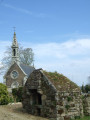
How to get there: From Quimper, take the D15 towards Coray. At the large roundabout at Croas Spern, near the Blue Solutions factory, take the last exit towards Lestonan, a district of Ergué-Gabéric. At the school, turn left into Rue du Menez and go round a roundabout. At the next junction (signposted ‘Chapelle Saint-Guénolé’), veer to the right. The chapel is situated about 600 metres further on, on the left.
GR®38signposting: White and Red
(S/E) From the chapel, follow Rue Saint-Guénolé to the left and turn left at the stop sign onto Rue de Quélennec. Take a slight detour fromthe GR® route to pass near the water tower via the street of the same name. Continue for a few dozen metres along the previous street.
(1) Turn right and follow the Chemin du Stangala (signposted ‘Site du Stangala’), which is initially tarmac-surfaced and then becomes a track suitable for vehicles. Pass under the power lines, leaving the entrance to a farm on your left, and you’ll come to a large car park (information sign about the site). Go through the barrier and cross this wooded area. You’ll come to a signpost marked ‘Tréouzon footbridge’ (right) and ‘Meilh Poul footbridge’ (left). Turn right onto theGR® and begin a long descent along a wide path that starts with a few bends. Please note that the map is no longer accurate for theGR® route.
Unmarked section
(2) At the signpost, leave theGR® to your right and continue the long descent towards the Odet, heading north-west. You’ll reach a wooded area of conifers on your left, then a signpost marked ‘Tréouzon footbridge’ (right) and ‘Meilh Poul footbridge’ (left). Turn right as you face the river to head towards the Tréouzon footbridge.
GR®38markings: White and Red
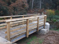
(3) Cross the footbridge and turn immediately left to follow the river along the right bank.
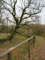
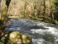
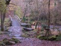
Please note: theGR® route is actually on the right bank, not the left bank as shown on the map. Ignore a path that climbs to the right and follow the riverbank. The narrow path, lined with an old wooden railing, climbs up overlooking a bend in the river. Continue on, cross two small wooden footbridges and reach a signpost marked ‘Tréouzon’.
No signposting (Note: there is an ‘unofficial’ green dot marking which can serve as a landmark but is not permanent.)
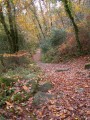
(4) Turn right and begin a climb, emerging opposite a field at a signpost. Turn left and follow the path running alongside this field. Continue uphill via a log staircase and follow this well-marked path, which winds its way up through the trees until it reaches a low stone wall. Walk alongside this wall on your right, cross a cleared area and pass through the opening in the wall.
Carry on straight ahead along the wide path through the trees until you reach another path (old General Council sign, protected natural area).
(5) Turn right, go through a gate and turn left twice (end of the ‘unofficial’ green dot markings). Take a stony path between two fields. Follow it straight on until you reach a road.
(6) Turn left to cross the Stancou car park (the busiest car park for accessing Stangala from the Quimper side). Go through the barrier at the edge of the car park (information sign) and carry on straight ahead. At the three-way junction, veer to the right despite the Yellow Cross and begin a steep descent towards the river. This is a wide path running along the rock face which was used to access the mill on the Odet until 1925.
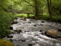
Please be careful: in wet weather, these stones can be slippery. Gradually, you’ll start to hear the river. You’ll reach the wooden footbridge at Meilh Poul.
PR® signposting: Yellow (in the opposite direction to the route)
(7) Cross it and you’ll come to a signpost marked ‘Tréouzon’ (left) and ‘Griffonnés’ (right). Follow the path climbing to the right, which leads away from the river on your right, past the ruins of an old mill – hence the name of the place. Follow this path as it climbs steeply. On your right, you’ll come across low walls that would have marked out plots of land. Also look out for a small fountain on the right, followed shortly afterwards by a beautiful granite trough, then another fountain and an old washhouse. Pass through a wooded area of holly and arrive at the edge of the woodland on the plateau. Turn right towards the car park and pass the first signpost you encountered on the way there.
Follow the path you took on the way there in the opposite direction to return to the chapel (S/E).

 Visorando Member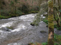
 Easy
Easy