Countryside and panoramic views near Edern

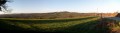
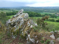
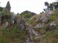
A route mainly along small country roads offering lovely views of the Montagnes Noires.

Details

48109
Creation:
Last update:
Last review:
  • Walking
    Activity: Walking
  • ↔
    Distance: 6.35 mi
  • ◔
    Average duration: 3h 15 
  • ▲
    Difficulty: Easy

  • ⚐
    Back to start: Yes
  • ↗
    Ascent: + 351 ft
  • ↘
    Descent: - 328 ft

  • ▲
    Highest point: 738 ft
  • ▼
    Lowest point: 486 ft
  • ⚐ Country: France
  • ⚐ City: Edern (29510)
  • ⚑
    Start/End: N 48.125116° / W 3.984967°
  • ❏
    IGN map(s): Ref. 0618OT
  • Hour-by-hour weather

Photos

Description of the walk

Access: In Briec, follow the D72 towards Edern. Pass the police station and, after the roundabout, take the first road on the left which passes through Langelin, Pennanéac’h and its wayside cross. Then turn right towards Ty Nevez ar Groas, then turn right again. The chapel is situated on the left in the hamlet of Landivigen.
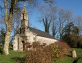
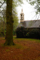
Starting point: Saint-Symphorien Chapel in Landivigen.

(S/E) From the chapel, return to the road and turn right to head up towards Ty Nevez Ar Groaz. Turn left

(1) Pass a small road on the left and take the stony track leading down to the hamlet of Stang-Kergoulay.

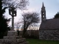
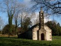
(2) Turn right towards Hellen, where you’ll find the Chapel of Notre-Dame-du-Hellen and its calvary.

(3) Continue along the narrow country lane, leaving the road leading to Ty Fléhan on your right.

(4) Carry on straight towards Kermalféta and pass through the village. There’s a lovely view of Karreg an Tan (279m) on your left. Pass the motocross track on your right to reach Croissant Glaz, where you’ll turn right.

(5) Follow this small road, from which you’ll have a view of the Montagnes Noires. On your left is the summit of Belle Roche, 239m. Join the road coming from Gouézec and follow it to the right to reach Ty Fléhan.

(6) In the hamlet, leave the road leading to Edern on your left, turn right to go round the village of Ty Fléhan, leave the road towards Hellen and rejoin the road to Landivigen on your right. Follow this road.

(7) At the sign for Park An Oac’h Ru, take a short 100-metre detour to the right to see a washhouse and fountain currently being restored (signposted). Return to the road and follow it to the right. Pass the road to Menez Roch Tourment and then the road to Menez Landivigen.

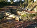
(8) Turn left onto the stony track leading to the Chapel of Saint-Symphorien, the starting point of the route (S/E)

Waypoints

  1. S/E : mi 0 - alt. 653 ft - Chapelle Saint- Symphorien
  2. 1 : mi 0.33 - alt. 686 ft - Ty Nevez ar Groaz
  3. 2 : mi 0.89 - alt. 499 ft - Turn right towards Hellen
  4. 3 : mi 1.53 - alt. 499 ft - Notre-Dame-du-Hellen Chapel and Calvary
  5. 4 : mi 1.93 - alt. 502 ft - Straight on to the three-way junction
  6. 5 : mi 3.1 - alt. 617 ft - Croissant Glaz
  7. 6 : mi 4.53 - alt. 722 ft - Ty Fléhan
  8. 7 : mi 5.45 - alt. 692 ft - Signpost for Park An Oac’h Ru
  9. 8 : mi 6.13 - alt. 722 ft - Junction. Return to the starting point.
  10. S/E : mi 6.35 - alt. 653 ft - Chapelle Saint- Symphorien

Notes

Route mainly along small country roads.

Worth a visit

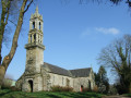
Saint Symphorien Chapel in Landivigen
Notre-Dame-du-Hellen Chapel
Gouezec: route leading to the summit of Karreg An Tan.
Panoramic view of the Montages Noires

Reviews and comments

3.8 / 5
Based on 4 reviews

Reliability of the description
4.3 / 5
Ease of following the route
4.5 / 5
Route interest
2.8 / 5
FLOCH
FLOCH ★

Thank you for your feedback.
"There’s no heritage there."
Perhaps you walked past two chapels without noticing them?

Machine-translated

jean marc brosse
jean marc brosse

Overall rating : 3.3 / 5

Date of your route : Aug 04, 2023
Reliability of the description : ★★★★☆ Good
Ease of following the route : ★★★★★ Very good
Route interest : ★☆☆☆☆ Very disappointing
Very busy route : No

This walk is a complete waste of time; what’s more, there’s absolutely nothing of historical interest there.

Best forgotten as soon as possible.

Jean Marc

Machine-translated

FLOCH
FLOCH ★

Thank you for this review.
Did you read the description before setting off?
"The route mainly follows small country roads."
Kind regards

Machine-translated

FredoS
FredoS

Overall rating : 3.7 / 5

Date of your route : Jul 14, 2021
Reliability of the description : ★★★★☆ Good
Ease of following the route : ★★★★★ Very good
Route interest : ★★☆☆☆ Disappointing
Very busy route : No

A route with very little traffic but well-paved. The wash house at the end of the walk is well worth a look.

Machine-translated

FLOCH
FLOCH ★

Thank you for this review.
I’ve actually just noticed a discrepancy at (7).
I’ll look into this in more detail.
All the best with Visorando

Machine-translated

Claude47
Claude47

Overall rating : 3.7 / 5

Date of your route : Aug 15, 2017
Reliability of the description : ★★★★☆ Good
Ease of following the route : ★★★☆☆ Average
Route interest : ★★★★☆ Good

An interesting route, particularly for the views over the Montagnes Noires. It’s a shame it isn’t signposted. The section between Ty Nevez ar Groas and Landivigen (points 8 to 1) isn’t straightforward.

Machine-translated

Nanor Redayug
Nanor Redayug

Overall rating : 4.7 / 5

Date of your route : Jan 12, 2017
Reliability of the description : ★★★★★ Very good
Ease of following the route : ★★★★★ Very good
Route interest : ★★★★☆ Good

A lovely walk despite the heavy drizzle!
A detour via the Picart Garden (private but open to the public) is well worth a look. Stunning views on a clear day.
Return via the Kermarzin path to minimise the amount of tarmac you walk on.

Machine-translated

Other walks in the area

For more walks, use our search engine .

The GPS track and description are the property of this route's author. Please do not copy them without permission.