Country:
 City:
City:


Start at the Maison Pour Tous, 47 Chemin de Prateyer, in Quimper.
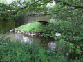
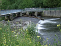
(S/E) With your back to the car park in front of the MPT at Moulin Vert, head south with the grassy esplanade on your left, go round the public toilets and head towards the River Steïr. Turn left and follow the right bank of the river. Pass the first metal footbridge on your right, reach the weir and cross via the footbridge.
(1) Leave the riverbank and take the path leading uphill opposite, which passes through a small wooded area. At the top, turn right, leaving the Coat Ty Dreux community gardens on your left, and rejoin the river at the footbridge you passed earlier.
Ignore it again and follow the course of the river along the Promenade du Manoir des Salles until you reach a new metal footbridge, which was opened in July 2026.
(2) Turn right onto this footbridge, which leads to a small, newly created concrete esplanade on the banks of the Steïr. Cross it (chairs, a small table and even a deckchair) and head for the nearby roundabout on the left.
(3) Go round the roundabout on the right and turn into the street opposite, to the right of the “Wash Café”. Follow this uphill street, passing a dead-end on your left, and continue for a few more metres.
Take the sharp right-hand bend into a small one-way street called “Garenne de Kermabeuzen” (book box at the entrance). Follow this street, which climbs steadily and occasionally offers glimpses of the western side of Quimper. Continue to the end of the street.
(4) At a large pine tree, veer right and take a path that continues to climb. Pass through a gate, cross a road and climb a few steps. Continue along the same sunken path and pass to the right of the buildings of the former Franciscan monastery of Kermabeuzen (mid-20th century), converted into social housing since 1998.
You’ll emerge into a hare-run, which you cross by following a single track. After a small wooded area crossed by a little stream, turn right and continue along another hare-run. You’ll emerge at a place called Kerlazenet, which is marked only on the map.
(5) Turn left and follow the path which runs alongside a large housing estate. At each fork, keep the housing estate on your right and you’ll reach a large electricity substation. Walk alongside it, then cross a road just before the bridge over Quimper’s northern ring road.
(6) Turn right onto the farm track running alongside the fields and emerge onto the Allée de Kerayen, a beautiful beech-lined avenue that was cut off during the construction of the North-West Bypass (CNO). Walk down this avenue and, at the end, turn left onto the Allée Abbé Paul Peyron, which leads down towards Saint-Conogan Cemetery. At the stop sign, go past thefirst street and you’ll come to another stop sign on the Route de Locronan (D63).
(7) Turn left and follow this road alongside the tree-lined cemetery. Continue via a pedestrian crossing and you’ll reach a large roundabout. Use the pedestrian crossings to go round it on the right and follow the sign for ZI Kergolvez. Pass a street on your right and cross over the Quimper–Landerneau railway line.
(8) At the bend, ignore the road leading to the industrial estate, pass through a metal barrier and follow the path down towards retention basin No. 31. The path joins the Steïr, which is somewhat obscured by the trees. Follow this path as it runs alongside the river, past meadows on your right. You’ll reach the Centre Avel Mor, a children’s home of a social nature, enclosed by a wire fence. Follow this fence, go under the railway bridge and arrive at the start of a street. Continue along the path running parallel to this street (note, on the right, the row of houses built in the 1950s, perfectly symmetrical) to reach the car park near the MPT du Moulin Vert (S/E).
.

 Visorando Member


 Moderate