Country:
 City:
City:


Start from the car park opposite the gendarmerie in Briec, Route de Landudal.
(S/E) Head south-southeast towards Landudal and walk along the right-hand side of the road.
(1) At the "Ty Nevez Pennarun" sign, cross the road carefully to enter the Bois de la Boissière. Turn right immediately and follow a path parallel to the road until you reach the edge of the woods.
(2) Turn left onto Route du Château. At the next intersection, turn left.
(3) Continue along the road and pass the entrance to Manoir de la Boixière. At the crossroads, turn right and you will immediately come to a fork.
(4) Take the road on the right, leaving La Petite Boissière on your left, and cross the hamlet of Ménez Barré.
(5) Take the first path on the left. At Kerbustoc'h, take a small road on the right.
(6) At Kerguèlen, take a path on the left. Cross a stream, come out onto a small road and follow it to the right.
(7) After about 350 m, take a path on the left and climb (it can be slippery in winter). Come out onto a small road and follow it to the left. Descend slightly, cross a stream and climb up the other side to the Merdy farm.
(8) Follow the road to the right for about 300 metres.
(9) Enter a field on the left, walk carefully along it, then go down the path at the end to the bottom.
(10) At the bottom, cross a slope, then turn left onto a path. Follow it to the end, veering left and going uphill. Cross a field to reach a gravel path.
(11) Follow this path to the right and descend slightly. At the end, turn right and descend more steeply. You will come to a small road; follow it to the left for about 50 metres.
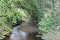
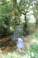
(12) Turn right onto a path into a small wood. Immediately turn right and follow a stream on your left. At the end, exit to the right of the bridge.
(13) Continue on the D50 to the left and cross the stream. Take the second road on the left, at the sign for "La Boissière".
(4) At a junction you passed earlier, first turn right then left and pass the Manoir de la Boixière again.
(3) Just after the entrance to the manor, turn right onto a path marked by a wooden barrier. Cross two footbridges and climb up to the Route de Landudal.
(1) Follow the road to the right, keeping to the left-hand side. This will take you back to the car park opposite the police station (S/E).

 Visorando Member
 Easy
Easy