


Refine your search for walks in Jouars-Pontchartrain
Jouars-Pontchartrain walks
 Bois de Saint-Apolline at Château de Plaisir
 Visorando Member
 5.22 mi
 +177 ft
 -177 ft
 2h 35
2h 35
 Easy
Easy
 Departure from Plaisir (Yvelines)
A short walk through the woods will take you to Saint-Pierre-de-Plaisir Church and Plaisir Castle.
From Villiers-Saint-Frédéric to Feucherolles
9.95 mi
+791 ft
-545 ft
5h 15
 Moderate
Departure from Villiers-Saint-Fréderic (Yvelines)
Moderate
Departure from Villiers-Saint-Fréderic (Yvelines)
This stage is the last of the old GR®1 route. The departure point is at Villiers-Saint-Frédéric, at the RER station. The entire route is rural. It passes through several villages, including Saint-Germain-la-Grange, Thiverval-Grignon and Davron. There are two notable churches: those of Davron and Thiverval-Grignon, not to mention Feucherolles. This is an undemanding section that allows you to finish the GR®1 at a leisurely pace.
Circular Villiers-Saint-Frédéric to Château de Plaisir
 9.12 mi
+420 ft
-436 ft
4h 35
Moderate
Departure from Villiers-Saint-Fréderic (Yvelines)
9.12 mi
+420 ft
-436 ft
4h 35
Moderate
Departure from Villiers-Saint-Fréderic (Yvelines)
A walk accessible to all, starting from Villiers-Saint-Frédéric station, to explore the park and the Château de Plaisir. This walk takes you through fields, the market square in Plaisir and the castle grounds. The return journey takes you through the Sainte-Apolline forest and the pretty village of Neauphle-le-Château.There are several water points if you have a dog. The route is accessible all year round. It may be a little muddy, but it remains accessible in the forest during the rainy season.
The Tremblay-sur-Mauldre circular route
11.07 mi
+551 ft
-571 ft
5h 35
Moderate
Departure from Villiers-Saint-Fréderic (Yvelines)
This is a walk around Pontchartrain, passing through Villiers-Saint-Frédéric, Neauphle-le-Vieux, Mareil-le-Guyon and Tremblay-sur-Mauldre. You will follow restored footpaths amongst castles, rivers and fields.
From Villiers-Saint-Frédéric to Orgerus in the heart of the Yvelines
 13.88 mi
+499 ft
-348 ft
6h 50
13.88 mi
+499 ft
-348 ft
6h 50
 Difficult
Departure from Villiers-Saint-Fréderic (Yvelines)
Difficult
Departure from Villiers-Saint-Fréderic (Yvelines)
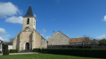
Fourth stage of the Grand Tour de l'Île-de-France on the GR® 11 and start of the clockwise circular section.This stage takes place entirely in the Yvelines department, connecting Villiers-Neauphle-Pontchartrain station to Orgerus-Béhoust station, crossing the Beynes forest and the agricultural landscapes of the Yvelines.
The route runs alongside the Avre aqueduct, which supplies drinking water to western Paris.
Circular country between Villiers-Saint-Frédéric and Neauphle-le-Château
 4.60 mi
+305 ft
-308 ft
2h 25
Easy
Departure from Villiers-Saint-Fréderic (Yvelines)
4.60 mi
+305 ft
-308 ft
2h 25
Easy
Departure from Villiers-Saint-Fréderic (Yvelines)
A circular route starting from Villiers-Saint-Frédéric station and crossing the village of Neauphle-le-Château. This route alternates between fields and charming little paths to reach the village square.
Along the way, you will discover wide open spaces, a small lake, an orientation table, a farmyard housing an old church, old stones, and the charm of the square in Neauphle-le-Château with its narrow cobbled streets.
From the Courance Basin towards Chennevières, La Richarderie and Ergal
 4.11 mi
+246 ft
-243 ft
2h 05
Easy
Departure from Maurepas (Yvelines)
4.11 mi
+246 ft
-243 ft
2h 05
Easy
Departure from Maurepas (Yvelines)
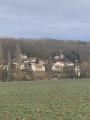
Starting from the Bassin de la Courance in Maurepas, you will walk through woods, fields and small hillside villages. This hike is accessible to everyone, young and old alike.
Short circular loop around the Courance Basin
 1.95 mi
+157 ft
-144 ft
1h 00
Easy
Departure from Maurepas (Yvelines)
1.95 mi
+157 ft
-144 ft
1h 00
Easy
Departure from Maurepas (Yvelines)
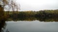
A very short walk to get some fresh air around a pond that is home to many birds. Along the way, you will discover a Gothic-style church, the ruins of the keep of the former Château de Maurepas and a remarkable oak tree.
A circular walk from Saint-Germain-de-la-Grange to Mareil-le-Guyon
 14.89 mi
+840 ft
-843 ft
7h 35
Difficult
Departure from Saint-Germain-de-la-Grange (Yvelines)
14.89 mi
+840 ft
-843 ft
7h 35
Difficult
Departure from Saint-Germain-de-la-Grange (Yvelines)
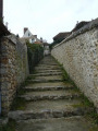
Circular route which, on the outward leg, follows the GR®1 from Saint-Germain-de-la-Grange to Mareil-le-Guyon. The route, which often runs through fields, passes through Neauphle-le-Vieux, Jouars-Pontchartrain and Neauphle-le-Château.
Bazoches-sur-Guyonne - Les Mesnuls - Montfort-Lamaury
 9.60 mi
+689 ft
-689 ft
5h 00
Moderate
Departure from Bazoches-sur-Guyonne (Yvelines)
9.60 mi
+689 ft
-689 ft
5h 00
Moderate
Departure from Bazoches-sur-Guyonne (Yvelines)
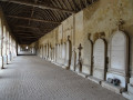
It's a very varied walk, combining nature, culture, history, tourism and curiosities. All of which means you won't miss a mile. And if you're lucky enough to do it in good weather, you'll come home feeling like you've just been on holiday.
Circular route between Bazoches-sur-Guyonne and Montfort-l'Amaury
 13.04 mi
+883 ft
-892 ft
6h 45
Difficult
Departure from Bazoches-sur-Guyonne (Yvelines)
13.04 mi
+883 ft
-892 ft
6h 45
Difficult
Departure from Bazoches-sur-Guyonne (Yvelines)
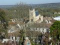
Whilst remaining in the countryside, this walk allows you to discover, amongst other things, Jean Monnet’s house in Bazoches, the Château des Mesnuls and the historic centre of Montfort-l’Amaury. 20/02/2019
On the hillside in the Bois de Maurepas
 2.60 mi
+184 ft
-194 ft
1h 20
Easy
Departure from Maurepas (Yvelines)
2.60 mi
+184 ft
-194 ft
1h 20
Easy
Departure from Maurepas (Yvelines)
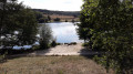
You will cross from one side of the small valley to the other, where the Ru de la Courance flows, and on the opposite side you will follow a hillside route amongst mainly oak and chestnut trees, as well as ferns and heather in season. You will have the opportunity to walk alongside the Bassin de la Courance, either close by or at a distance.
Elancourt-Maurepas
 10.37 mi
+689 ft
-689 ft
5h 20
Moderate
Departure from Élancourt (Yvelines)
10.37 mi
+689 ft
-689 ft
5h 20
Moderate
Departure from Élancourt (Yvelines)
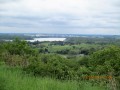
Short hike in the Île-de-France region, from Élancourt Village to the Courance de Maurepas pond.
The outward journey follows the left bank of the Ru d'Elancourt, the return journey follows the right bank.
The first part (from (S) to (3)) can no longer be done. The entire Elancourt hill (la Revanche) is under construction in preparation for the Olympic Games and is therefore closed to hiking. This will remain the case until 2025... See reviews
Passing by the Bassin de la Muette and the Colline de la Revanche
 3.07 mi
+407 ft
-413 ft
1h 45
Moderate
Departure from Élancourt (Yvelines)
3.07 mi
+407 ft
-413 ft
1h 45
Moderate
Departure from Élancourt (Yvelines)
PLEASE NOTE THAT IT WILL NO LONGER BE POSSIBLE TO DO THIS ROUTE FROM SEPTEMBER 2022 DUE TO THE DEVELOPMENT OF THE HILL FOR THE 2024 OLYMPIC GAMES.
This route passes by many interesting sites and places: an old church, a lake, viewpoints and, in particular, La Revanche hill, the highest point in the Île-de-France region. It is advisable to do this route on a clear day if possible, so that you can enjoy the view of the entire region to the full.
Loop between Beynes and Saulx-Marchais
 7.61 mi
+453 ft
-453 ft
3h 55
Moderate
Departure from Beynes (Yvelines) (Yvelines)
7.61 mi
+453 ft
-453 ft
3h 55
Moderate
Departure from Beynes (Yvelines) (Yvelines)
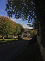
This circular hike in the Beynes forest takes you past several underground gas storage sites. You will then cross the village of Saulx-Marchais, passing by its old church and town hall before crossing the fields to reach Neauphle-le-Vieux and the Mauldre river. Return to the starting point via the Beynes forest.
From Méré to Carrefour Baron (circular route)
 14.51 mi
+620 ft
-643 ft
7h 15
Difficult
Departure from Yvelines
14.51 mi
+620 ft
-643 ft
7h 15
Difficult
Departure from Yvelines
A circular route covering theGR®1from Mareil-le-Guyon to the Carrefour Baron in the Rambouillet Forest. The walk also passes through the towns of Montfort-l’Amaury, Les Mesnuls and Bazoches-sur-Guyonne.
Walk in the greenery of Élancourt
 3.66 mi
+36 ft
-33 ft
1h 45
Easy
Departure from Élancourt (Yvelines)
3.66 mi
+36 ft
-33 ft
1h 45
Easy
Departure from Élancourt (Yvelines)
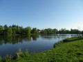
A walk in a green setting and beside a peaceful little lake in the middle of Élancourt (on the border with Maurepas). Combine it with a visit to the Commanderie des Templiers de la Villedieu and, why not, a visit to France Miniature, which is right next door.
From Coignières to Villiers-Saint-Frédéric through the Yvelines
 11.61 mi
+466 ft
-751 ft
5h 45
Moderate
Departure from Coignières (Yvelines)
11.61 mi
+466 ft
-751 ft
5h 45
Moderate
Departure from Coignières (Yvelines)
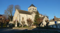
This is the thirty-fourth and final stage of the Grand Tour of Île-de-France via the GR®11. It starts in Coignières and ends in Villiers-Saint-Frédéric, where the radial section of the GR® coming from Paris meets the circular section, which will therefore be completed here. The route follows, more or less closely, the course of the Mauldre River, passing through Bazoches-sur-Guyonne, Mareil-le-Guyon and Neauphle-le-Vieux.
From Beynes to Verneuil-sur-Seine via the Étang d'Abbecourt
 13.38 mi
+942 ft
-1,033 ft
7h 00
Difficult
Departure from Beynes (Yvelines) (Yvelines)
13.38 mi
+942 ft
-1,033 ft
7h 00
Difficult
Departure from Beynes (Yvelines) (Yvelines)
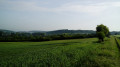
From the Mauldre Valley to the Seine Valley, a hike from station to station that alternates between fields and woodland. The Étang d’Abbecourt offers a perfect spot for a break, and the Church of Saint-Étienne in Vernouillet adds a touch of heritage.
Beynes - Maule, with return by train
 6.70 mi
+302 ft
-371 ft
3h 20
Moderate
Departure from Beynes (Yvelines) (Yvelines)
6.70 mi
+302 ft
-371 ft
3h 20
Moderate
Departure from Beynes (Yvelines) (Yvelines)
A walk on the plateaus above the Mauldre valley. A rolling landscape as far as the eye can see accompanies you throughout the hike.
From Coignières to Saint-Rémy-lès-Chevreuse
9.44 mi
+203 ft
-509 ft
4h 30
Moderate
Departure from Coignières (Yvelines)
Hike along the Yvette river, with its wash houses, passing by the Château de la Madeleine. The route also passes through a forest in a former sandstone quarry.
The slopes of the Mauldre
 6.73 mi
+367 ft
-367 ft
3h 25
Moderate
Departure from Beynes (Yvelines) (Yvelines)
6.73 mi
+367 ft
-367 ft
3h 25
Moderate
Departure from Beynes (Yvelines) (Yvelines)
A hike on the slopes of both banks of the Mauldre, a tributary of the Seine between the Plaine de Versailles and the Mantois. The route, consisting of two loops, alternates between residential areas, forests and fields. A rich heritage, partly linked to water, can be discovered along the way: an old fortified castle, old mills, a siphon bridge, farm buildings, a church, etc.
Tour in the north-west of the Chevreuse Valley
 11.00 mi
+407 ft
-427 ft
5h 25
Easy
Departure from Coignières (Yvelines)
11.00 mi
+407 ft
-427 ft
5h 25
Easy
Departure from Coignières (Yvelines)
A very beautiful hike to discover the wonderful rural and natural landscape of the north-west of the Chevreuse Valley, offering a radical change of scenery from the urban and commercial area of Coignières.
Around the Ruisseau des Brûlins
 4.50 mi
+335 ft
-328 ft
2h 20
Easy
Departure from Les Mesnuls (Yvelines)
4.50 mi
+335 ft
-328 ft
2h 20
Easy
Departure from Les Mesnuls (Yvelines)
A lovely route between the château, forest, ponds and rivers, on the outskirts of Montfort-l'Amaury.
Étang des Noës and Champ Garnier Forest in Mesnil-Saint-Denis
 4.94 mi
+75 ft
-75 ft
2h 20
Easy
Departure from Le Mesnil-Saint-Denis (Yvelines)
4.94 mi
+75 ft
-75 ft
2h 20
Easy
Departure from Le Mesnil-Saint-Denis (Yvelines)
A walk between ponds, country lanes and forest, passing through the small town of Mesnil-Saint-Denis.
This hike is accessible to all. It takes you through a variety of places with lovely views.
Please note that there is virtually no shade for two-thirds of the route between the points (1) and (6), so it is best to avoid it in very hot weather.
The tour of the Étang des Noës and a detour into the Port Royal Forest
 4.10 mi
+26 ft
-26 ft
1h 55
Easy
Departure from Le Mesnil-Saint-Denis (Yvelines)
4.10 mi
+26 ft
-26 ft
1h 55
Easy
Departure from Le Mesnil-Saint-Denis (Yvelines)
A walk between the new town and the forest. The Étang des Noés is home to many birds that nest in the reeds on its banks. After walking around the pond, the more adventurous can take an easy stroll through the forest.
Montfort-l'Amaury-Les Étangs de Hollande loop
 9.65 mi
+292 ft
-292 ft
4h 40
Moderate
Departure from Montfort-l'Amaury (Yvelines)
9.65 mi
+292 ft
-292 ft
4h 40
Moderate
Departure from Montfort-l'Amaury (Yvelines)
An easy and very pleasant circuit in the Rambouillet forest, passing by the Étangs de Hollande.
Étangs et Rigoles d'Yvelines Nature Reserve
8.82 mi
+23 ft
-23 ft
4h 05
Moderate
Departure from Trappes (Yvelines)
Discover the Ile de Loisirs de Saint-Quentin-en-Yvelines with its nature reserve, a route with few hills and accessible to all.
From Mesnil Saint-Denis to Chevreuse, between history and nature
 12.77 mi
+499 ft
-525 ft
6h 20
Difficult
Departure from Le Mesnil-Saint-Denis (Yvelines)
12.77 mi
+499 ft
-525 ft
6h 20
Difficult
Departure from Le Mesnil-Saint-Denis (Yvelines)
Circular route dotted with beautiful views. You pass through forests and villages, streams and ponds, and alongside historic and remarkable sites such as Château de la Madeleine and Port Royal with its Jean Racine trail. The only difficulty is the short steep climb to Château de Chevreuse.
 The Rambouillet Forest by bike
 49.17 mi
+705 ft
-709 ft
5 hrs
Difficult
Departure from Saint-Léger-en-Yvelines (Yvelines)
49.17 mi
+705 ft
-709 ft
5 hrs
Difficult
Departure from Saint-Léger-en-Yvelines (Yvelines)
The Rambouillet Forest is criss-crossed by numerous cycle paths that wind through the undergrowth. The proposed route takes several of these cycle paths, with connections on small roads. An original way to discover this beautiful forest.
This long circular route can be divided into two circular routes of 37 and 42 km, respectively.
Ponds and lakes in the Rambouillet Forest
 34.02 mi
+364 ft
-381 ft
4 hrs
Moderate
Departure from Saint-Léger-en-Yvelines (Yvelines)
34.02 mi
+364 ft
-381 ft
4 hrs
Moderate
Departure from Saint-Léger-en-Yvelines (Yvelines)
Discover the ponds and pools that dot this route in the Rambouillet Forest. The private pond at Château de l'Artoire, visible from the road; Étang du Moulin des Roches; the waterfalls and rocks at Vaux de Cernay; the private pond at Les Hogues, visible from the road; Étang de la Tour; Étang de Coupe-Gorge; the ponds at Vilpert; and the ponds at Hollande.
Some remarkable trees in the north of the Rambouillet Forest
 8.17 mi
+138 ft
-144 ft
3h 55
Moderate
Departure from Saint-Léger-en-Yvelines (Yvelines)
8.17 mi
+138 ft
-144 ft
3h 55
Moderate
Departure from Saint-Léger-en-Yvelines (Yvelines)
A forest trail featuring several remarkable trees, including the particularly tall Hêtre du CERF and the majestic Chêne de l'Ascension. The route generally follows very well-maintained paths. A section on a poorly maintained path requires a good sense of direction.
Around Autouillet
 4.94 mi
+236 ft
-246 ft
2h 30
Easy
Departure from Autouillet (Yvelines)
4.94 mi
+236 ft
-246 ft
2h 30
Easy
Departure from Autouillet (Yvelines)
A short, pleasant, rural half-day hike with some historical features.
Crespières, Thiverval-Grignon, Davron: rural valleys, open plateaus
 9.26 mi
+643 ft
-666 ft
4h 50
Moderate
Departure from Crespières (Yvelines)
9.26 mi
+643 ft
-666 ft
4h 50
Moderate
Departure from Crespières (Yvelines)
A pleasant route alternating between small villages, forest edges and wide open horizons.
Follow the Yvette from Essarts-le-Roi to Saint-Rémy-lès-Chevreuse
 12.16 mi
+564 ft
-879 ft
6h 05
Difficult
Departure from Les Essarts-le-Roi (Yvelines)
12.16 mi
+564 ft
-879 ft
6h 05
Difficult
Departure from Les Essarts-le-Roi (Yvelines)
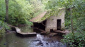
A hike from station to station that takes us to the source of the River Yvette and then up and down through the woods that frame its valley. The route crosses the Maincourt Marsh and then an area of rocky chaos. The forest trails are interspersed with villages and hamlets rich in heritage.
The Flambertins Forest and the Abbecourt Pond
 9.22 mi
+384 ft
-381 ft
4h 35
Moderate
Departure from Crespières (Yvelines)
9.22 mi
+384 ft
-381 ft
4h 35
Moderate
Departure from Crespières (Yvelines)
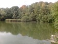
A hike that alternates between forest and fields, with a small pond that is ideal for a pleasant break.
Short loop in the Plaine de Versailles
 4.46 mi
+118 ft
-128 ft
2h 10
Easy
Departure from Villepreux (Yvelines)
4.46 mi
+118 ft
-128 ft
2h 10
Easy
Departure from Villepreux (Yvelines)
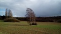
A short walk on either side of the Ru de Gally, with beautiful views of the plain and the Palace of Versailles and a rich heritage in the charming village of Rennemoulin.
Woods, countryside and heritage around the Ru du Pommeret
 4.07 mi
+344 ft
-322 ft
2h 10
Moderate
Departure from Lévis-Saint-Nom (Yvelines)
4.07 mi
+344 ft
-322 ft
2h 10
Moderate
Departure from Lévis-Saint-Nom (Yvelines)
A short hike in the Upper Chevreuse Valley, rich in heritage and offering beautiful views of the Vallon du Pommeret and the wooded hills that surround it.
Sainte-Gemme and the western part of the Marly Forest
5.62 mi
+121 ft
-115 ft
2h 40
Easy
Departure from Feucherolles (Yvelines)
A walk featuring a beautiful woodland route through the western part of the Marly Forest and a stroll through the village of Feucherolles, offering a chance to see the Sainte-Gemme Chapel along the way. The Marly State Forest is a natural area of ecological, faunal and floristic interest (ZNIEFF) that is home to over 80 species of birds, as well as red deer, roe deer, badgers, foxes and wild boar. Sainte-Gemme is a legendary Christian saint, often associated with the Saintonge region. She is depicted as a young virgin martyr. Converted to Christianity by Saint Denis of Paris, she is said to have refused an arranged marriage to a pagan nobleman, which is believed to have triggered her persecution. According to tradition, she was beheaded for her faith. Her story, although popular locally, belongs more to hagiographic tradition than to proven history.
Loop of the Yvette spring
 5.89 mi
+456 ft
-486 ft
3h 05
Moderate
Departure from Les Essarts-le-Roi (Yvelines)
5.89 mi
+456 ft
-486 ft
3h 05
Moderate
Departure from Les Essarts-le-Roi (Yvelines)
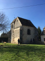
Loop around the source of the Yvette at Les Essarts-le-Roy.
Loops of Feucherolles and the western part of the Marly Forest
 8.09 mi
+322 ft
-351 ft
4h 00
Moderate
Departure from Feucherolles (Yvelines)
8.09 mi
+322 ft
-351 ft
4h 00
Moderate
Departure from Feucherolles (Yvelines)
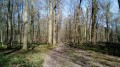
A varied hike, with a beautiful wooded route in the western part of the Forest of Marly and a stroll through the village of Feucherolles. A hike with two loops, lending itself to several variations, such as limiting yourself to the 7.5 km forest loop.
From the Ferme du Manet in Romainville
4.97 mi
+39 ft
-39 ft
2h 20
Easy
Departure from Montigny-le-Bretonneux (Yvelines)
A short walk between forest and fields without leaving Saint-Quentin-en-Yvelines. It will take you to the "Garde Manger", a shop selling local and short route products.
Circular walk between Feucherolles and Saint-Germain-de-la-Grange
 14.56 mi
+843 ft
-869 ft
7h 25
Difficult
Departure from Feucherolles (Yvelines)
14.56 mi
+843 ft
-869 ft
7h 25
Difficult
Departure from Feucherolles (Yvelines)
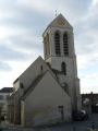
This circular route follows theGR®1from Feucherolles to Saint-Germain-de-la-Grange on the outward leg, passing through Davron and Thiverval-Grignon. On the return leg, you’ll discover Chavenay. Each of the three villages has its own wash house and a remarkable church. Much of the walk takes place through fields.
The Maincourt Reed Bed
 5.64 mi
+194 ft
-220 ft
2h 45
Moderate
Departure from Lévis-Saint-Nom (Yvelines)
5.64 mi
+194 ft
-220 ft
2h 45
Moderate
Departure from Lévis-Saint-Nom (Yvelines)
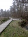
In the heart of the Haute Vallée de Chevreuse Nature Park, this walk takes you through a protected natural site along a nature trail developed by the Park. In the Bois de Maincourt, you can see old sandstone quarries. The course of the River Yvette, which you follow on the way back, offers a glimpse into the area’s heritage with its old mills and wash houses.
Les Granges de Port-Royal and the Rhodon Valley
 3.79 mi
+174 ft
-177 ft
1h 55
Easy
Departure from Magny-les-Hameaux (Yvelines)
3.79 mi
+174 ft
-177 ft
1h 55
Easy
Departure from Magny-les-Hameaux (Yvelines)
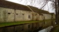
A short forest hike in two stages. After a lovely view of the former Port-Royal-des-Champs Abbey, you climb up the Vallon du Rodhon on a path and trails that wind through the undergrowth. The hike then follows the wide paths of the Port-Royal Forest.
Around Mareil-sur-Mauldre
4.47 mi
+256 ft
-256 ft
2h 15
Easy
Departure from Mareil-sur-Mauldre (Yvelines)
From Mareil-sur-Mauldre station, the walk follows the railway line to the hamlet of La Maladrerie. Viathe Côte de Chavoye, then the Chemin aux Bœufs, it heads towards Crespières. On the plateau, at the model-making site, it turns left towards the Cheminet and Beurres areas before reaching the houses inthe Parc de Mareil. A descent through the park along narrow paths, with the occasionalflight of steps, leads back to the station.
From Mareil-sur-Mauldre to Épône along the Mauldre and through the countryside
 8.01 mi
+505 ft
-561 ft
4h 05
Moderate
Departure from Mareil-sur-Mauldre (Yvelines)
8.01 mi
+505 ft
-561 ft
4h 05
Moderate
Departure from Mareil-sur-Mauldre (Yvelines)
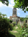
On this walk from station to station, you’ll follow the Mauldre river through the countryside, passing through several villages to discover some heritage sights.
From Mareil-sur-Mauldre station to Poissy station, via Orgeval
 11.36 mi
+587 ft
-666 ft
5h 45
Moderate
Departure from Mareil-sur-Mauldre (Yvelines)
11.36 mi
+587 ft
-666 ft
5h 45
Moderate
Departure from Mareil-sur-Mauldre (Yvelines)
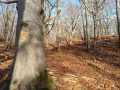
A fairly easy walk from station to station, the first part of which is through woodland where you can admire superb specimens of various species of deciduous trees, particularly beeches and oaks, which are certainly over a hundred years old. You also pass close to the Alluets-le-Roi telecommunications centre and its many antennas of all types.The second part, which is more varied, includes a visit to the ruins of Abbecourt Abbey and the centres of the villages of Orgeval and Villennes-sur-Seine with their churches. The walk ends with a pleasant stroll along the banks of the Seine.
Over hill and dale, from Mareil-sur-Mauldre to Beynes
 8.73 mi
+712 ft
-705 ft
4h 40
Moderate
Departure from Mareil-sur-Mauldre (Yvelines)
8.73 mi
+712 ft
-705 ft
4h 40
Moderate
Departure from Mareil-sur-Mauldre (Yvelines)
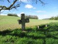
A hike along the hillsides on both banks of the Mauldre river, offering beautiful panoramic views. There are heritage sites to discover in the three towns along the route.
Around Montainville
4.71 mi
+262 ft
-262 ft
2h 25
Easy
Departure from Mareil-sur-Mauldre (Yvelines)
Montainville is situated in the centre of the Yvelines department. The commune’s territory extends across the eastern edge of the Mantois plateau and the western slope of the Mauldre valley. The village site forms a promontory bounded by two valleys named after their springs: the Serpe valley to the north and the Orme valley to the south.
Around the Étang de Saint-Hubert
 2.61 mi
+23 ft
-23 ft
1h 15
Easy
Departure from Le Perray-en-Yvelines (Yvelines)
2.61 mi
+23 ft
-23 ft
1h 15
Easy
Departure from Le Perray-en-Yvelines (Yvelines)
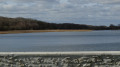
Short walk around the Étang d'Hubert lake with historical passages.
Moderator's note See reviews. It seems that the circular is no longer possible. Please leave a comment to confirm.
Around Thoiry
 6.36 mi
+230 ft
-220 ft
3h 05
Easy
Departure from Thoiry (Yvelines) (Yvelines)
6.36 mi
+230 ft
-220 ft
3h 05
Easy
Departure from Thoiry (Yvelines) (Yvelines)
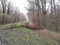
This hike is recommended when the paths are too muddy.
This route goes around Thoiry Wildlife Park. It mainly follows quiet, small tarmac roads, for seasons when the paths are almost impassable.
Around Maincourt-sur-Yvette and Dampierre
 4.49 mi
+420 ft
-394 ft
2h 25
Moderate
Departure from Dampierre-en-Yvelines (Yvelines)
4.49 mi
+420 ft
-394 ft
2h 25
Moderate
Departure from Dampierre-en-Yvelines (Yvelines)
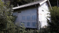
The first part of the hike takes in many points of interest. The second part offers a route through forest and quiet country lanes. This circuit is not recommended for young children as it includes some very steep and stony paths.
In the Rambouillet Forest from the Étangs de Hollande
 4.19 mi
+36 ft
-36 ft
2h 00
Easy
Departure from Les Bréviaires (Yvelines)
4.19 mi
+36 ft
-36 ft
2h 00
Easy
Departure from Les Bréviaires (Yvelines)
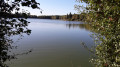
A pleasant walk along small paths and footpaths in the Rambouillet Forest. The hike ends with a short tour of the Étangs de Hollande.
Starting from Auffargis via the watercourses, woods and the Vaux de Cernay
 12.25 mi
+394 ft
-394 ft
6h 00
Moderate
Departure from Auffargis (Yvelines)
12.25 mi
+394 ft
-394 ft
6h 00
Moderate
Departure from Auffargis (Yvelines)
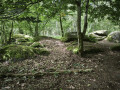
This walk will first take you on a tour of Auffargis’s heritage. Then, following only footpaths, you’ll walk alongside streams and watercourses to discover the Étang du Perray. You will then walk through the Bois des Vindrins to reach a well-known sand pit. Continuing your walk through this woodland, you will arrive at Les Vaux de Cernay, where you can see its abbey.
Dampierre-en-Yvelines route via the Rouillon de Valence
 3.72 mi
+233 ft
-233 ft
1h 55
Easy
Departure from Dampierre-en-Yvelines (Yvelines)
3.72 mi
+233 ft
-233 ft
1h 55
Easy
Departure from Dampierre-en-Yvelines (Yvelines)
This short route alternates between forest paths and paths along fields, following a small stream called Rouillon de Valence. It ends with a return to Dampierre-en-Yvelines in front of the château and its majestic park.