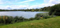
The Maincourt Reed Bed

In the heart of the Haute Vallée de Chevreuse Nature Park, this walk takes you through a protected natural site along a nature trail developed by the Park. In the Bois de Maincourt, you can see old sandstone quarries. The course of the River Yvette, which you follow on the way back, offers a glimpse into the area’s heritage with its old mills and wash houses.

Details

107680
Creation:
Last update:
Last review:
  • Walking
    Activity: Walking
  • ↔
    Distance: 5.64 mi
  • ◔
    Average duration: 2h 45 
  • ▲
    Difficulty: Moderate

  • ⚐
    Back to start: Yes
  • ↗
    Ascent: + 194 ft
  • ↘
    Descent: - 220 ft

  • ▲
    Highest point: 541 ft
  • ▼
    Lowest point: 312 ft

Photos

Description of the walk

Parking is available in the car park for the nature trail, situated on a bend in the D58 road, near the Lavagot mill, between Maincourt-sur-Yvette and the church at Saint-Nom. Access is via the N10 and Le Mesnil-Saint-Denis, or via the N118 then the D906 via Chevreuse.

PNR signposts
Throughout the first part of the walk, the route is signposted by small posts from the Haute Vallée de Chevreuse Regional Nature Park (PNR), topped with a white metal plate bearing a black arrow indicating the direction to follow.

(S/E) Take the path that starts at the far end of the car park and heads east. At a fork in the road, ignore the red and white markings which suggest turning left diagonally and continue straight on towards a large information board. Referring to the map on this board, follow the green route and then the orange route.

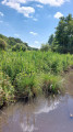
(1) Shortly after the sign, turn right onto a wooden walkway over the marsh (there are several information boards along the way). Go round the reed bed on the right. Cross the Yvette via a footbridge. At the Pinguenet pond (sign), there is access on the left to a viewing platform above the water.

(2) Immediately afterwards, at a junction on the boardwalk, turn right. Further on, the boardwalk gives way to a footpath. At a fork in the road, turn left and step onto a boardwalk again. You’ll come to a T-junction (boardwalk on the left, dirt track on the right).

(3) Turn right onto the ‘circular’ path, which runs between two wetlands and crosses a few streams via wooden footbridges. Shortly after the information board about the mill, turn left level with a property and follow the path bordered by two fences. Pass through a forest gate and emerge onto a small street in Maincourt. Turn left (metal gate, red and white marker) and follow the old mill embankment, with the reed bed on your left.

(4) At the junction at the end of the embankment (PNR signpost), continue along the embankment, cross the Yvette, take an immediate left-hand bend in front of a green gate and pass through a forest gate. At a large information board (identical to the one at the start), ignore two paths branching off to the right. Immediately afterwards, pass a PNR signpost and, after a few more metres, reach another PNR signpost (a red and white marker on a tree, the size of a pole).

(5) Turn right onto a path that climbs amongst exposed sandstone boulders (follow the sign on the PNR post and ignore theGR®® markings). The slope is steep but the climb is short. At the top of the hill (large oak tree), turn left. Walk along the edge of the plateau, passing a beautiful viewpoint on the left and a first old sandstone quarry on the right. Further on, take a short detour to the left to the information panel facing a sandstone outcrop. Retrace your steps and continue westwards along the main path. You will reach a second old sandstone quarry (information panel).

Red and white + blue and white markings (sparse in both cases)

(6) At a fork in the road just past the old quarry, leave the nature trail and ignore the PNR signpost and the blue and white marker, which direct you to turn left. Take the path on the right, heading north (you won’t find any markings until a few hundred metres further on, but if you look back after the junction, you can see arrows for walkers coming from the opposite direction). At the next fork in the road (plot no. 28.22), take the path on the left, continuing along the path you’ve just come from.

“Chevreuse” mountain bike signs + orange markings

(7) Follow the signs for “Pommeret” (ignore the red and white arrow indicating a left turn) and you will immediately reach the Carrefour des Six Croix. Heading east, take the first path on the right from the gate (follow the “Chevreuse” MTB sign). Stay along the edge of the woodland on this well-maintained path. At a crossroads (plot no. 28.26), turn left and pass through a forest gate. Ignore a path branching off to the right and ride alongside the meadows, keeping a farm shed clearly in sight. At the T-junction, turn left towards the shed. You’ll come out onto a road; ride through the hamlet of Grand Ambésis, passing a castle on your right.

Mountain bike signs “Chevreuse”

(8) On leaving the hamlet, turn sharply right (at the ‘Accès pompiers’ barrier). Take care: there is no sign indicating the exit from the hamlet, so look carefully for the path leading off at the corner of a garden. Ride alongside fields on your left and, on your right, a hedge followed by woodland. At a T-junction (with a reservoir on the left), turn right. At a fork in the road at the entrance to the woodland, take the left-hand path. Continue southwards along the edge of the woodland. At the next junction, turn left, leave the woodland and stay on the edge with a field on your left. During a brief stretch through the undergrowth, ignore the path on the right. Continue south-east, alongside a meadow on your right. You’ll reach some houses and then a crossroads in the hamlet of Le Bel-Air.

Orange markings

(9) Turn sharply right onto Allée de la Butte Ronde (no entry). The road soon gives way to a path that descends steeply into the woods. In a wide bend to the left, ignore a path coming from the right and, at the Fork in the road that appears immediately, take the left-hand path. Continue downhill, as the path becomes increasingly narrow and steep. At the bottom of the descent, you’ll reach a junction with a wire fence at an angle: carry on straight ahead towards an ONF sign, which you’ll see from behind.

Red and white + blue and white markings

(10) At the “Forêt Domaniale de Rambouillet” sign, follow theGR®®11to the right towards Coignières SNCF (sign high up on a tree). The path winds its way whilst maintaining a general west-north-westerly direction. Pass through a beech forest with several remarkable trees and note the sandstone boulders on the slope to your right. Pass the Source aux Fées wash house (information sign). Continue along the path and you will soon reach the edge of a property on your left (an old mill), with the River Yvette running alongside it. At a fork in the road, take the left-hand path and cross the bridge over the Yvette: this will take you to the Maincourt wash house (information board). Continue westwards and you will come to a crossroads you passed on the way out.

(4) At the crossroads, turn right, cross the Yvette again, immediately take a sharp left-hand bend in front of a green gate and pass through a forest barrier. Walk past the large information board for the nature trail and reach the PNR signpost you followed on the way out.

(5) Continue westwards on theGR®®11(marker on a tree in the shape of a pole) and follow the course of the Yvette from a distance.

(1) Look out for the start of the wooden walkway on your left, then continue straight ahead. Pass the very first information board you come across and, at the next junction, continue straight ahead. You will very quickly reach the car park (start/end).


Waypoints

  1. S/E : mi 0 - alt. 358 ft - Car park for the nature trail
  2. 1 : mi 0.1 - alt. 351 ft - Start of the signposted path
  3. 2 : mi 0.27 - alt. 338 ft - Junction on the footpath
  4. 3 : mi 0.44 - alt. 338 ft - End of the signposted path
  5. 4 : mi 0.75 - alt. 335 ft - Maincourt Mill Embankment - Yvette (l')
  6. 5 : mi 0.84 - alt. 344 ft - Junction – PNR signpost
  7. 6 : mi 1.24 - alt. 495 ft - Fork in the road just after the second disused quarry
  8. 7 : mi 1.51 - alt. 522 ft - Junction just before the Carrefour des Six Croix
  9. 8 : mi 2.35 - alt. 535 ft - Grand Ambésis walk
  10. 9 : mi 3.83 - alt. 541 ft - Le Bel-Air
  11. 10 : mi 4.29 - alt. 315 ft - Junction – ONF sign
  12. S/E : mi 5.64 - alt. 358 ft - Car park for the nature trail

Notes

The time given (3 hours) refers mainly to walking time, with few stops. The nature trail is ideal for observing wildlife and taking a leisurely stroll: do feel free to take your time...

In wet weather, the path built on a wooden jetty, between (1) and (3), is slippery.

Alternative route:
It is possible to limit this walk to the nature trail alone, which will allow you to explore the marsh and see the old quarries. In this case, follow the PNR signposts from start to finish:
- Follow this route from the start to point (4).
- Walk to and from the Maincourt wash house.
- Continue along the route via points (5) and (6).
- At the crossroads at point (6), leave this route and turn left (blue and white markings with red and white stripes).
- Head straight down and, a few metres west of point (1), join the path that follows the course of the Yvette.
- Take this path to the right and return to the starting point.
Allow 1 hour’s walking time for the whole route, excluding stops.

Most of the paths are well-maintained and the ground is generally dry. Wet patches may be encountered between points (1) and (6) and on the unpaved sections of the marsh trail. The entire paved section is accessible to people with reduced mobility.

On the nature trail, from (1) to (6), dogs must be kept on a lead and cycling is prohibited. The Maincourt Marsh is a protected site: please observe the other guidelines displayed on the large information boards.

A detailed map is required (at the very least, the one accompanying this description).

This walk has been completed twice by the author, the first time on 20 March 2015 and the second on 14 October 2018.

Worth a visit

The Maincourt Marsh and its footpath, developed by the Haute Vallée de Chevreuse Regional Nature Park, between points (1) and (5) and then (5) and (1):
- Reed beds and other forms of vegetation suited to the environment.
- Numerous birds (don’t hesitate to come early in the morning to increase your chances of spotting them and to enjoy the peace and quiet).
- Numerous information boards all along the route.
A place likely to appeal to a very wide audience!

The upper section of the nature trail, between (5) and (6), featuring two former sandstone quarries.

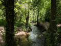
The course of the Yvette, between (1) and (4) and then between (10) and (1):
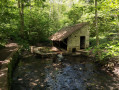
- The Source aux Fées wash house and the Maincourt wash house
- Old mills
- Beech forest with several remarkable trees

Always be cautious and plan ahead when you're outdoors. Visorando and the author of this route cannot be held responsible for any accidents occurring on this route.

The GR® and PR® markings are the intellectual property of the Fédération Française de Randonnée Pédestre.

Reviews and comments

4.7 / 5
Based on 147 reviews

Reliability of the description
4.7 / 5
Ease of following the route
4.6 / 5
Route interest
4.7 / 5
Rct92
Rct92

Overall rating : 4.3 / 5

Date of your route : Apr 25, 2026
Reliability of the description : ★★★★☆ Good
Ease of following the route : ★★★★☆ Good
Route interest : ★★★★★ Very good
Very busy route : No

A smooth ride. A bit of a steep climb, but nothing too bad. A pleasant ride on a lovely sunny Saturday afternoon. Not many people about

Machine-translated

GRESSIN  FRANCINE
GRESSIN FRANCINE

Overall rating : 4 / 5

Date of your route : Mar 01, 2026
Reliability of the description : ★★★★☆ Good
Ease of following the route : Not used / Not applicable
Route interest : ★★★★☆ Good
Very busy route : No

A pleasant hike with varied terrain. The first quarter was muddy in places. Wooden footbridges in others. Small climbs, changes of direction, but following the route on the map makes it easy to follow. In the last quarter, there are rocks like those in Fontainebleau on the coast. A few people towards the end.

Machine-translated

webmarc
webmarc

Overall rating : 5 / 5

Date of your route : Oct 04, 2025
Reliability of the description : ★★★★★ Very good
Ease of following the route : ★★★★★ Very good
Route interest : ★★★★★ Very good
Very busy route : No

Very nice hike.
Thank you for sharing.

Machine-translated

User 26521022

Overall rating : 5 / 5

Date of your route : Aug 10, 2025
Reliability of the description : ★★★★★ Very good
Ease of following the route : ★★★★★ Very good
Route interest : ★★★★★ Very good
Very busy route : No

Very beautiful route, very accessible and offering beautiful wooded landscapes.
It's just a shame that two sections were closed for safety reasons.

Machine-translated

LLaura
LLaura

Overall rating : 4.7 / 5

Date of your route : Apr 06, 2025
Reliability of the description : ★★★★★ Very good
Ease of following the route : ★★★★☆ Good
Route interest : ★★★★★ Very good
Very busy route : No

A lovely, accessible walk with different types of landscape, forests, plains, wetlands, ponds, between sun and shade, and a section at the start of the route that seems to be busier than the rest of the route.

Machine-translated

maxledieu
maxledieu

Overall rating : 4.7 / 5

Date of your route : Sep 09, 2024
Reliability of the description : ★★★★★ Very good
Ease of following the route : ★★★★☆ Good
Route interest : ★★★★★ Very good
Very busy route : No

Very nice walk, between forest, pond and fields. We'll probably go back another time.

Machine-translated

Fyly
Fyly

Overall rating : 4.7 / 5

Date of your route : Jun 10, 2024
Reliability of the description : ★★★★★ Very good
Ease of following the route : ★★★★☆ Good
Route interest : ★★★★★ Very good
Very busy route : No

Superb. As mentioned above, the terrain is very varied. We took the climb up the path before point 5, where there was a large information panel that put us in the wrong (not a problem at all).
Towards point 7 (the 6 crossings?) You need to read the instructions very carefully as the GPS was having trouble.

There are some very nice picnic spots on the way back down (big rocks that look like couches
)

Machine-translated

krando94
krando94

Overall rating : 5 / 5

Date of your route : May 03, 2024
Reliability of the description : Not used / Not applicable
Ease of following the route : ★★★★★ Very good
Route interest : ★★★★★ Very good
Very busy route : No

A short, pleasant and attractive walk all the way.

Machine-translated

jplaugier
jplaugier

Overall rating : 5 / 5

Date of your route : Apr 10, 2024
Reliability of the description : ★★★★★ Very good
Ease of following the route : ★★★★★ Very good
Route interest : ★★★★★ Very good
Very busy route : No

A very pleasant and varied route, described in great detail (thank you!). Thanks to the wooden pontoons in the reed beds, it's passable even after a rainy spell.

Machine-translated

sasha
sasha

Overall rating : 4.3 / 5

Date of your route : Mar 30, 2024
Reliability of the description : ★★★★★ Very good
Ease of following the route : ★★★★☆ Good
Route interest : ★★★★☆ Good
Very busy route : No

A very pleasant and varied walk!
Note that some of the posts seem to have disappeared, but that's not too much of a problem except for (4): you need to take the 3rd path on the right after the large information panel.

Machine-translated

Tara Zanetti
Tara Zanetti

Overall rating : 4.3 / 5

Date of your route : Dec 30, 2023
Reliability of the description : ★★★★☆ Good
Ease of following the route : ★★★★☆ Good
Route interest : ★★★★★ Very good
Very busy route : Yes

Walk completed in 2 hours 10 minutes. Very varied route, very pleasant on the platforms at the start, then the climb is quite sporty, almost 50m difference in height over 300 metres, so it took me a while to recover Then, the top of the route is very pleasant with clear views. On the way back down, be careful, it can be slippery, and the path is quite narrow, but it's still very pleasant overall. Worth doing again!
Machine-translated

Sandra78
Sandra78

Overall rating : 4.3 / 5

Date of your route : Aug 13, 2023
Reliability of the description : ★★★★☆ Good
Ease of following the route : ★★★★☆ Good
Route interest : ★★★★★ Very good
Very busy route : No

Hello, lovely varied walk. The sandstone boulders are impressive and magnificent, set in a beautiful forest, and the washhouse with its works of art by the artist Charlotte Rouhier is well presented and pays tribute to the washerwomen.

Machine-translated

GwennBen
GwennBen

Overall rating : 5 / 5

Date of your route : Jul 16, 2023
Reliability of the description : ★★★★★ Very good
Ease of following the route : ★★★★★ Very good
Route interest : ★★★★★ Very good
Very busy route : No

A very beautiful walk, full of beautiful scenery. We really enjoyed it, it was wonderful. Thank you for all these wonderful discoveries.

Machine-translated

limkat78
limkat78
• Edited:

Overall rating : 5 / 5

Date of your route : May 28, 2023
Reliability of the description : Not used / Not applicable
Ease of following the route : Not used / Not applicable
Route interest : ★★★★★ Very good
Very busy route : Yes

It's a route I know almost by heart by now, so it's hard to give an opinion on the descriptions. With the IGN map it's very easy to follow anyway. The walk starts from a place that is well known to walkers and runners and the car park was full, so we had to park a little further away. Avoid the 11 a.m. to 4 p.m. time slot at weekends... otherwise the route is varied, with reed beds, wash-houses, forest, fields and hilly terrain: a really lovely walk.

Machine-translated

User 2739851

Overall rating : 3 / 5

Date of your route : Mar 03, 2023
Reliability of the description : ★★★☆☆ Average
Ease of following the route : ★☆☆☆☆ Very disappointing
Route interest : ★★★★★ Very good
Very busy route : No

not very comprehensible explanations, i got lost there are no more dykes at Maincourt or i didn't see them. i asked a local who told us there weren't any
Avoid going east or west..... it's not concrete
At the Carrefour des Six Croix, the VTT Chevreuse sign is no longer there, it must have fallen off, and the suggestion "the first path on the right from the barrier" is confusing, because from the barrier the path is on the left... What about something like "take the 3rd (or 2nd? I can't remember) path on the right, eastwards, at the edge of the wood"?
Difficult orientation at the end of the route in the hamlet of Grand Ambesy,

Otherwise a very nice route

Machine-translated

Other walks in the area

For more walks, use our search engine .

The GPS track and description are the property of this route's author. Please do not copy them without permission.