Sainte-Gemme and the western part of the Marly Forest

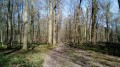
A walk featuring a beautiful woodland route through the western part of the Marly Forest and a stroll through the village of Feucherolles, offering a chance to see the Sainte-Gemme Chapel along the way. The Marly State Forest is a natural area of ecological, faunal and floristic interest (ZNIEFF) that is home to over 80 species of birds, as well as red deer, roe deer, badgers, foxes and wild boar. Sainte-Gemme is a legendary Christian saint, often associated with the Saintonge region. She is depicted as a young virgin martyr. Converted to Christianity by Saint Denis of Paris, she is said to have refused an arranged marriage to a pagan nobleman, which is believed to have triggered her persecution. According to tradition, she was beheaded for her faith. Her story, although popular locally, belongs more to hagiographic tradition than to proven history.

Details

98776550
Creation:
Last update:
Last review:
  • Walking
    Activity: Walking
  • ↔
    Distance: 5.62 mi
  • ◔
    Average duration: 2h 40 
  • ▲
    Difficulty: Easy

  • ⚐
    Back to start: Yes
  • ↗
    Ascent: + 121 ft
  • ↘
    Descent: - 115 ft

  • ▲
    Highest point: 594 ft
  • ▼
    Lowest point: 499 ft

Description of the walk

The walk starts from the car park at Place de la Mairie in Feucherolles. Park in one of the two car parks, one after the other, on the left-hand side of the street when approaching from the D307.

(S/E) The starting point is at Feucherolles Town Hall. Walk up the Grand Rue, then turn left straight away onto Rue Bernard Deniau and continue left onto Rue de Poissy. Then turn right onto Rue de la Chapelle.

(1) Turn left onto Rue Tricherie, then onto Rue de la Mare Jeanne, and then turn right onto Route Neuve du Roi, continuing to the Étoile du Silence junction.

(2) Take Route de la Mare à Blonde as far as the Carrefour du Précipice.

(3) Turn right and continue to the Étoile Ténébreuse.

(4) Turn right to continue along the Route de Poix until you reach the Étoile de Poix.

(5) Turn left onto the path leading to the Route Neuve du Roi; take this road to the left as far as the Belle Étoile.

(6) Turn right onto the path leading to the Étoile de Vénus, where you should turn right again to reach the Étoile d'Avignières.

(7) Continue along the path to the Étoile du Braconnier. There, turn left onto the path leading to the Étoile du Bout du Monde.

(8) Go through the gate leading to Rue du Bout du Monde; follow this until you reach Rue des Marronniers, then turn left and continue until you reach the crossroads. Keep to the right onto Rue de la Chapelle and return to the junction you passed at the start of the walk.

(1) Retrace your steps along the outbound route to reach the Place de la Mairie in Feucherolles (S/E).

Waypoints

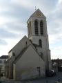
  1. S/E : mi 0 - alt. 505 ft - Place de la Mairie in Feucherolles - Église Sainte-Geneviève (Feucherolles)
  2. 1 : mi 0.45 - alt. 577 ft - Junction of the circular loop
  3. 2 : mi 1.09 - alt. 568 ft - Étoile du Silence
  4. 3 : mi 1.84 - alt. 548 ft - Carrefour du Précipice
  5. 4 : mi 2.24 - alt. 554 ft - Etoile Ténébreuse - Vestiges du Château de Retz
  6. 5 : mi 2.62 - alt. 584 ft - Étoile de Poix
  7. 6 : mi 3.22 - alt. 587 ft - Belle Étoile
  8. 7 : mi 3.97 - alt. 571 ft - Étoile d’Avignières
  9. 8 : mi 4.65 - alt. 577 ft - L’Etoile du Bout du Monde
  10. S/E : mi 5.62 - alt. 509 ft - Place de la Mairie in Feucherolles - Église Sainte-Geneviève (Feucherolles)

Other walks in the area

For more walks, use our search engine .

The GPS track and description are the property of this route's author. Please do not copy them without permission.