Country:

 City:
City:


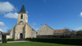
Start from the car park on Rue Bocquet in Méré. For access by train, see the ‘Practical Information’ section.
(S/E) Opposite the church, turn left into Rue Bocquet and follow the red and white markings ofthe GR®1. At the end of the street, turn left into Rue Léopold Bellan, then turn right into Rue François Quesnay. At the three-way junction, go straight ahead, then pass Rue des Pommiers on your right.
(1) Cross the roundabout and stay on Rue François Quesnay, continuing straight on until you reach the ‘Stop’ sign on Avenue de la Reine Anne.
(2) Go straight on, turn left at the end of Rue François Quesnay, then turn right at the junction, following Rue de Mantes. Before the roundabout, turn left into the cul-de-sac.
(3) At the end of the alley, turn right, then keep left immediately at the Fork in the road. Ignore Ruelle des Fossés, go up the steps and pass under the arch. Turn right onto Rue Maurice Ravel. Then go down all the steps on the left and turn right twice.
(4) At the fork in the road, turn left onto Rue de Château Gaillard, going against the one-way flow. Keep left again at the next fork.
(5) At the junction, leave the tarmac road by taking the second right. At the next crossroads, turn left and walk alongside a field on your right. Leave the edge of the field at its corner by turning left.
(6) Follow the road to the right. At the car park, continue straight ahead down the left-hand lane. At the junction where the two lanes meet, carry on straight ahead. At the Fork in the road, follow the path downhill.
(7) Pass the pond on your right, then stay on the widest path. At the top of the climb, keep to the right and, at the Carrefour des Maurus, carry straight on.
(8) At the Carrefour Belsédène, take the second turning on the right. Cross a diagonal track. At the Carrefour de la Mare Ronde, take the third path on the right.
(9) At the Carrefour Baron, leave theGR®1by following the tarmac to the left. At the next four-way junction (Carrefour Saint-Ruffin), turn left. Cross a stream and then a track. Ignore a path on the right, veer slightly to the right at the junction and carry on straight ahead to the roundabout at the Carrefour du Comte de Toulouse.
(10) Take the Chemin de Bazoches aux Mesnuls, which starts to the right of the small shelter. At the Fork in the road, keep to the right and, at the next Fork in the road a few dozen metres further on, turn left. Cross a footpath, then leave a track on your right.
(11) After the barrier, head down Rue de la Millière. Go straight on at the junction. Ignore the dead-end road and keep to the right onto Rue de la Millière. Ignore Chemin des Grands Prés on the left and stay on the tarmac.
(12) Pass Rue de la Vallée on your right. At the Stop sign, turn left, walk past the castle gate and follow the cobbled street. Walk past the church, staying on Grande Rue.
(13) Turn right at the town hall. Ignore Rue des Essarts, then turn left onto Chemin des Fontenelles. Then take the first path on the right.
(14) At the end, turn left. Carry on straight ahead, cross the bridge over the Guyon and ignore the paths branching off to the left and right. Leave the hairpin bend behind, then keep right at the Fork in the road to follow the Chemin du Vieux Pressoir.
(15) Leave the tarmac road and the path that winds away. Ignore the Chemin des Bruyères on the right, then reach a four-way junction.
(16) Turn left, then keep left twice. Further on, take the dead-end track on the left, ignore the path on the right and rejoin the tarmac road (Chemin du Vieux Pressoir).
(17) Turn right. At the end of Chemin du Vieux Pressoir, keep to the right and continue to the junction with Chemin d’Houjarray. Take the footpath on the left. Push open the gate.
(18) At the end, turn right and carry on straight ahead until you reach the road called Chemin du Rocher Marquant. Turn left and do the same at the Fork in the road. At the Stop sign, turn left, crossing the D13 with care. Stay on the tarmac road until you reach Mareil-le-Guyon. Ignore a path on the right leading into the fields.
(19) At the Stop sign, take the road opposite that runs past the church.
(20) At the bend, take a path on the right which runs alongside the Guyonne on your left. Stay by the river until you reach the bridge. Turn left to cross it, then left again to rejoin the road.
(21) Follow theGR®1, signposted in red and white, going straight on along the N12. Turn left, then right, then ignore a path on the right and another on the left.
(22) Pass under the power line, keep right at the Fork in the road and ignore a path on the left, then two streets on the right. At the Fork in the road, keep left to reach the car park straight away (S/E).


 Visorando Member
 Moderate

 Easy
Easy