Around Mareil-sur-Mauldre

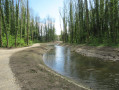
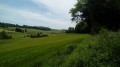
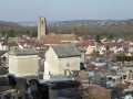
From Mareil-sur-Mauldre station, the walk follows the railway line to the hamlet of La Maladrerie. Viathe Côte de Chavoye, then the Chemin aux Bœufs, it heads towards Crespières. On the plateau, at the model-making site, it turns left towards the Cheminet and Beurres areas before reaching the houses inthe Parc de Mareil. A descent through the park along narrow paths, with the occasionalflight of steps, leads back to the station.

Details

88324668
Creation:
Last update:
Last review:
  • Walking
    Activity: Walking
  • ↔
    Distance: 4.47 mi
  • ◔
    Average duration: 2h 15 
  • ▲
    Difficulty: Easy

  • ⚐
    Back to start: Yes
  • ↗
    Ascent: + 256 ft
  • ↘
    Descent: - 256 ft

  • ▲
    Highest point: 417 ft
  • ▼
    Lowest point: 141 ft

Description of the walk

The walk begins at the car park at Mareil-sur-Mauldre station, where you can park.

(S/E) Head south along the path that runs alongside the railway line, veering away from it slightly at the Pont de Falaise.

(1) Turn left and continue along the Ru de Gally to La Maladrerie.

(2) Turn left onto the Chemin de la Côte de Chavoye.

(3) At the top of the hill, carry on straight ahead along the Chemin de Cheminet.

(4) Turn left onto the Cheminet, then turn right to walk alongside the Beurres housing estate.

(5) Turn left, then left again to go round the residential area.

(6) Follow Avenue de la Chardonnière to the right through Parc de Mareil until you reach the roundabout.

(7) There, turn left onto Avenue de la Côte Barbe, then turn left at the first road. Pass in front of Les Crayons Nursery School, then turn right onto Allée Pierre Scieux, which you follow until you rejoin Avenue de la Côte Barbe. This leads onto Avenue de Chavoye.

(8) Follow it to the right until you reach Rue Christian Pouillard. Turn left onto this street, which leads to the car park at Mareil-sur-Mauldre station (S/E).

Waypoints

  1. S/E : mi 0 - alt. 161 ft - Gare de Mareil-sur-Mauldre
  2. 1 : mi 0.81 - alt. 148 ft - Pont de la Falaise
  3. 2 : mi 1.5 - alt. 151 ft - Ru de Gally (rivière)
  4. 3 : mi 1.77 - alt. 256 ft - Côte de Chavoye
  5. 4 : mi 2.12 - alt. 384 ft - Chemin de Cheminet
  6. 5 : mi 2.7 - alt. 397 ft - Junction
  7. 6 : mi 3.32 - alt. 394 ft - Avenue de la Chardonnière
  8. 7 : mi 3.78 - alt. 325 ft - Roundabout
  9. 8 : mi 4.08 - alt. 226 ft - Avenue de Chavoye
  10. S/E : mi 4.47 - alt. 161 ft - Gare de Mareil-sur-Mauldre

Other walks in the area

For more walks, use our search engine .

The GPS track and description are the property of this route's author. Please do not copy them without permission.