A circular walk from Saint-Germain-de-la-Grange to Mareil-le-Guyon

Circular route which, on the outward leg, follows the GR®1 from Saint-Germain-de-la-Grange to Mareil-le-Guyon. The route, which often runs through fields, passes through Neauphle-le-Vieux, Jouars-Pontchartrain and Neauphle-le-Château.

Details

n°20963478
Creation:
Last update:
Last review:
  • Walking
    Activity: Walking
  • ↔
    Distance: 14.89 mi
  • ◔
    Average duration: 7h 35 
  • ▲
    Difficulty: Difficult

  • ⚐
    Back to start: Yes
  • ↗
    Ascent: + 840 ft
  • ↘
    Descent: - 843 ft

  • ▲
    Highest point: 561 ft
  • ▼
    Lowest point: 190 ft

Photos

Description of the walk

Start from the car park at Saint-Germain-de-la-Grange Town Hall. For access by train, see the practical information.

(S/E) Take the path running to the left of the town hall. Turn left onto the street. Walk to the end of Rue de la Mairie until you reach the ‘Stop’ sign. Use the pedestrian crossings to follow the grassy path beyond the barrier. Turn left.

(1) At the junction, turn right to follow theGR®1, marked in red and white. At the end, turn right onto the footpath. Cross the road carefully and continue through the fields. Ignore a path on the right. At the crossroads, head straight down. Pass a path on the right, then another on the left. Follow the road to the left. Further on, take the path on the right.

(2) At the end, turn right. Go under the railway line, then turn left. Follow Rue Charles de Gaulle to the right.

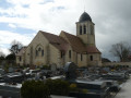
(3) At the junction, cross the D191 with care. At the stop sign, follow the road to the right. Cross the Mauldre. At the church and at the end of Place Sully, turn left onto Rue de la Libération. Pass Rue aux Moutons. Ignore Ruelle de la Poste. Pass two one-way streets coming from the right. Cross the stream, Le Lieutel.

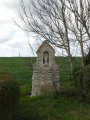
(4) At the junction, carefully take the one-way street to the left of the oratory. Cross the railway line. Continue to the stop sign. Carefully cross the D912 and turn right. At the roundabout, take the first road on the left. Cross the bridge over the N12.

(5) Leave the red and white markings here by taking the track on the left at an acute angle. Ignore a path on the right. At the road, turn left and walk carefully alongside the D191 for about 200 m. Before the bridge over the N12, take the track on the right.

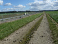
(6) Cross the D34 to head straight across into the fields. The narrow path runs alongside some copses. When you see a ruined farm, go to the right of the clump of trees to avoid having to climb over a fence on the path. Keep left and follow the D23 very carefully.

(7) Cross the Mauldre. Leave the D23 by keeping to the right onto the first path.

(8) Enter the cemetery and leave via a passage on the left. Follow the road to the right. Turn left onto the first path. Ignore a path on the left. Take the first turn right then left. Ignore the dead end. Keep left at the Fork in the road. Take all the steps on the left along Rue de la Galeterie.

(9) Keep left at the Fork in the road. Turn right into the woodland and follow the yellow markings. Keep left, then ignore a path on the left. Turn left at the junction. At the roundabout, take thesecond exit to reach the end of Rue de la Butte à Madame.

(10) At the crossroads, head up into the woods opposite and cross the road. At the junction near a picnic area, turn left. Go straight on at the next crossroads. The path leads to a roundabout.

(11) Follow Avenue de la République. Turn left into the cul-de-sac. On the descent, keep to the right at the Fork in the road. At the bottom of Chemin de Bricassard, turn right. At the Stop sign, keep to the left then take the path on the right. Turn left onto Rue de la Gouttière. Ignore the paths coming from the right or left.

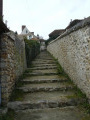
(12) At the end of the steps, turn right. Turn left onto Rue Traversière. Walk between the town hall and the church. Head down to the left into the car park, then at the far end of it, take the steps. Turn right. Head down to the left along the Sente de l’Orme Imbert and cross the road to continue along the same path.

(13) Ignore the paths branching off to the left. After the picnic area, head down to the left. At the car park, turn right onto the Sente des Écoles. At the end, turn left and keep left, then turn right. Follow the Sente du Sac à Vin to the right. Turn left and head straight down at the junction. Ignore a path on the left. Return to the junction you passed on the way there.

(2) Leave the path on your right. Go under the railway line and turn right. As you cross the railway tracks, first turn right then left. At the end, turn left. Then turn right, cross a path and keep to the right at the Stop sign. Do the same at the ‘Give Way’ sign. Ignore the square on the left. At the Stop sign, head left to return to the town hall car park (S/E).

Waypoints

  1. S/E : mi 0 - alt. 367 ft - Town Hall car park
  2. 1 : mi 0.73 - alt. 387 ft - Junction with the GR1
  3. 2 : mi 2.56 - alt. 266 ft - La Pièce de l’Épine – Junction of the circular loop
  4. 3 : mi 3.01 - alt. 246 ft - Gare de Villiers-Neauphle-Pontchartrain
  5. 4 : mi 3.9 - alt. 210 ft - Oratory - Lieutel (rivière) - Affluent dela Mauldre
  6. 5 : mi 5.14 - alt. 249 ft - Junction
  7. 6 : mi 6.75 - alt. 269 ft - Start of the trail
  8. 7 : mi 7.52 - alt. 243 ft - Bridge over the - Mauldre (rivière)
  9. 8 : mi 8.16 - alt. 331 ft - Cemetery - Église Saint-Martin (Jouars)
  10. 9 : mi 8.97 - alt. 318 ft - Jouars-Pontchartain
  11. 10 : mi 9.48 - alt. 456 ft - La Pierre Sauteuse
  12. 11 : mi 10.39 - alt. 558 ft - Neauphle-le-Château
  13. 12 : mi 11.25 - alt. 522 ft - Église Saint-Nicolas (Neauphle-le-Château)
  14. 13 : mi 11.49 - alt. 509 ft - Fond des Granges
  15. S/E : mi 14.89 - alt. 367 ft - Town Hall car park

Notes

Access to the walk:
- By car: park in the car park at Saint-Germain-de-la-Grange Town Hall. Please note that this car park has limited capacity; if it is full, look for a parking space in the adjacent streets.
- By train: Villiers-Neauphle-Pontchartrain station, Transilien line N (Paris Montparnasse network). For timetables, visit the Transilien website. Follow the street opposite the station. Turn right, then at the junction (3), start the walk by turning left onto Rue Charles de Gaulle.

Worth a visit

Always be cautious and plan ahead when you're outdoors. Visorando and the author of this route cannot be held responsible for any accidents occurring on this route.

The GR® and PR® markings are the intellectual property of the Fédération Française de Randonnée Pédestre.

Reviews and comments

3.6 / 5
Based on 3 reviews

Reliability of the description
3.7 / 5
Ease of following the route
3.3 / 5
Route interest
3.7 / 5
ealet
ealet

Overall rating : 3.7 / 5

Date of your route : Feb 28, 2024
Reliability of the description : ★★★★☆ Good
Ease of following the route : ★★★☆☆ Average
Route interest : ★★★★☆ Good
Very busy route : No

This walk should not be undertaken after a spell of rain, as many of the paths are very muddy
I can confirm that at point 6 you have to cross a field to reach a barely marked path
Furthermore, on several occasions you’ll have to walk alongside (admittedly not for long) very busy roads
but you pass through some lovely villages and the viewpoint at Neauphle (next to the town hall and car park at altitude 12)
is very lovely
Thanks to the author for sharing this

Machine-translated

croux74
croux74

Overall rating : 3 / 5

Date of your route : Aug 15, 2023
Reliability of the description : ★★★☆☆ Average
Ease of following the route : ★★★☆☆ Average
Route interest : ★★★☆☆ Average
Very busy route : No

Walks that pass through pretty villages, but half of which run alongside fields, running parallel to the N12. It becomes pleasant from the church at Jouars at point 12.
Note that from point 6, you have to cross the field to reach a copse. I couldn’t really find the path that ran alongside it.
I set off on the walk from Villiers-Neauphle-Pontchartrain station. If you choose this route, you can skip the circular route to Saint-Germain-de-la-Grange, which isn’t particularly interesting.

Machine-translated

ovil
ovil

Overall rating : 4 / 5

Date of your route : Mar 14, 2023
Reliability of the description : ★★★★☆ Good
Ease of following the route : ★★★★☆ Good
Route interest : ★★★★☆ Good
Very busy route : No

A walk undertaken in grey and very windy weather. A varied route with good paths, narrow tracks, a few steep climbs and relatively little road walking, but marred by the long stretch along or near the particularly noisy N12.
For your information, there are public toilets at the town hall in Neauphle-le-Château (point 11).

Machine-translated

Other walks in the area

For more walks, use our search engine .

The GPS track and description are the property of this route's author. Please do not copy them without permission.