


Refine your search for walks in Verneuil-sur-Seine
Verneuil-sur-Seine walks


 Along the Seine from Verneuil-sur-Seine to Villennes-sur-Seine
 Visorando Member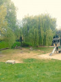
 11.46 mi
 +482 ft
 -486 ft
 5h 40
5h 40
 Moderate
 Departure from Verneuil-sur-Seine (Yvelines)
This walk, which initially follows the Seine to Villennes, will allow you to see many different aspects of the riverbanks and the surrounding area.
You will then take the town’s narrow streets, before heading back down through the woods and fields to Verneuil.
Circular urban then forest loop in Verneuil-sur-Seine
 5.83 mi
+161 ft
-151 ft
2h 50
5.83 mi
+161 ft
-151 ft
2h 50
 Easy
Departure from Verneuil-sur-Seine (Yvelines)
Easy
Departure from Verneuil-sur-Seine (Yvelines)
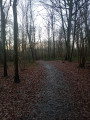
This walk through the old streets of Verneuil, its parks and gardens is not difficult. The walk continues through the forest and along some of its varied paths. End of the urban route, nice little shops, cheese shop, bakery, etc. Finally, a gently sloping path leads to the station.
From Verneuil-sur-Seine to Cergy via the Hautil Forest
 10.58 mi
+866 ft
-584 ft
5h 35
Moderate
Departure from Verneuil-sur-Seine (Yvelines)
10.58 mi
+866 ft
-584 ft
5h 35
Moderate
Departure from Verneuil-sur-Seine (Yvelines)
A hike from station to station which, with a few climbs, leads from the Seine valley to the Oise valley. After the streets, alleys and paths of Triel-sur-Seine and Chanteloup-les-Vignes, you cross the Hautil Forest in a very pleasant way. Three beautiful churches and two beautiful farmhouses are to be discovered along the way.
Circular walk between Vernouillet and Parc de la Bruneterie
 13.40 mi
+741 ft
-735 ft
6h 50
13.40 mi
+741 ft
-735 ft
6h 50
 Difficult
Departure from Vernouillet (Yvelines) (Yvelines)
Difficult
Departure from Vernouillet (Yvelines) (Yvelines)
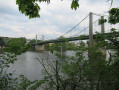
A circular walk following the GR®1 from the Triel-sur-Seine Bridge to the Parc de la Bruneterie in Orgeval. Along the way, you’ll discover Villennes-sur-Seine and then Médan, the town where Émile Zola’s famous house stands on the banks of the Seine.
On the Seine: from the Impressionists to Port des Mureaux
12.30 mi
+463 ft
-472 ft
6h 05
Difficult
Departure from Triel-sur-Seine (Yvelines)
A walk along the Seine from Triel-sur-Seine to Gargenville, taking in footpaths, narrow streets and the Île de Loisirs du Val de Seine, with panoramic views over the plain. Castles, wash houses and ponds are all waiting to be discovered along this route.
Circular route between Vaux-sur-Seine and Sagy
 12.88 mi
+1,047 ft
-1,027 ft
6h 50
Difficult
Departure from Vaux-sur-Seine (Yvelines)
12.88 mi
+1,047 ft
-1,027 ft
6h 50
Difficult
Departure from Vaux-sur-Seine (Yvelines)
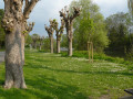
A circular route which, on the outward journey, follows theGR®1from Vaux-sur-Seine to Sagy. The route passes very close to the Châteaux de Villette and Vaux. Before reaching the finish, the route runs alongside the Seine for a few hundred metres.
Circular route between Vaux-sur-Seine and Triel-sur-Seine
 13.04 mi
+1,188 ft
-1,168 ft
7h 00
Difficult
Departure from Vaux-sur-Seine (Yvelines)
13.04 mi
+1,188 ft
-1,168 ft
7h 00
Difficult
Departure from Vaux-sur-Seine (Yvelines)
A circular route which, on the outward journey, follows theGR®1from Vaux-sur-Seine to Triel-sur-Seine. On the return journey, the route passes through Chanteloup-les-Vignes. Overall, the route circles the Forêt de l'Hautil.
Banks of the Seine from Triel-sur-Seine
5.75 mi
+404 ft
-384 ft
3h 00
Easy
Departure from Triel-sur-Seine (Yvelines)
The banks of the Seine and the hillsides in Triel-sur-Seine
Bures loop in Chapet
6.85 mi
+371 ft
-371 ft
3h 30
Moderate
Departure from Morainvilliers (Yvelines)
The first part of the circuit from Bures to Chapet passes through fields along farm tracks, then crosses Chapet and reaches the hamlet of Brezolles, before returning through the woods
Banks of the Seine from Les Mureaux to Conflans-Ste-Honorine via the Bois de l'Hautil
 11.79 mi
+522 ft
-505 ft
5h 50
Moderate
Departure from Les Mureaux (Yvelines)
11.79 mi
+522 ft
-505 ft
5h 50
Moderate
Departure from Les Mureaux (Yvelines)
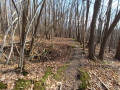
The walk begins with a very varied section of the GRP® "la Seine impressionniste", starting with the imposing ESA Ariane rocket factory and its loading dock, a charming marina, the Île de loisir du Val de Seine, and several very large ponds. It continues through Triel-sur-Seine, with its pleasant Parc Senet and the architecturally intricate St Martin’s Church. The walk through the Bois d’Hautil along easy yet unspoilt paths is well worth the detour for its chestnut forests dotted with a few fine oaks, and punctuated by a large number of sinkholes resulting from the collapse of underground quarries. And we finish off gently, admiring the confluence of the Oise and the Seine.
⚠️ User comment on 18 May 2026:>Please note: at point 8, the path is closed in both directions due to reported risks of collapse; instead, take the GR®2 further down to cross from east to west
From Thun-le-Paradis to Mantes via Brueil-en-Vexin
 18.17 mi
+1,230 ft
-1,243 ft
9h 25
Difficult
Departure from Meulan-en-Yvelines (Yvelines)
18.17 mi
+1,230 ft
-1,243 ft
9h 25
Difficult
Departure from Meulan-en-Yvelines (Yvelines)
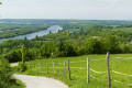
A long hike from station to station, alternating between the banks of the Seine, forests, fields, towns and villages, offering numerous views of the Seine and the French Vexin. The route, dotted with historical landmarks, also serves as a reminder that heavy fighting took place in the region in August 1944.
From Meulan to Triel, from station to station
 8.01 mi
+758 ft
-725 ft
4h 20
Moderate
Departure from Meulan-en-Yvelines (Yvelines)
8.01 mi
+758 ft
-725 ft
4h 20
Moderate
Departure from Meulan-en-Yvelines (Yvelines)
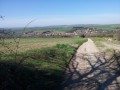
A lovely walk along the banks of the Seine, passing through pretty villages such as Evecquemont. The starting point and finishing point are two stations on the same SNCF line.
Aubette Valley from Meulan en Yvelines
 5.63 mi
+587 ft
-577 ft
3h 05
Easy
Departure from Meulan-en-Yvelines (Yvelines)
5.63 mi
+587 ft
-577 ft
3h 05
Easy
Departure from Meulan-en-Yvelines (Yvelines)
Half urban, half rural route to discover old Meulan-en-Yvelines and the views over the Aubette and Seine valleys.
Between fields and woods in Andrésy
4.18 mi
+318 ft
-318 ft
2h 10
Easy
Departure from Andrésy (Yvelines)
A pleasant walk starting from the top of Andrésy towards Maurecourt and Jouy-le-Moutier along country lanes.
From Dalibray to the Seine from Hardricourt
 6.48 mi
+554 ft
-554 ft
3h 30
Moderate
Departure from Hardricourt (Yvelines)
6.48 mi
+554 ft
-554 ft
3h 30
Moderate
Departure from Hardricourt (Yvelines)
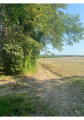
This walk can be started from Meulan-Hardricourt station and follows marked paths for a good part of the way, even if they are not always easy to identify, particularly the access tothe GR® 2. During this walk, you can see the church of Hardricourt, pass through fields, see La Défense, enjoy the undergrowth, admire the pretty village of Mézy-sur-Seine and, if you are feeling adventurous, dip your feet in the water (in summer) and enjoy the banks of the Seine.
Please note that in cold weather, some sections of the forest may be muddy and difficult to walk on.
From Meulan to Mantes-la-Jolie through woods and fields on the right bank
 13.51 mi
+738 ft
-748 ft
6h 50
Difficult
Departure from Hardricourt (Yvelines)
13.51 mi
+738 ft
-748 ft
6h 50
Difficult
Departure from Hardricourt (Yvelines)
A long hike from station to station that veers away from the Seine Valley (which is not particularly suitable for hiking in this area) and climbs to higher ground. The route alternates between wooded sections and stretches through fields with sweeping views. There is a wealth of heritage to discover, with two beautiful Romanesque churches in the first part and, towards the end and as a grand finale, the Gothic Collegiate Church of Mantes-la-Jolie.
Tessancourt-sur-Aubette
 16.09 mi
+889 ft
-860 ft
8h 10
Difficult
Departure from Tessancourt-sur-Aubette (Yvelines)
16.09 mi
+889 ft
-860 ft
8h 10
Difficult
Departure from Tessancourt-sur-Aubette (Yvelines)
A water-themed hike: from the meanders of the Aubette to the springs that enliven the Vexin region.
Andrésy Naturellement - Route de la Seine
4.05 mi
+56 ft
-59 ft
1h 55
Easy
Departure from Andrésy (Yvelines)
What could be more relaxing than discovering the architectural, historical and natural heritage whilst strolling along the Seine... A route suitable for everyone, young and old, which will take you from the Fin-d’Oise district, the historic heart of the river trade, to the Denouval district, passing by the main monuments in the city centre.
Andrésy Naturellement - Paths and trails
4.15 mi
+253 ft
-223 ft
2h 10
Easy
Departure from Andrésy (Yvelines)
Narrow paths, steep trails. Explore the picturesque paths and trails of the town of Andrésy. It's a different way to discover the charm of Andrésy, between town, countryside and the banks of the Seine.
Hautil route in Andrésy
 5.47 mi
+600 ft
-597 ft
3h 00
Moderate
Departure from Andrésy (Yvelines)
5.47 mi
+600 ft
-597 ft
3h 00
Moderate
Departure from Andrésy (Yvelines)
Do you enjoy walking? Here is the ideal hike that will take you on a route full of surprises! Between town, countryside and forest, discover Andrésy as you've never seen it before: a town in its natural state!
Along the banks of the Oise from Maurecourt to Andrésy
 5.93 mi
+299 ft
-285 ft
3h 00
Easy
Departure from Andrésy (Yvelines)
5.93 mi
+299 ft
-285 ft
3h 00
Easy
Departure from Andrésy (Yvelines)
A lovely, flat route to enjoy at a leisurely pace along the banks of the Oise, with a section high up behind the Pays de Maurecourt offering magnificent views of the Oise. This region is even more beautiful when viewed from the footpaths.
From Morainvilliers to Zola's house
 9.32 mi
+817 ft
-820 ft
5h 00
Moderate
Departure from Morainvilliers (Yvelines)
9.32 mi
+817 ft
-820 ft
5h 00
Moderate
Departure from Morainvilliers (Yvelines)
A hilly route from village to village, with views of Paris and La Défense.
The Avenue Verte in Vauréal, return via the Cergy ponds
5.38 mi
+141 ft
-164 ft
3h 20
Easy
Departure from Jouy-le-Moutier (Val-d'Oise)
The route follows the Avenue Verte (Paris-London cycle route) from Jouy-le-Moutier to Vauréal. After crossing the Oise at the major axis, it returns via the Cergy ponds and the towpath to the Pont de Neuville bridge.
Along the Oise between Jouy-le-Moutier and Vauréal
 4.04 mi
+262 ft
-269 ft
2h 05
Easy
Departure from Jouy-le-Moutier (Val-d'Oise)
4.04 mi
+262 ft
-269 ft
2h 05
Easy
Departure from Jouy-le-Moutier (Val-d'Oise)
A short walk, where heritage sites (churches, wash houses, covered walkway) alternate with a path along the Oise river.
A circular from Maurecourt to Jouy-le-Moutier
 Association / Club / Walk leader7.79 mi
+489 ft
-472 ft
4h 00
Moderate
Departure from Maurecourt (Yvelines)
Association / Club / Walk leader7.79 mi
+489 ft
-472 ft
4h 00
Moderate
Departure from Maurecourt (Yvelines)
A circular starting from Maurecourt cemetery, passing through the Berthe Morisot trail, the Château du Fay, the Écancourt farm, the Bois de Jouy and returning to Maurecourt along the old railway line.
The vineyards of Jouy-le-Moutier
 5.19 mi
+282 ft
-282 ft
2h 40
Easy
Departure from Jouy-le-Moutier (Val-d'Oise)
5.19 mi
+282 ft
-282 ft
2h 40
Easy
Departure from Jouy-le-Moutier (Val-d'Oise)
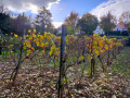
This circular walk takes you on a journey of discovery through the four vineyards of Jouy-le-Moutier. You will learn about the past activities of this hillside with its old limestone quarries, the former CGB railway line that linked Pontoise to Poissy, the Jouy-le-Moutier menhir and two wash houses.
From the Seine to Villa Paul Poiret
 5.62 mi
+413 ft
-404 ft
2h 55
Easy
Departure from Mézy-sur-Seine (Yvelines)
5.62 mi
+413 ft
-404 ft
2h 55
Easy
Departure from Mézy-sur-Seine (Yvelines)
Starting from the banks of the Seine opposite Île Verte, walk up the narrow streets and paths to Villa Paul Poiret.
Cergy Ponds and Megaliths
 8.06 mi
+509 ft
-512 ft
4h 10
Moderate
Departure from Neuville-sur-Oise (Val-d'Oise)
8.06 mi
+509 ft
-512 ft
4h 10
Moderate
Departure from Neuville-sur-Oise (Val-d'Oise)
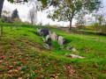
Set off to explore the three megaliths listed as historic monuments on the circular Oise route: two menhirs and a covered passageway, as well as the banks of the Oise, a pond, woods, a wash house, two wells, a fountain, the Axe Majeur and scenic viewpoints.
The wash houses of the Oise circular
 7.30 mi
+203 ft
-203 ft
3h 30
Moderate
Departure from Neuville-sur-Oise (Val-d'Oise)
7.30 mi
+203 ft
-203 ft
3h 30
Moderate
Departure from Neuville-sur-Oise (Val-d'Oise)
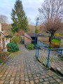
This walk takes you past numerous wash houses fed by springs located on the circular Oise in the municipalities of Jouy-le-Moutier, Vauréal and Cergy. Along the way, you will discover the Jouy-le-Moutier municipal park known as "Parc Raclet", the Rue des Blanchards and its curiosities, the old railway line that linked Pontoise to Poissy, the Axe Majeur, Gérard Philippe's house and the Cergy ponds leisure centre.
From Parc de la Bruneterie to Forêt de Marly circular route
 14.75 mi
+860 ft
-850 ft
7h 30
Difficult
Departure from Orgeval (Yvelines) (Yvelines)
14.75 mi
+860 ft
-850 ft
7h 30
Difficult
Departure from Orgeval (Yvelines) (Yvelines)
This circular route follows theGR®1 trailfrom Parc de la Bruneterie in Orgeval to the Forest of Marly on the way there. On the way back, the route crosses the Joyenval Golf Course and the commune of Chambourcy.
From Poissy to Conflans-Sainte-Honorine via the Forest of Saint-Germain-en-Laye
 11.38 mi
+154 ft
-138 ft
5h 20
Moderate
Departure from Poissy (Yvelines)
11.38 mi
+154 ft
-138 ft
5h 20
Moderate
Departure from Poissy (Yvelines)
A hike from station to station, most of which takes place in the Forest of Saint-Germain-en-Laye, which we cross from south-west to north-east. It is an opportunity to walk through forests of various species and to come across two ancient crosses and two oratories. The route ends with a water theme, at the confluence of the Seine and the Oise.
The Jardins de la Douaye from Gaillon-sur-Montcient
 5.92 mi
+499 ft
-499 ft
3h 10
Easy
Departure from Gaillon-sur-Montcient (Yvelines)
5.92 mi
+499 ft
-499 ft
3h 10
Easy
Departure from Gaillon-sur-Montcient (Yvelines)
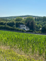
A walk between Gaillon-sur-Montcient and Tessancourt-sur-Aubette to discover different aspects of the Vexin region, as well as the Jardin de la Douaye (Vexin flora, photo exhibitions), a perfect spot for a break along the route.
From Achères to Achères via the Forêt de Saint-Germain and the Étang du Corra
 9.78 mi
+135 ft
-72 ft
4h 35
Moderate
Departure from Achères (Yvelines) (Yvelines)
9.78 mi
+135 ft
-72 ft
4h 35
Moderate
Departure from Achères (Yvelines) (Yvelines)
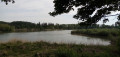
A station-to-station walk, which can also be done as a slightly shorter loop. The route is mainly woodland, using both signposted paths and little-travelled paths in the undergrowth. The Étang du Corra, a protected site, offers an interlude with beautiful views and the chance to spot many birds.
Circular around the Aubette Valley
 13.17 mi
+558 ft
-558 ft
6h 30
Difficult
Departure from Sagy (Val-d'Oise) (Val-d'Oise)
13.17 mi
+558 ft
-558 ft
6h 30
Difficult
Departure from Sagy (Val-d'Oise) (Val-d'Oise)
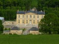
A circular route for a day's hike. Starting from Sagy, you will pass through Saillancourt, Villette, Condécourt, Longuesse and Vigny.
From Cergy to Valmondois along the Oise
 13.98 mi
+253 ft
-528 ft
6h 40
Difficult
Departure from Cergy (Val-d'Oise)
13.98 mi
+253 ft
-528 ft
6h 40
Difficult
Departure from Cergy (Val-d'Oise)
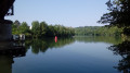
A hike from station to station with the Oise as the guiding thread. You will cross several wooded parks and follow the river for a long time, mostly on a right of way. At the end of the route, the passage through Auvers-sur-Oise is an opportunity to evoke the famous painter Vincent Van Gogh.
The Étang du Corra and the Pavillon de la Muette
 4.42 mi
+89 ft
-89 ft
2h 05
Easy
Departure from Saint-Germain-en-Laye (Yvelines)
4.42 mi
+89 ft
-89 ft
2h 05
Easy
Departure from Saint-Germain-en-Laye (Yvelines)
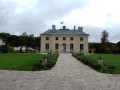
This route to the north of the Forest of Saint-Germain-en-Laye and near Conflans-Sainte-Honorine takes you to the Étang du Corra, a pond with rich biodiversity that is a popular spot for birdwatching. The Pavillon de la Muette is a neoclassical hunting lodge built at the request of Louis XV.
The Saint-Germain-en-Laye golf course tour
 4.80 mi
+49 ft
-49 ft
2h 15
Easy
Departure from Saint-Germain-en-Laye (Yvelines)
4.80 mi
+49 ft
-49 ft
2h 15
Easy
Departure from Saint-Germain-en-Laye (Yvelines)
In search of a little blue butterfly.
During a break halfway through, I saw a magnificent blue butterfly, just once, which was quite exceptional.
This gave me the idea to write an article and since then, I have always dreamed of seeing it again.
From Cergy Saint-Christophe to Conflans-Sainte-Honorine
10.63 mi
+161 ft
-410 ft
5h 00
Moderate
Departure from Cergy (Val-d'Oise)
A walk starting from the new town of Cergy will take you past the circular bends of the Oise, the Cergy leisure centre and its ponds, and the old villages of Vauréal, Jouy-le-Moutier and Neuville-sur-Oise in the Val d'Oise. You will arrive in the Yvelines at Conflans-Sainte-Honorine, the capital of inland waterway transport at the confluence of the Seine and the Oise.
From Achères to Poissy through the Forest of Saint-Germain-en-Laye
 7.64 mi
+167 ft
-207 ft
3h 40
Moderate
Departure from Saint-Germain-en-Laye (Yvelines)
7.64 mi
+167 ft
-207 ft
3h 40
Moderate
Departure from Saint-Germain-en-Laye (Yvelines)
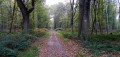
A hike from station to station that crosses the entire western part of the Saint-Germain-en-Laye National Forest. A few ancient crosses mark this forest trail. The route ends in Poissy, where you can admire the Notre-Dame Collegiate Church.
From Achères to Saint-Germain-en-Laye through the forest
 6.89 mi
+161 ft
-0 ft
3h 20
Moderate
Departure from Saint-Germain-en-Laye (Yvelines)
6.89 mi
+161 ft
-0 ft
3h 20
Moderate
Departure from Saint-Germain-en-Laye (Yvelines)
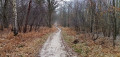
A hike from station to station that crosses the entire eastern part of the Saint-Germain-en-Laye National Forest. A few crosses and oratories mark this forest trail. The route ends in Saint-Germain-en-Laye, where you can admire its castle, built in the 12th century.
Les Tailles d'Herbelay
5.80 mi
+374 ft
-394 ft
3h 00
Moderate
Departure from Aigremont (Yvelines) (Yvelines)
A pleasant hike through the forest and along a golf course in a little-known part of the Marly National Forest.
The Oise River near the Cergy-Neuville Leisure Centre
 12.24 mi
+515 ft
-531 ft
6h 05
Difficult
Departure from Éragny (Val-d'Oise)
12.24 mi
+515 ft
-531 ft
6h 05
Difficult
Departure from Éragny (Val-d'Oise)
The Cergy-Neuville Leisure Centre is located in a loop of the Oise River. The hike crosses the centre, giving you an idea of the variety of activities on offer there. It continues along the slopes of the right bank of the river, offering beautiful views of the entire meander. The passage through Port-Cergy, as well as several heritage sites (churches, wash houses, covered walkways, etc.), adds to the interest of the walk.
The Bois du Domaine and the Ru de la Rouase
 5.90 mi
+476 ft
-489 ft
3h 10
Moderate
Departure from Bazemont (Yvelines)
5.90 mi
+476 ft
-489 ft
3h 10
Moderate
Departure from Bazemont (Yvelines)
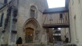
Starting from the village of Bazemont, rich in heritage, this is a forest loop for a good half of the route, with passages between fields and along the streams that drain them.
Heritage along the Brillante and Bernon rivers
 10.73 mi
+784 ft
-787 ft
5h 35
Moderate
Departure from Seraincourt (Val-d'Oise) (Val-d'Oise)
10.73 mi
+784 ft
-787 ft
5h 35
Moderate
Departure from Seraincourt (Val-d'Oise) (Val-d'Oise)
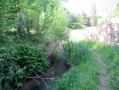
This walk will take you along streams and through countryside, valleys and paths to discover the heritage of three charming villages. Beautiful views are also on the menu for this walk.
Théméricourt loop starting from Vigny
 7.28 mi
+213 ft
-203 ft
3h 30
Moderate
Departure from Vigny (Val-d'Oise) (Val-d'Oise)
7.28 mi
+213 ft
-203 ft
3h 30
Moderate
Departure from Vigny (Val-d'Oise) (Val-d'Oise)
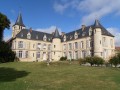
A loop starting from Vigny via Théméricourt and Avernes.
Sagy circular starting from Vigny
 7.94 mi
+348 ft
-344 ft
3h 55
Moderate
Departure from Vigny (Val-d'Oise) (Val-d'Oise)
7.94 mi
+348 ft
-344 ft
3h 55
Moderate
Departure from Vigny (Val-d'Oise) (Val-d'Oise)
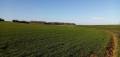
A circular route in the French Vexin, mainly through fields. Starting from the church in Vigny, the route passes through the villages of Sagy and Longuesse, each with their own church.
The Heights of Boissy-l'Aillerie
4.55 mi
+285 ft
-282 ft
2h 20
Easy
Departure from Boissy-l'Aillerie (Val-d'Oise)
A pleasant walk starting from Boissy-l'Aillerie station, through the wooded and grain-growing areas of the Vexin plateau.
The Chaussée Jules César and the Coteaux de la Viosne
 7.47 mi
+486 ft
-486 ft
3h 50
Moderate
Departure from Boissy-l'Aillerie (Val-d'Oise)
7.47 mi
+486 ft
-486 ft
3h 50
Moderate
Departure from Boissy-l'Aillerie (Val-d'Oise)
A hike on the slopes of both banks of the Viosne, alternating between cultivated fields, woodland and charming villages. For about 3 kilometres, the route follows the course of an ancient Roman road, the Chaussée Jules César. There is a rich heritage to discover along the way: mills, a castle, churches, crosses, wash houses and beautiful houses.
Around Boissy-l'Aillerie
8.41 mi
+404 ft
-413 ft
4h 15
Moderate
Departure from Boissy-l'Aillerie (Val-d'Oise)
Between town and countryside, this walk is mainly marked by yellow PR® markers.
Osny circular to Boissy-l'Aillerie
5.73 mi
+187 ft
-184 ft
2h 50
Easy
Departure from Osny (Val-d'Oise)
The hike begins in front of Osny Town Hall in the beautiful setting of Château Grouchy and its park bordered by a pond. The walk heads north-west to the town of Boissy-l'Aillerie, returning south and then east to the starting point via Grouchy Park.
Much of the route is away from roads with motor traffic.
Fourqueux - Marly Forest - a circuit for when the paths are muddy
 7.83 mi
+230 ft
-230 ft
3h 50
Easy
Departure from Chambourcy (Yvelines)
7.83 mi
+230 ft
-230 ft
3h 50
Easy
Departure from Chambourcy (Yvelines)
This circuit consists almost exclusively of paved forest roads, at least in part, and is closed to motor traffic.
This allows you to hike in the forest without having to surf on paths full of water and mud in winter.
Discovering Pontoise
 4.60 mi
+279 ft
-279 ft
2h 20
Moderate
Departure from Pontoise (Val-d'Oise)
4.60 mi
+279 ft
-279 ft
2h 20
Moderate
Departure from Pontoise (Val-d'Oise)
This route is rich in history and allows you to discover the heritage of Pontoise and its little-known paths.
The Flambertins Forest and the Abbecourt Pond
 9.22 mi
+384 ft
-381 ft
4h 35
Moderate
Departure from Crespières (Yvelines)
9.22 mi
+384 ft
-381 ft
4h 35
Moderate
Departure from Crespières (Yvelines)
A hike that alternates between forest and fields, with a small pond that is ideal for a pleasant break.
Crespières, Thiverval-Grignon, Davron: rural valleys, open plateaus
 9.26 mi
+643 ft
-666 ft
4h 50
Moderate
Departure from Crespières (Yvelines)
9.26 mi
+643 ft
-666 ft
4h 50
Moderate
Departure from Crespières (Yvelines)
A pleasant route alternating between small villages, forest edges and wide open horizons.
Around Montainville
4.71 mi
+262 ft
-262 ft
2h 25
Easy
Departure from Mareil-sur-Mauldre (Yvelines)
Montainville is situated in the centre of the Yvelines department. The commune’s territory extends across the eastern edge of the Mantois plateau and the western slope of the Mauldre valley. The village site forms a promontory bounded by two valleys named after their springs: the Serpe valley to the north and the Orme valley to the south.
From Mareil-sur-Mauldre station to Poissy station, via Orgeval
 11.36 mi
+587 ft
-666 ft
5h 45
Moderate
Departure from Mareil-sur-Mauldre (Yvelines)
11.36 mi
+587 ft
-666 ft
5h 45
Moderate
Departure from Mareil-sur-Mauldre (Yvelines)
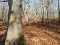
A fairly easy walk from station to station, the first part of which is through woodland where you can admire superb specimens of various species of deciduous trees, particularly beeches and oaks, which are certainly over a hundred years old. You also pass close to the Alluets-le-Roi telecommunications centre and its many antennas of all types.The second part, which is more varied, includes a visit to the ruins of Abbecourt Abbey and the centres of the villages of Orgeval and Villennes-sur-Seine with their churches. The walk ends with a pleasant stroll along the banks of the Seine.
Over hill and dale, from Mareil-sur-Mauldre to Beynes
 8.73 mi
+712 ft
-705 ft
4h 40
Moderate
Departure from Mareil-sur-Mauldre (Yvelines)
8.73 mi
+712 ft
-705 ft
4h 40
Moderate
Departure from Mareil-sur-Mauldre (Yvelines)
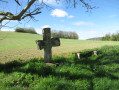
A hike along the hillsides on both banks of the Mauldre river, offering beautiful panoramic views. There are heritage sites to discover in the three towns along the route.
From Mareil-sur-Mauldre to Épône along the Mauldre and through the countryside
 8.01 mi
+505 ft
-561 ft
4h 05
Moderate
Departure from Mareil-sur-Mauldre (Yvelines)
8.01 mi
+505 ft
-561 ft
4h 05
Moderate
Departure from Mareil-sur-Mauldre (Yvelines)
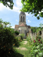
On this walk from station to station, you’ll follow the Mauldre river through the countryside, passing through several villages to discover some heritage sights.
The Bois de Galluis forest, starting from Frémainville
 5.85 mi
+443 ft
-453 ft
3h 05
Easy
Departure from Frémainville (Val-d'Oise)
5.85 mi
+443 ft
-453 ft
3h 05
Easy
Departure from Frémainville (Val-d'Oise)
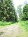
This mainly forest hike will take you to the Galluis Regional Forest, then on to the village of Frémainville, where you will discover some interesting heritage sites. It is best to do this walk during the dry season.
More walks in Verneuil-sur-Seine
Select a point of interest below: