Country:
 City:
City:


The walk starts from Triel-sur-Seine station, coming from Paris –Gare Saint-Lazare. Take the J train towards Mantes-la-Jolie.
(S) On leaving the station, head to the right until you reach the three-way junction, then turn left onto Rue de la Gare. Walk down to the square, then turn left onto Rue de l’HautiL and continue to the end of the street. At the traffic lights, head almost straight ahead onto Rue du Port and continue to the banks of the Seine at Place Foch.
(1) Turn left (Quai Auguste Roy) then take the ramp that climbs to the left to reach the suspension bridge over the Seine. Cross the bridge, then take the stairs on the right to descend to the opposite bank. Walk along the river on your right until you reach a viewpoint overlooking the Étang du Gallardon.
(2) Continue along the path between the pond and the river, walk alongside the Étang de la Grosse Pierre, then head for the jetty at the Île de Loisirs du Val de Seine marina, staying on the main path which branches off to the left but keeping to the right to go round it.
(3) Carry on towards the Seine, then turn left and walk alongside the Étang du Rouillard on your left, ignoring the path between the two ponds. At the end, turn right and reach the riverbank.
(4) Continue along the GRP® to the left and follow the Seine to the end of the cycle path. Carry on along the tarmac road until you reach a three-way junction.
(5) Turn left, ignore Rue Pierre Leroy and reach the end of Rue Félix Faure. Note the Parc des Marronniers on your right. Turn right, then keep to the right and cross the bridge over the Seine, followed by the bridge over the river’s branches, and continue straight on until you reach the D190 on your left.
(6) Take this road (Rue Georges Clemenceau), heading towards Le Paradis. Ignore Avenue de la Gare on the right – which leads to Meulan-en-Yvelines station – and continue to the next junction.
(7) Turn right onto the D913, go under the railway bridge and, immediately on the left, take the path that runs alongside the houses on your right. At the road, carry straight on and, at the three-way junction, keep left onto Rue Chantereine and follow it to the end.
(8) First turn right then left and take the small street that leads down to the left towards the church and Place Bargeton.
(9) Enter the square, ignore the Mézy-sur-Seine Town Hall, and take the path that runs alongside the sports grounds. Climb, zigzagging your way up, until you reach a road.
(10) Cross the road and continue along the path that climbs to the left, passing number 12. Walk to number 21 and, at the corner, take the small path on the left that climbs through the woodland. Pass the viewpoint and its orientation table and come out onto a road. Follow it until you reach another road.
(11) Follow it to the left for about 1 km. Enjoy a lovely view over the plain and the River Seine. Enter Jusiers and arrive at a multi-way junction.
(12) Turn left downhill onto Rue de la Côte d’Apremont, pass a wash house on the corner of Sente des Bioudres, and at the end of the street, by the reservoir, continue along the woodland path which starts at the corner of No. 13. Carry on straight ahead to the bottom of the slope and arrive at Saint-Michel Church.
(13) Turn right onto Avenue de Paris, go under the railway bridge and carry on until you reach Avenue Lucie Desnos on the left.
(14) Follow this road, passing the chapel at the first roundabout, and carry on to the next one. Turn right, then immediately left at the three-way junction to reach Gargenville Station (E).
 Visorando Member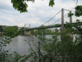
 Easy
Easy 
 Moderate
  Very difficult