Start
The hike begins at the start of Rue des Belles Hates in the town of Eragny (Val d'Oise).
(S) Head north until you reach the T-junction with Rue de Neuville on the edge of the hillside, where you turn right and follow thePR® (yellow) signposts.
PR® signposting (yellow)
At the next crossroads, turn left onto the road that goes downhill. At the bottom of this road (Rue de la Gare), leave the marked route and turn left onto Rue de la Fontaine, continuing for about 50 metres. Go down the few steps on the right to reach the Eragny wash house.
(1) Continue to the right, following the path along the stream. This will bring you back to the marked route on Rue du Ru, which you take to the left to reach the banks of the Oise. Then turn left and follow the towpath. Go under a railway bridge, then after walking alongside cultivated fields, go under the D203 bridge. You will then arrive next to the fence of a property, which you follow. Shortly afterwards, in the woods, you will see the tennis courts through the vegetation on your left. You are opposite Port-Cergy, located on the other bank of the Oise.
No signposts
(2) Turn left onto the path leading to a small road, which you take to the left to go around the tennis courts. At the crossroads, turn right onto Rue des Fournières, then, about 50 metres further on, turn left onto Rue de la Féculerie. You will arrive at the entrance to the Leisure Centre.
(3) Turn right and enter the Leisure Centre. Continue for about 100 metres and turn left to follow the lake walk. Pass a restaurant and the centre's reception building. Continue straight ahead through the Adventure Course area until you see a sign for "Rolling Bulle".
(4) Turn left onto the grassy path leading up to the top of the hill where you will find the start of a very long zip line. Then descend towards the Oise to join the path running along its bank.
PR® signposting (yellow)
(5) Follow the Oise on your right for about one kilometre until you reach the bridge. Go under the bridge: you are next to the Pavillon d'Amour in Neuville-sur-Oise.
(6) Turn left, climb the stairs, cross the Oise and turn right into Rue de la Prairie. After a few metres, at the bottom of the descent at the end of the bend, take the path on the right that leads to the riverbank.
No signposts
Continue left, following the course of the Oise. The path runs alongside the wire fences of a few properties until you reach a wood. Cross the stream and turn left onto the path that takes you back to Rue de la Prairie. Turn right.
PR® signposting (yellow)
(7) Continue right along Rue de la Fontaine Bénite, passing a wash house a few metres further on. At the end of the bend to the left of the street, climb the steps in the narrow passage straight ahead. This will take you to Grande Rue, at the foot of the church. Go around the church on the right and climb the steps to the level of a garden, which you cross to exit, after climbing another set of steps, at the Chemin des Miettes, built on the platform of an old railway line.
(8) Continue right along Chemin des Miettes for 500 metres, then turn left onto the grassy path that descends into the valley. Cross the first street, then Rue des Pendants, and continue straight ahead along Sente des Pendants, which climbs up the hillside. At the crossroads, turn left and continue climbing. You will come to a path marked in red and yellow (GRP® Ceinture Verte de l'Ile-de-France). Turn right and continue to the fence of a recreation area, which you can enter through a swing gate.
(9) Continuing on, you will arrive at an esplanade with a belvedere on the right, offering a beautiful view of the Cergy-Neuville Leisure Centre. Then continue north. You will leave the recreation area through another swing gate.
No signposts
Continue straight ahead along the Vauréal circuit (sign). Four hundred metres further on, you will see a badly damaged covered walkway on your right, below the path, called the Cimetière des Anglais (English Cemetery, a Neolithic burial site).
PR® signposts (yellow)
(10) Continue straight ahead (there are also red and yellow markings). After about 100 metres, turn right onto the steeply sloping path. After a hairpin bend to the right, it leads to Impasse Jules Bourgoin. Turn left into the cul-de-sac, continue along the narrow crossroad and then turn left. You will come to a crossroads with traffic lights.
(11) Cross and continue to the left. After a few dozen metres, turn right onto the promenade towards the Axe Majeur. Walk until you reach the monumental staircase, which you will come across after about 1.5 km.
No signposts
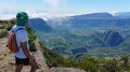
(12) It is worth climbing to the top of the stairs, at the columns, to enjoy the view. (On a clear day, you can see the towers of the La Défense district to the south-east).
Then go down the stairs, cross the road and take the footbridge to return to the Parc de Loisirs. Continue left along the beautiful path between the Oise and the pond. This will take you to a crossroads near a bridge close to another entrance to the Leisure Centre. Turn left and, at the end of this lane, climb the stairs up to the bridge. Cross the bridge and you are at the entrance to Port-Cergy.
(13) Turn right to pass under the entrance porch to Port-Cergy. Go around the quays on the left. You will cross a small footbridge and reach the banks of the Oise. Keep left alongside the houses and turn left at the end of them. At the T-junction with Avenue Jean Bart, you will join a route marked in yellow.
PR® signposting (yellow)
(14) Turn right, then, after passing under the road bridge 200 metres further on, turn left into Chemin Neuf. This will take you to two bridges, then to Allée des Plantes, which you take on the right.
(15) At the end of the housing estate, this lane continues along a winding path through the woods. Follow the signs carefully (they are very clear) as there are several junctions that could lead you astray. The path ends at a road at the edge of the woods.
(16) Continue left on the road towards Pontoise until you reach Parc des Larris. Continue straight ahead and cross Parc des Larris. You will pass under a railway line and a road bridge.
(17) At the end of the park, turn left onto the path that climbs up to the road and then left again to cross the Oise. Once you have crossed the bridge, go down the steps on the left to the riverbank. Continue left, following the towpath that takes you back to Rue du Ru, which you take on the left to Rue de la Gare, in front of the church. Go up Rue de la Gare on the right to the crossroads, where you turn right to reach the car park (E).