The Jardins de la Douaye from Gaillon-sur-Montcient

A walk between Gaillon-sur-Montcient and Tessancourt-sur-Aubette to discover different aspects of the Vexin region, as well as the Jardin de la Douaye (Vexin flora, photo exhibitions), a perfect spot for a break along the route.

Details

30692226
Creation:
Last update:
Last review:
  • Walking
    Activity: Walking
  • ↔
    Distance: 5.92 mi
  • ◔
    Average duration: 3h 10 
  • ▲
    Difficulty: Easy

  • ⚐
    Back to start: Yes
  • ↗
    Ascent: + 499 ft
  • ↘
    Descent: - 499 ft

  • ▲
    Highest point: 299 ft
  • ▼
    Lowest point: 79 ft

Photos

Description of the walk

 Start from the car park at Gaillon-sur-Montcient Town Hall on Rue de la Montcient.

(S/E) Leave the car park heading towards the church, go round it on the right, reach Rue du Point du Jour and follow it to the right. Go up a hill and, at the top, turn right onto the Sente des Mulets. Follow the path downhill to the Moulin de Metz.

(1) Turn left and follow the Montcient stream to the Moulin des Marais (hotel and restaurant). When you reach the mill, turn left and then immediately right onto a path that runs behind the hotel buildings. After 800 metres, you’ll come out onto a road; follow it to the left. At the top of the hill, you’ll arrive in front of a secondary school.

(2) Carry on straight ahead and, at the next junction, take the street leading uphill to the left. In front of the entrance porch to a property, take the path leading uphill to the right. At the next fork in the road, turn right and continue to the first junction.

(3) Turn right onto a bridge spanning a bypass and, immediately afterwards, turn right again. The path descends, passes the Ferme d’Orzeau and arrives at Tessancourt-sur-Aubette.

(4) When you reach the Grand Rue, turn left towards the church. In front of the church, take Rue du Moulin Brulé, which descends to the right of the building. When the street bends to the right, take the path that goes straight on, overlooking the sports grounds, and follow it to the end. This leads onto Route de Condécourt.

(5) Turn left onto it. Just past No. 17, turn right up a small flight of steps and continue along the path to the end. You’ll come out onto Chemin de la Cavée; follow it to the left. When the road bends to the left, take the path that veers slightly to the right and follow it to the bridge. Cross back over the bypass and return to the junction you passed on the way there.

(3) Carry on straight ahead, pass the first junction and then, at a Fork in the road, take the path on the right. At the end, turn right towards the water tower; let the path branch off to the right and carry on straight ahead between two fields along a barely visible track that descends towards the first houses in Gaillon. This track leads into a street; follow it straight on and, at the next junction, take Rue de la Douaye straight ahead until you reach the garden of the same name opposite No. 2.

(6) After the garden, continue to the end of Rue de la Douaye and turn right into Grande Rue. Just past No. 65 on Grande Rue, turn left into Rue du Four aux Prêtres. After No. 43, take a grassy path uphill to the right. At the top, take a path to the left and follow it until it joins a road.

(7) Follow the road (Rue de la Cavée) to the left and, after 400 m, turn right into Rue des Bourgeons. At the end of the street, turn left to arrive directly at the car park (S/E).


Waypoints

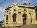
  1. S/E : mi 0 - alt. 161 ft - Town Hall car park. Towards the - Église Notre-Dame-de-l'Assomption (Gaillon-sur-Montcient)
  2. 1 : mi 0.46 - alt. 98 ft - Metz Mill - Ru de la Montcient (rivière) - Affluent de l'Aubette
  3. 2 : mi 1.12 - alt. 112 ft - Montcient Secondary School
  4. 3 : mi 2.12 - alt. 299 ft - Bridge over the ring road
  5. 4 : mi 2.85 - alt. 141 ft - Tessancourt-sur-Aubette
  6. 5 : mi 3.28 - alt. 184 ft - Route de Condécourt
  7. 6 : mi 4.83 - alt. 180 ft - Jardin de la Douaye
  8. 7 : mi 5.68 - alt. 272 ft - Rue de la Cavée
  9. S/E : mi 5.92 - alt. 161 ft - Town Hall car park

Notes

You can join the route at point (2) from Meulan Hardricourt railway station (approximately 1 km away).

There are no refreshment points along the route.

Worth a visit

The churches of Gaillon and Tessancourt.

Moulins de Metz and Moulins des Marais.

The snail farm in Oinville-sur-Montcient.

Meulan Hardricourt railway station.

Reviews and comments

4.3 / 5
Based on 3 reviews

Reliability of the description
4.3 / 5
Ease of following the route
4.3 / 5
Route interest
4.3 / 5
PedroB
PedroB

Overall rating : 5 / 5

Date of your route : Oct 27, 2025
Reliability of the description : ★★★★★ Very good
Ease of following the route : ★★★★★ Very good
Route interest : ★★★★★ Very good
Very busy route : No

Beautiful course, very diverse. Very pleasant.

Machine-translated

Fred Chauveau
Fred Chauveau

Hello, I just did this hike again to see if there was a problem at the bottom of the mule track. A branch had fallen and was blocking the entrance to the path (I added a photo at point 1 after removing the branch). I think that was the source of the difficulty encountered by flat6twin, because if you stay to the left of the hedge, you do indeed encounter barbed wire. So there is no longer a problem now.
Thanks for the feedback

Machine-translated

User 11313547

Hello
I did this hike not long ago and didn't encounter any barbed wire. I took the mule track to the Metz mill
The hardest part is getting between the two fields! The trail is not very visible, as mentioned in the description
An interesting hike with a visit to the Douaye garden
Best regards

Machine-translated

flat6twin
flat6twin

Overall rating : 4 / 5

Date of your route : Aug 25, 2025
Reliability of the description : ★★★★☆ Good
Ease of following the route : ★★★★☆ Good
Route interest : ★★★★☆ Good
Very busy route : No

There is indeed a problem at the start of the hike.
I don't think you should go down the Sente des Mulets to the Metz mill, but find a passage on the left (if there is one) well before you reach the bottom.
Otherwise, you can't get through because there's barbed wire. I managed to find a way through, but I had to walk a few dozen metres through thick grass and nettles before finding the path that leads to the school.
The rest of this pleasant walk went smoothly.

Machine-translated

User 11313547

Overall rating : 4 / 5

Date of your route : May 27, 2025
Reliability of the description : ★★★★☆ Good
Ease of following the route : ★★★★☆ Good
Route interest : ★★★★☆ Good
Very busy route : No

Hello
An interesting, varied walk
It’s true that some sections are very grassy!

Machine-translated

Other walks in the area

For more walks, use our search engine .

The GPS track and description are the property of this route's author. Please do not copy them without permission.