Country:
 City:
City:


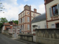
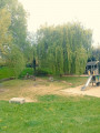
Start from the car park on Rue du Pépin in Vernouillet. For access by train, see the practical information.
(S/E) With your back to the lake, follow theGR®1to the end of Rue du Pépin. Turn right into Rue Jean Jaurès. Go through the railway tunnel. Cross Boulevard de l’Europe at the pedestrian crossing and continue in the same direction. At the end of Rue Jean Jaurès, turn left and pass the two cul-de-sacs on your left.
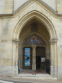
(1) Walk past the church entrance along Rue Aristide Briand. Go under the porch on the left. Rue du Clos Thonesse bends to the right then to the left. Turn right onto Rue de la Fontaine Romée, which runs alongside the cemetery. Turn left, then go straight on at the junction.
(2) At the next two junctions, take Rue des Carrières opposite, then Rue des Poiriers. After the high-voltage power line, keep to the right. Then ignore the paths branching off to the right.
(3) Follow the road to the left and, before the roundabout, turn right onto the path that runs alongside a field. Ignore a path on the right to keep the copse on your right-hand side. In the woods, follow the main path uphill. When you reach the houses, keep to the right.
(4) Follow Rue du Louvre to the left. Pass Rue du Clos au Faîte on your right. Stay on the tarmac for 500 m. After the clearing, leave the road at the Fork in the road, keeping to the right.
(5) Turn right immediately. In the woods, ignore the paths to the right and left. At the Fork in the road, keep to the right. At the crossroads, turn left. Join Rue de Brezolles.
(6) At the crossroads, follow the path straight ahead, to the left of the dead-end road. Turn right at the end of the path. Ignore a path on the left. At the end of the street, turn right.
(7) Keep left, walk past the château, then turn left into Rue des Clos. At the crossroads, head down to the left. At the end, follow Rue Sainte-Anne to the right, then keep right at the Fork in the road. Pass under the A13 motorway.
(8) Cross the D113 carefully and continue along the one-way road. Cross a stream. At the junction, go straight on. Turn into the second path on the left. At the crossroads, take the first turn right then left.
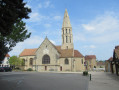
(9) Follow the tarmac straight ahead. Cross Rue de la Gare. At the Stop sign, head towards the traffic lights on the left. Use the pedestrian crossing to follow the road opposite. Continue straight ahead until you reach the church.
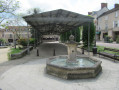
(10) Walk round the church on the right. Pass the covered market on your left. At the end of the car park, turn right at the Stop sign. Follow Chemin du Ru to the end. Turn left onto Rue de Colombet. Go through the gate on the right into Parc de la Bruneterie. Follow the path on the right which leads uphill to the park’s exit.
(11) After the exit, leave theGR®1and follow the road to the left. At the junction, turn left. At the Stop sign, first turn right then left. At the roundabout, follow the Chemin des Guêtes against the flow of traffic. Ignore the paths to the left and right. Use the pedestrian crossing to cross the D113 and continue straight ahead.
(12) Cross over the Normandy Motorway. Walk past the Villennes Golf Course and its car parks. At the roundabout, turn left using the pedestrian crossing. Before the next roundabout, use the pedestrian crossing to turn right onto Avenue de la Ferme de Marolles. Go straight on at the Stop sign.
(13) Turn right onto Avenue Irène. At the end, go down the stairs. At the bottom, carry straight on until you reach the Stop sign. Make a right-left turn. At the end of the street, turn left and then enter the park on the right. Go down the steps and, at the bottom of the park, cross one of the small bridges.
(14) Turn right, passing a bandstand on your left, and head towards the church. Turn left and walk alongside the station. Keep to the right at the Stop sign.
(14) Walk past the town hall park. At the Fork in the road, turn right. At the junction, carry on straight ahead. Pass the path on your left and turn left into Rue Vandernack.
(15) Turn right into Rue Pierre Curie. Walk down Rue de la Victoire. Follow the path on the left alongside the wall. At the end, take the stairs on the right. Turn left. Walk past the church on your right. Follow Rue Pierre Curie to the right again. At the Fork in the road, keep right. Walk down the hairpin bend to the right.
(16) After Emile Zola’s house, carry on straight ahead along Rue Pasteur. At the church, turn slightly right into Rue Ronsard, which you have already taken. At the end, turn left into Rue Pasteur. After the washhouse, go under the railway line and turn left.
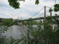
(17) Continue along the Seine, leaving Rue Emile Zola on your left. Walk past the campsites. Go under a road bridge. The road veers away from the Seine. Follow the path on the right through the fields. Go under the Triel-sur-Seine bridge.
(19) Join theGR®1again by climbing the steps on the left. Walk to the middle of the bridge.
(19) Turn round and go back down the same steps.
(19) Walk along the right-hand side of the Seine. Turn left, then, at the crossroads, take the Route de Verneuil straight ahead. Stay on the tarmac. Walk along the lake. At the Stop sign, there are two options depending on your mode of transport:
- If you’ve come by car, head straight ahead to the car park (S/E).
- If you’ve come by train, turn right twice to reach Rue Louis Berson, which runs alongside the ponds and leads to Vernouillet-Verneuil station.

 Visorando Member
 Very difficult
 Moderate
 Easy
Easy