


Refine your search for walks in Corps
Corps walks


 Peyrague Circular Route
 Visorando Member
 6.02 mi
 +2,178 ft
 -2,178 ft
 4h 40
4h 40
 Moderate
 Departure from Corps (Isère)
Starting from Corps, this is a lovely circular walk, mostly through woodland, suitable for average walkers who are fit enough for the effort; children, under supervision, will fall into this category of participants. Peyrague offers an ideal spot for a picnic and an interesting 360° viewpoint.
Valbonnais Circular Loop
 6.81 mi
+2,526 ft
-2,510 ft
5h 20
Moderate
Departure from Les Côtes-de-Corps (Isère)
6.81 mi
+2,526 ft
-2,510 ft
5h 20
Moderate
Departure from Les Côtes-de-Corps (Isère)
Hike to discover views of the main mountain ranges surrounding Valbonnais. A varied route through forests and alpine meadows, accessible to all average hikers.
The Samblue ridges via the Col des Faîsses
 Association / Club / Walk leader
 7.44 mi
+3,264 ft
-3,268 ft
6h 15
Moderate
Departure from Pellafol (Isère)
7.44 mi
+3,264 ft
-3,268 ft
6h 15
Moderate
Departure from Pellafol (Isère)
Visit to His Majesty the Obiou. From the Samblue ridges, there is a beautiful view of the Pellafol and Obiou plains.
Notre-Dame de la Salette: from the Col de l’Homme to the summit of the Gargas
 4.85 mi
+1,880 ft
-1,854 ft
3h 50
Moderate
Departure from La Salette-Fallavaux (Isère)
4.85 mi
+1,880 ft
-1,854 ft
3h 50
Moderate
Departure from La Salette-Fallavaux (Isère)
The Sanctuary of La Salette is set amidst lush greenery and steep mountains. The suggested route will take you to the summit of Gargas (2,208 m), where an orientation board will help you identify the Dévoluy, the Obiou and the peaks of the Barre des Écrins, amongst dozens of other peaks. The view in fine weather is superb.
Please note: the 600-metre climb is covered over the first four kilometres. This hike is best suited to experienced walkers.
Lovely circuit under the Préaux
 4.32 mi
+676 ft
-676 ft
2h 35
4.32 mi
+676 ft
-676 ft
2h 35
 Easy
Departure from Aspres-lès-Corps (Hautes-Alpes)
Easy
Departure from Aspres-lès-Corps (Hautes-Alpes)
Easy walk, 2/3 in the shade and 1/3 with beautiful views over the vast Drac valley and surrounding mountains.
Pic Gazonné via the Col des Vachers
 7.33 mi
+3,527 ft
-3,543 ft
6h 25
7.33 mi
+3,527 ft
-3,543 ft
6h 25
 Difficult
Departure from Aspres-lès-Corps (Hautes-Alpes)
Difficult
Departure from Aspres-lès-Corps (Hautes-Alpes)
A superb hike in the magnificent Valgaudemar massif, starting from the charming and picturesque hamlet of Brudour. The well-signposted route is easy to follow and features numerous remarkable landmarks along the way.From the very first steps, we are immersed in a sea of tall, green, fresh and lush grass. The path then runs alongside the rushing Brudour torrent, whose roar cheerfully accompanies our progress.Once on the ridge, the view is breathtaking. The surrounding mountain ranges reveal themselves in all their splendour. A hike that is both straightforward and spectacular, perfect for filling your lungs with fresh air and your mind with unforgettable memories.
La Croix de Rougny, return via the ridges
 4.82 mi
+1,860 ft
-1,827 ft
5 hrs
4.82 mi
+1,860 ft
-1,827 ft
5 hrs
 Very difficult
Departure from La Salette-Fallavaux (Isère)
Very difficult
Departure from La Salette-Fallavaux (Isère)
From the forecourt of the Basilica of Notre-Dame de la Salette, there is a view of the entire hike. An exceptional panorama. With the optional Gargas, it's nothing but happiness.
Ridges around La Salette: from Le Gargas to La Croix de Rougny
 7.01 mi
+2,625 ft
-2,635 ft
5h 30
Difficult
Departure from La Salette-Fallavaux (Isère)
7.01 mi
+2,625 ft
-2,635 ft
5h 30
Difficult
Departure from La Salette-Fallavaux (Isère)
This is a magnificent ridge walk around the Sanctuary of La Salette, a circular route offering stunning views all along the way. First, you climb the Gargas, crossing from the Col d’Huretières to the Col de l’Éterpat, then ascend to Le Chamoux to follow the long ridge via the Tête de la Pale Traversière and then the Croix du Rougny, before descending for a mid-slope traverse back to the Sanctuary.
Please read the practical information carefully before setting out on this route.
Le Chauvet from the Col de l'Holme
 4.48 mi
+1,660 ft
-1,631 ft
3h 30
Moderate
Departure from Sainte-Luce (Isère)
4.48 mi
+1,660 ft
-1,631 ft
3h 30
Moderate
Departure from Sainte-Luce (Isère)
This hike is not marked, but it is easy to follow and the 360° view from the summit is magnificent.
Around the Haute Gillarde springs
 5.02 mi
+1,024 ft
-1,004 ft
3h 10
Moderate
Departure from Pellafol (Isère)
5.02 mi
+1,024 ft
-1,004 ft
3h 10
Moderate
Departure from Pellafol (Isère)
A pleasant walk, accessible to all, where you can take your children along, under supervision of course.The trickier sections are protected. Take your time.Enjoy the view of the crushing foothills of Dévoluy and discover an unusual phenomenon: the resurgent source of Haute Gillarde and its confluence with La Souloise.
Moulins de la Sézia circular loop
 5.61 mi
+1,345 ft
-1,339 ft
3h 45
Moderate
Departure from Quet-en-Beaumont (Isère)
5.61 mi
+1,345 ft
-1,339 ft
3h 45
Moderate
Departure from Quet-en-Beaumont (Isère)
Hike in Beaumont with the almost constant view of the Obiou Massif as your companion.
The alternating tracks, paths and trails combine with woods and undergrowth, through the rural activities of yesteryear (mills, vineyards, etc.).
This walk is suitable for all walkers, including families who are used to a bit of effort...
The Bâtie and Ruisseau de la Croix de la Pigne circular loop
 4.83 mi
+892 ft
-892 ft
3h 00
Easy
Departure from Cordéac (Isère)
4.83 mi
+892 ft
-892 ft
3h 00
Easy
Departure from Cordéac (Isère)
Châtel-en-Trièves invites you to take this short walk to discover the hidden corners of our village. Nestled between the plains and the mountains, the walk ends alongside a stream where you can enjoy the cool, refreshing air – and why not take the time for a picnic?
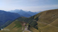
Circular to Notre-Dame de la Salette
 8.90 mi
+2,044 ft
-2,041 ft
5h 50
Difficult
Departure from Saint-Michel-en-Beaumont (Isère)
8.90 mi
+2,044 ft
-2,041 ft
5h 50
Difficult
Departure from Saint-Michel-en-Beaumont (Isère)
This magnificent circular route, in the Beaumont and Valbonnais mountains, towards the sanctuary of Notre-Dame-de-la-Salette, offers breathtaking views of the Oisans massif, the Dévoluy, the Obiou, the Matheysine and, further afield, the Vercors massif.
⚠️ 20/05/2026: This hike should be avoided in winter. Some sections are comparable to mountaineering.
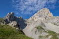
Grande Tête de l'Obiou
 6.23 mi
+4,154 ft
-4,140 ft
8 hrs
Very difficult
Departure from Pellafol (Isère)
6.23 mi
+4,154 ft
-4,140 ft
8 hrs
Very difficult
Departure from Pellafol (Isère)
A magnificent hike on vertiginous trails in the Dévoluy Massif, offering splendid panoramic views of the surrounding mountains throughout the entire route. A real breath of fresh air.
Hikers beware: this route is for experienced hikers only and a helmet is mandatory. It is also advisable to only attempt this hike in good weather.
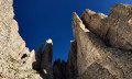
Obiou via the cat flaps and the chimney of the Petit Obiou
 6.17 mi
+4,350 ft
-4,321 ft
6 hrs
6.17 mi
+4,350 ft
-4,321 ft
6 hrs
 Extremely difficult
Departure from Pellafol (Isère)
Extremely difficult
Departure from Pellafol (Isère)
This fun and spectacular variation on the magnificent ascent of the Grande Tête de l’Obiou allows you to complete a circular loop, climbing up the splendid Cheminée du Petit Obiou wedged between the stone pillars of this wild summit, then squeezing through the two narrow passages on the east face of the Grand Obiou.
A few short sections of easy climbing (maximum 3c) and a route largely off the beaten track lend the hike a sense of wild adventure.
The Achards circular route via Les Roussins and Les Pierres d’Antoires
3.44 mi
+814 ft
-794 ft
2h 20
Easy
Departure from Cordéac (Isère)
This walk will take you past the Ruisseau des Achards, the old hamlets at the foot of the Obiou (Les Achards, Les Roussins, Côte Belle) and the mysterious Pierres d’Antoires. This route is particularly pleasant in hot weather as it runs mainly through woodland.
Saint-Firmin Castle Discovery Trail
2.19 mi
+643 ft
-636 ft
1h 35
Easy
Departure from Chauffayer (Hautes-Alpes)
A short walk following the discovery trail around the fortified castle of Saint-Firmin.
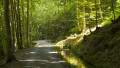
Ridges and the Beaumont Canal
 9.88 mi
+2,405 ft
-2,411 ft
6h 40
Difficult
Departure from Valbonnais (Isère)
9.88 mi
+2,405 ft
-2,411 ft
6h 40
Difficult
Departure from Valbonnais (Isère)
This circular loop offers a chance to appreciate the enormous effort made by our ancestors, who achieved a technical feat here by building this canal, which still irrigates the Beaumont region today.
The Chapeau de l’Évêque circular walk, returning via Les Auberges
 6.19 mi
+2,421 ft
-2,418 ft
4h 55
Moderate
Departure from Le Glaizil (Hautes-Alpes)
6.19 mi
+2,421 ft
-2,418 ft
4h 55
Moderate
Departure from Le Glaizil (Hautes-Alpes)
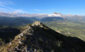
Set amongst the rocks and the Sapet forest , this circular route takes you to the Chapeau de l’Évêque promontory , offering a fine view of the entrance to the Valgaudemar, the foothills of the Dévoluy, the Drac valley and the western part of the Ecrins massif. Only a short section requires you to use your hands to reach this small summit, also known as the Pic du Glaizil.
Infernet Circular Loop
 3.06 mi
+597 ft
-597 ft
1h 55
Easy
Departure from Pellafol (Isère)
3.06 mi
+597 ft
-597 ft
1h 55
Easy
Departure from Pellafol (Isère)
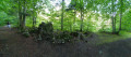
On the border between Dévoluy (Hautes-Alpes) and Isère, a lovely circular route along the Souloise where you’ll discover the Gillardes resurgences, look out over the Défilé de l’Infernet and cross a footbridge...
The rugged Souloise valley, from Les Guillardes to Lac du Sautet via L’Infernet
 9.44 mi
+1,726 ft
-1,739 ft
5h 50
Moderate
Departure from Pellafol (Isère)
9.44 mi
+1,726 ft
-1,739 ft
5h 50
Moderate
Departure from Pellafol (Isère)
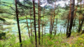
This magnificent walk, which is easy and accessible to all, immerses you in the heart of lush, unspoilt countryside, where the tumult of the bubbling waters of the Souloise carries you away into a damp and invigorating world. Passing through the old hamlet of Pellafol, nestled in the heart of wild and peaceful countryside, will fill you with wonder and transport you to a soothing world. A perfect adventure for young and old alike, ideal for reconnecting with nature or sharing precious moments with the family.
Furnaces and heritage of Cordéac
2.53 mi
+266 ft
-256 ft
1h 25
Easy
Departure from Cordéac (Isère)
This walk is accessible to all and takes you on a tour of the village of Cordéac and its four ovens. The route is suitable for walkers, mountain bikers and horse riders. It passes by a large children's playground with a picnic area, close to an equestrian centre, and allows you to discover the local architecture.
Wild balcony at Cordéac
 5.20 mi
+1,955 ft
-1,936 ft
4h 05
Difficult
Departure from Cordéac (Isère)
5.20 mi
+1,955 ft
-1,936 ft
4h 05
Difficult
Departure from Cordéac (Isère)
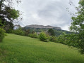
Wild balcony above the village. Start gently on the Sentier des Pavés, then turn off towards the Ruisseau de Chalanne. This is where a small, very wild path begins, often in poor condition due to bad weather. The hike ends at the Bois du Permay and then Pierre Grosse.
Col des Faïsses - Loop via the Tête de la Garde
 10.34 mi
+3,432 ft
-3,412 ft
7h 45
Difficult
Departure from Pellafol (Isère)
10.34 mi
+3,432 ft
-3,412 ft
7h 45
Difficult
Departure from Pellafol (Isère)
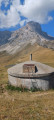
This route takes you through forest and undergrowth for a long time, protecting you from the heat and any wind, and leads you to the foot of the Obiou. The 1,500 metres before the pass are on a wide track, exposed to the sun.The path is obvious, marked in yellow at the start, then in yellow and red (GRP®). The markings help you avoid taking the wrong path or trail, of which there are many on this route.Cows and vultures await you at the pass. The small additional loop offers a panoramic view of the turquoise waters of Lac du Sautet and the Trièves region, with Lac de Monteynard. (However, you can limit yourself to a return trip to the pass, which is 300 metres less in altitude). Take the opportunity to admire the Défilé de la Souloise and the Paroi des Voutes. In the distance, the Pic de Bure shows off its characteristic silhouette.
Chalp Valley
 4.01 mi
+3,465 ft
-3,465 ft
4h 50
Difficult
Departure from Valjouffrey (Isère)
4.01 mi
+3,465 ft
-3,465 ft
4h 50
Difficult
Departure from Valjouffrey (Isère)
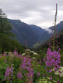
Ascent through the wild and unspoilt Chalp valley. With a bit of luck, you’ll spot plenty of marmots and chamois.The climb is quite steep. It begins in the forest, then cuts across beneath the rocky ridges of the valley, which the path crosses on the left (as you ascend).
Le Lauvet - Lac Labarre
 11.84 mi
+4,869 ft
-3,711 ft
9h 40
Difficult
Departure from Valjouffrey (Isère)
11.84 mi
+4,869 ft
-3,711 ft
9h 40
Difficult
Departure from Valjouffrey (Isère)
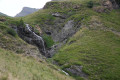
From Le Lauvet, descend to La Chapelle-en-Valjouffrey. Then take the Sentier du Facteur trail, cross the Haute Vallée du Béranger nature reserve in Valsenestre, and finish on the GR®54B trail to Lac Labarre.
The Col de l'Aup at the start of the Hauts Gicons
 5.02 mi
+1,260 ft
-1,260 ft
3h 25
Easy
Departure from Saint-Disdier (Hautes-Alpes)
5.02 mi
+1,260 ft
-1,260 ft
3h 25
Easy
Departure from Saint-Disdier (Hautes-Alpes)
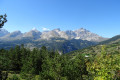
Easy hike up to the Col de l'Aup via the Queyras ravine, below the Montagne de Faraut.
Gicon
 5.13 mi
+2,628 ft
-2,654 ft
4h 40
Moderate
Departure from Saint-Disdier (Hautes-Alpes)
5.13 mi
+2,628 ft
-2,654 ft
4h 40
Moderate
Departure from Saint-Disdier (Hautes-Alpes)
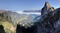
This short hike takes you quickly to one of the most beautiful viewpoints in Dévoluy, offering views of the entire syncline and the peaks of Vercors Nord, Chartreuse, Taillefer and Oisans.
The view towards the turquoise Sautet Lake is spectacular and, with a bit of luck, a sea of clouds will add a romantic touch to the landscape.
Grouse and chamois abound on the slopes of the Gicon and can be seen if you are discreet enough.
Le Petit and Le Grand Brechon
 4.82 mi
+1,893 ft
-1,913 ft
3h 50
Difficult
Departure from Saint-Disdier (Hautes-Alpes)
4.82 mi
+1,893 ft
-1,913 ft
3h 50
Difficult
Departure from Saint-Disdier (Hautes-Alpes)
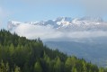
A magnificent hike with the Dévoluy range as a backdrop and the formidable walls of Les Gillardes (René Demaison’s playground) in the foreground.
Le Gicon via the Combe des Chèvres ridge and the north face ledge
 4.77 mi
+2,500 ft
-2,467 ft
4h 20
Difficult
Departure from Saint-Disdier (Hautes-Alpes)
4.77 mi
+2,500 ft
-2,467 ft
4h 20
Difficult
Departure from Saint-Disdier (Hautes-Alpes)
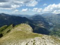
An exceptional view from the summit of Gicon!
Valbonnais Canal Circular Loop
8.60 mi
+804 ft
-801 ft
4h 40
Moderate
Departure from Valbonnais (Isère)
A lovely route between Valbonnais and Entraigues. This peaceful valley, surrounded by high peaks, allows us to discover the two villages and the 14th-century irrigation systems.
La Dreyre hut via the small pass of Plan Collet
 6.79 mi
+3,412 ft
-3,396 ft
6h 05
Difficult
Departure from Valbonnais (Isère)
6.79 mi
+3,412 ft
-3,396 ft
6h 05
Difficult
Departure from Valbonnais (Isère)
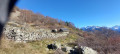
A lovely walk above Valbonnais, beneath the peaks of La Grisonnière and Le Coiro.
Most of the ascent and descent take place in the forest.
The Puits des Bans from Saint-Disdier
 3.39 mi
+512 ft
-512 ft
2h 00
Easy
Departure from Saint-Disdier (Hautes-Alpes)
3.39 mi
+512 ft
-512 ft
2h 00
Easy
Departure from Saint-Disdier (Hautes-Alpes)
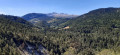
A shaded path starting from the church at Saint-Disdier, which runs along the banks of the Souloise to the Puits des Bancs. After crossing the torrent via footbridges, part of the route is somewhat steep but secured by cables and rungs to reach the top of the gorges.
A true natural gem in the heart of the Dévoluy, the luckiest visitors may spot brown trout and red-legged frogs, not to mention stunning views of the Dévoluy peaks.
Saint-Michel signal and Beaumont Canal circular loop
 9.15 mi
+2,031 ft
-2,028 ft
6h 00
Moderate
Departure from Saint-Laurent-en-Beaumont (Isère)
9.15 mi
+2,031 ft
-2,028 ft
6h 00
Moderate
Departure from Saint-Laurent-en-Beaumont (Isère)
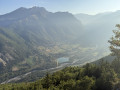
A hike to discover this small natural region of Beaumont from one of its peaks, at 1,493 m, and its irrigation canal, which is over 150 years old. Beautiful views of the Écrins and Obiou massifs and the Matheysin plateau (when there is no fog!).
The route is very well signposted and marked, so it's impossible to get lost!
La Tête de Lapras, starting from Saint-Disdier
 9.83 mi
+5,194 ft
-5,171 ft
9h 05
Difficult
Departure from Saint-Disdier (Hautes-Alpes)
9.83 mi
+5,194 ft
-5,171 ft
9h 05
Difficult
Departure from Saint-Disdier (Hautes-Alpes)
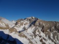
To round off the list of beautiful hikes in the Dévoluy, here is a circular route that takes us to the Tête de Lapras via the Crête des Samarroux.
Then, you can choose either to climb Le Nid via the Col de Lapras or, still via the Col de Lapras, descend into the Vallon du Mas to reach the Baudinard hut.
It is, of course, possible to shorten the route by simply hiking up the Vallon du Mas and back.
The hedgerow trail
 1.67 mi
+144 ft
-144 ft
0h 55
Easy
Departure from Chauffayer (Hautes-Alpes)
1.67 mi
+144 ft
-144 ft
0h 55
Easy
Departure from Chauffayer (Hautes-Alpes)
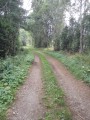
This circular walk allows you to discover one of the Champsaur’s treasures: one of the few remaining preserved bocage landscapes. As you follow the educational information boards, the trail winds its way through hedgerows, canals and sunken lanes…
The Cirque de Larcisse
 5.94 mi
+2,956 ft
-2,959 ft
6 hrs
Very difficult
Departure from Les Costes (Hautes-Alpes)
5.94 mi
+2,956 ft
-2,959 ft
6 hrs
Very difficult
Departure from Les Costes (Hautes-Alpes)
A challenging and rugged hike beneath the ridges of Banc du Peyron and Moussière.
Lake Roaffan via Mallarua and Torrent des Courts
 6.13 mi
+1,627 ft
-1,621 ft
4h 15
Moderate
Departure from Les Costes (Hautes-Alpes)
6.13 mi
+1,627 ft
-1,621 ft
4h 15
Moderate
Departure from Les Costes (Hautes-Alpes)
A balcony walk with views of the Champsaurin bocage, the Chaîne du Faraut, the Banc du Peyron and the Petit Chaillol mountain.
The Mas au Départ gallery in the village of Villard Joli
 5.88 mi
+1,946 ft
-1,949 ft
4h 25
Moderate
Departure from Saint-Disdier (Hautes-Alpes)
5.88 mi
+1,946 ft
-1,949 ft
4h 25
Moderate
Departure from Saint-Disdier (Hautes-Alpes)
A visit to the tunnel dug between 1913 and 1933 to search for water, overlooking the Gillardes resurgence, with spectacular scenery all along the walk!
The Drouillet Pass
 8.56 mi
+3,802 ft
-3,802 ft
7h 15
Difficult
Departure from Saint-Disdier (Hautes-Alpes)
8.56 mi
+3,802 ft
-3,802 ft
7h 15
Difficult
Departure from Saint-Disdier (Hautes-Alpes)
Starting from the hamlets above St Disdier en Dévoluy, several large parallel valleys climb up towards the ridge connecting Grand Ferrand to Obiou.
This hike takes you up to the Col du Douillet, just below the Petit Ferrand, via the Truchière valley, and back via the Narittes valley.
As always in Dévoluy, the landscape is rocky, but the Truchière valley is quite grassy, while the Narittes valley is much more austere.
La Demoiselle and Les Prêtres
 7.41 mi
+3,724 ft
-3,724 ft
6h 40
Difficult
Departure from Saint-Disdier (Hautes-Alpes)
7.41 mi
+3,724 ft
-3,724 ft
6h 40
Difficult
Departure from Saint-Disdier (Hautes-Alpes)
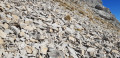
A hike with no significant difficulty, although it is a little steep in the upper section and mainly off-track. It ends at a curious little summit perched in the middle of the upper cirque to the south of the Tête de l’Aupet. It offers a superb view. Griffon vultures are often seen here.
Tête de l'Aupet
 8.60 mi
+4,600 ft
-4,580 ft
7h 55
Very difficult
Departure from Saint-Disdier (Hautes-Alpes)
8.60 mi
+4,600 ft
-4,580 ft
7h 55
Very difficult
Departure from Saint-Disdier (Hautes-Alpes)
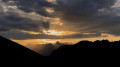
A very beautiful, uncrowded walk leading to the splendid viewpoint at the Tête de l’Aupet and winding through two wild valleys where chamois and marmots seek refuge.
The summit offers a spectacular view of its two higher neighbours, the Grand Ferrand and the Obiou, as well as the ridge connecting them and the neighbouring Vercors and Oisans mountain ranges.
Please note: the route is mainly off-trail but does not present any navigation difficulties. See the ‘Practical information’ section.
Summit of La Cavale from Oris-en-Rattier
 5.41 mi
+3,724 ft
-3,724 ft
5h 45
Difficult
Departure from Oris-en-Rattier (Isère)
5.41 mi
+3,724 ft
-3,724 ft
5h 45
Difficult
Departure from Oris-en-Rattier (Isère)
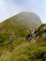
The Sommet de la Cavale does not claim to be on a par with its imposing neighbour, Le Coiro, which is 460 m higher. However, it remains a worthwhile destination, both for its wild and airy setting and for the beauty of the surrounding landscapes.
The fairly sustained climb up this long ridge is richly rewarded by the magnificent viewpoint offered by the summit, which provides breathtaking views of the Valbonnais, Dévoluy, Matheysine and Vercors massifs and the high peaks of the Écrins.
The Orgues de Valsenestre and return via the Combe Oursière
 7.98 mi
+3,632 ft
-3,609 ft
6h 50
Difficult
Departure from Valjouffrey (Isère)
7.98 mi
+3,632 ft
-3,609 ft
6h 50
Difficult
Departure from Valjouffrey (Isère)
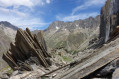
A hike in several stages:- The Orgues de Valsenestre (or the ‘great library’), a geological curiosity featuring a multitude of perfectly aligned vertical strata.- The Col de Côte Belle, offering panoramic views over the Font Turbat valley.- A return via the balcony path to the small hanging valley of Combe Oursière.- Finally, you’ll cross a forest of ‘crooked’ larch trees (larch trees bent by the weight of the snow).... Not forgetting the Hobbit house
Important: please read the practical information carefully.
Pic de Valsenestre circular walk
 Tourism professional9.97 mi
+5,866 ft
-5,863 ft
9h 40
Extremely difficult
Departure from Valjouffrey (Isère)
Tourism professional9.97 mi
+5,866 ft
-5,863 ft
9h 40
Extremely difficult
Departure from Valjouffrey (Isère)
This hike is reserved for very experienced walkers who enjoy adventurous terrain, steep slopes and new discoveries: the ‘orgues’, the panoramic view from the summit, the volcanic geology of La Rache and the Cabane de l’Oursière (from *The Hobbit*).
From Valsenestre to the Cabane de la Cantine des Carrières
 3.32 mi
+1,421 ft
-1,122 ft
2h 45
Moderate
Departure from Valjouffrey (Isère)
3.32 mi
+1,421 ft
-1,122 ft
2h 45
Moderate
Departure from Valjouffrey (Isère)
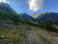
Splendid view of the mountain cirque culminating at the Roche de la Muzelle. Walk through the cool woods before arriving at a gallery of peaks in the Écrins. You will follow the Torrent du Béranger for two-thirds of the hike.
Tête de Rame (or Tête des Chétives) via Lac de Labarre
 9.51 mi
+4,823 ft
-4,846 ft
10 hrs
Very difficult
Departure from Valjouffrey (Isère)
9.51 mi
+4,823 ft
-4,846 ft
10 hrs
Very difficult
Departure from Valjouffrey (Isère)
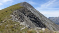
To enjoy an unbroken panorama stretching from the Pic de Bure to Mont Aiguille, taking in all the peaks of the Vercors as well as the Trièves plateau, and on the other side the Taillefer and several peaks of the Écrins.
You’ll also pass by the turquoise-green Lac Labarre, at the foot of the Lauvitel signal.
Valsenestre - Refuge de la Muzelle
 6.07 mi
+4,541 ft
-1,886 ft
6h 45
Difficult
Departure from Valjouffrey (Isère)
6.07 mi
+4,541 ft
-1,886 ft
6h 45
Difficult
Departure from Valjouffrey (Isère)
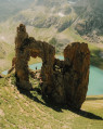
A short 10 km stage but with 1,400 m of elevation gain, featuring the very technical and rocky ascent of the Col de la Muzelle. It requires the utmost caution, especially with a heavy rucksack. A narrow passage between two magnificent mountains, the Roche de La Muzelle and the Pic du Clapier du Peyron. Throughout the ascent, you are surrounded by mountain ranges over 3,000 m high. From the pass, there is a splendid view of the rest of the Glacier de la Muzelle, the lake and the corridor leading down to Valsenestre.