Country:

 City:
City:


Easy parking at the Place du Marché in Corps, where the start of the walk is located at the easternmost part of the square. Directional signs and yellow markings are in place throughout the walk.
(S/E) Join the old RN85; after about a hundred metres, turn right onto the path of the old railway line. From there, the route is clear and easy to follow, leading towards the Cime du Peyrague – Saint-Julien-les-Corps – simply follow the signs and markings. Cross the Ruisseau de la Sallette and reach an X-shaped junction at an elevation of 1026.
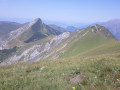
(1) Take the track on the left towards Peyrague, passing through the forest gate. This track soon gives way to a path where the climb is steeper, winding its way up in switchbacks and along ledges, mainly through woodland. After a steady but demanding ascent, you’ll reach the summit of Peyrague at an elevation of 1,494 metres.
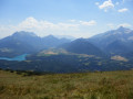
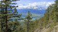
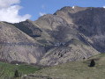
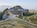
(2) From this high vantage point, you’ll enjoy an eastern view of Gargas and the Sanctuary of La Salette, and a western view of Lac du Sautet, the foothills of the Dévoluy and the Obiou; it’s the ideal spot to settle down for a picnic. After this tasty break, the descent back down follows the same path, heading broadly north, sometimes requiring you to navigate by sight if it’s early in the season. Leave the wooded area and reach a meadow.Please note: during the summer grazing season, sheepdogs guard the flocks, so do check beforehand.
(3) Turn off to the right, come out onto another path and follow it to the right. Cross the Ruisseau des Faux, turn sharply right at an acute angle to the path and reach a three-way junction.
(4) Keep to the right to follow the well-marked and obvious descending path, which is consistently signposted in yellow. You’ll reach the small car park at the end of the tarmac road (Chemin des Opinious).
(5) Cross this small car park and take the path opposite, which winds down between the houses to the steps leading to the Route du Sanctuaire. Follow this path downhill for about 150 metres.
(6) Turn right towards the chapel and the village cemetery, then take the path on the right leading down towards Corps to reach the ford over the Ruisseau des Faux.
(7) Take care in wet weather; the current and the moss covering the stones may have made the crossing tricky, so choose the right spot. Continue downhill through the woodland without any particular difficulty and reach the junction at elevation 1026, which you’ve already passed on the way up: on this section, the IGN trail marker is incorrect.
(1) Head straight on to follow the ascent route in the opposite direction, returning to the Place du Marché and the car park (S/E).


 Visorando Member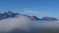

 Association / Club / Walk leader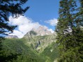
 Very difficult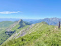
 Difficult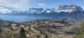
 Easy
Easy