Ridges and the Beaumont Canal

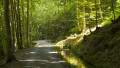
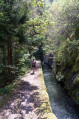
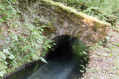
This circular loop offers a chance to appreciate the enormous effort made by our ancestors, who achieved a technical feat here by building this canal, which still irrigates the Beaumont region today.

Details

3130779
Creation:
Last update:
Last review:
  • Walking
    Activity: Walking
  • ↔
    Distance: 9.88 mi
  • ◔
    Average duration: 6h 40 
  • ▲
    Difficulty: Difficult

  • ⚐
    Back to start: Yes
  • ↗
    Ascent: + 2,405 ft
  • ↘
    Descent: - 2,411 ft

  • ▲
    Highest point: 4,859 ft
  • ▼
    Lowest point: 2,989 ft

Photos

Description of the walk

After the village of Les Angelas, heading towards the Col de Parquetout, park at the hairpin bend at Bois Chainard, level with the canal.

(S/E) Just past the bend, take the path on the right that runs alongside the canal, crossing the Ruisseau d’Aiguebelle via a footbridge. Continue along the right bank of the canal until you reach another footbridge.

(1) Leave the canal and take the footbridge on the left, then follow the path. After a few hairpin bends, you’ll reach the track leading to the telecoms pylons at the Col de Pierre Grosse.

(2) Take this track, making a wide bend to reach another pylon. Continue along the Crête de la Sciau until you reach the Signal de Saint-Michel.

(3) Continue along the ridge until you reach the highest point at Croix de la Roche.

(4) Turn slightly left downhill to reach a crossroads of paths.

(5) Stay on the path on the right, ignoring the paths branching off to the right or left at each junction.

(6) At the junction of tracks, continue along the path opposite. When you reach another track, turn left onto the descending path. On leaving the forest, you’ll reach the hamlet of Chalméane.

(7) Turn right onto the road, cross the Beaumont Canal before reaching the hamlet of Villelongue. Walk through it and, at the edge of the woods, you’ll find the junction with the path running alongside the canal.

(8) Turn right onto this path and follow it along a virtually flat route. You’ll return to the original junction by the footbridge.

(1) Follow the same route as on the way out to return to the car park at the hairpin bend (S/E).
Waypoints

  1. S/E : mi 0 - alt. 3,091 ft - Car park at the hairpin bend
  2. 1 : mi 0.65 - alt. 3,071 ft - Junction of the circular loop
  3. 2 : mi 1.53 - alt. 4,324 ft - Col de Pierre Grosse
  4. 3 : mi 2.51 - alt. 4,639 ft - Saint-Michel signpost
  5. 4 : mi 3.03 - alt. 4,836 ft - Croix de la Roche (1492 m)
  6. 5 : mi 3.48 - alt. 4,626 ft - Path junction
  7. 6 : mi 4.04 - alt. 4,242 ft - Crossroads, path opposite
  8. 7 : mi 4.96 - alt. 3,222 ft - Chalméane
  9. 8 : mi 5.65 - alt. 3,022 ft - Canal path junction
  10. S/E : mi 9.88 - alt. 3,091 ft - Car park at the hairpin bend

Notes

Between (6) and (S/E) This canal is a remarkable feat of engineering.

Worth a visit

Reviews and comments

4.1 / 5
Based on 4 reviews

Reliability of the description
4.5 / 5
Ease of following the route
4 / 5
Route interest
3.8 / 5
champet67
champet67

Overall rating : 4 / 5

Date of your route : Apr 30, 2024
Reliability of the description : ★★★★☆ Good
Ease of following the route : ★★★★☆ Good
Route interest : ★★★★☆ Good
Very busy route : No

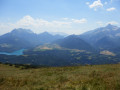
A short kilometre on flat ground, then a steep climb up to the pass. But what lovely views of the peaks of Tabor, the Taillefer Massif, Ecrins, Obiou and, in the distance, Grand Veymont and Mont Aiguille, etc... Then the return journey along the canal – a bit of a long haul, but the flowing water draws the eye to this structure, built in the 1870s! Hats off to the workers of that era, when everything was done by hand… Best done in fine weather. Thanks to the route planner.

Machine-translated

geai47
geai47

We set off from Les Verneys and, from the canal, climbed up to Pierre Grosse, following the route described on Visorando.
From the canal, rather than heading straight back down to Les Verneys via the steep slope – to spare our knees – we followed the canal and descended to Les Angelas, then returned to Les Verneys via the small road.
This climb along the canal from Villelonge may seem a bit long, but it offers some lovely views over the Bonne Valley.

Machine-translated

mb300d85
mb300d85

Overall rating : 5 / 5

Date of your route : Jul 29, 2020
Reliability of the description : ★★★★★ Very good
Ease of following the route : Not used / Not applicable
Route interest : ★★★★★ Very good
Very busy route : No

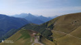
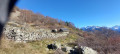
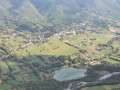
Lovely view from the Croix de la Roche (point 4), a picturesque setting by the canal, all nicely shaded (which is just as well on a scorcher of a day)... the climb between points 1 and 2, straight up the slope, is very steep: this is worth mentioning in the description . I’ve attached a few photos to give you a feel for the place.

Machine-translated

bernardino
bernardino ★

Hello, and thank you for your comment.
You’ve rated the route as ‘Average’ – could you tell me how it could be improved?
As for the ‘Disappointing’ rating regarding the route’s appeal, it’s true that the stretch along the canal is very flat, which makes it long and tedious. On the other hand, this route allows you to see that hundreds of people worked here to build this magnificent canal.
And you’re quite right – there are better routes in the area, though others might find them less appealing.
Have a lovely day and enjoy the rest of your time on the site.

Machine-translated

JPC07
JPC07

Overall rating : 3 / 5

Date of your route : Jul 04, 2020
Reliability of the description : ★★★★☆ Good
Ease of following the route : ★★★☆☆ Average
Route interest : ★★☆☆☆ Disappointing
Very busy route : No

Coming from GAP, starting at 7: CHALMÉANE. From 8 to 1: a lovely canal, very clear water, well-maintained, but too long and tedious. Best done by mountain bike. Ascent from 1 to 2: very steep gradient, entirely through woodland. From 2 to 3, on the road: not very interesting. The only viewpoint is at 4. Descent from 4 to 7 with little or no scenery. In short: long, tedious, with practically no viewpoints. There are much better options in the surrounding area.

Machine-translated

gilane
gilane

Overall rating : 4.7 / 5

Date of your route : May 24, 2020
Reliability of the description : ★★★★★ Very good
Ease of following the route : ★★★★★ Very good
Route interest : ★★★★☆ Good
Very busy route : No

A really lovely walk. A beautiful view from the top of the Obieu, amongst other things, then back along the canal through the woods, which isn’t unpleasant when it’s hot.

Machine-translated

Other walks in the area

For more walks, use our search engine .

The GPS track and description are the property of this route's author. Please do not copy them without permission.