Country:

 City:
City:


From Cordéac by car, follow the D66 for 2.5 km towards Pellafol . Immediately after the ‘Les Achards’ sign, turn right onto the Piste Forestière de Bachilianne and park about 200 m past the houses in the hamlet of Les Achards, on a widening of the forest track on the right.
(S/E) From the car park, follow the Bachilianne track uphill and, at the first fork, take the left-hand path leading to the Ruisseau des Achards.
(1) Look out for the return path on your right, cross the wooden footbridge and turn left, following the sign for “Les Roussins”: yellow marker. You’ll come out onto a path; follow it to the right towards the farm.
(2) At the “Les Roussins” sign, carry on along the path heading uphill opposite. You’ll reach the water intake: yellow marker.
(3) Head almost straight ahead, following the signs for “Bois de l’Aigle – Ruisseau des Rabès”. You’ll come to a fork in the path: a yellow signpost for “Bois de l’Aigle”.
(4) Take the path on the right which descends towards the Ruisseau de la Casse de l’Obiou: Yellow Cross + yellow and red markings. Cross the stream: if the current is too strong to wade across, you can climb further up to the forest track, 100 m away, and follow it to the right to cross. You’ll come out onto the track in question.
(5) Head down to the right as far as the “Pierres d’Antoires” signpost.
(6) Take the hairpin bend to the right and head down towards the Moulin Vieux. Walk for about 250 m until you reach the Pierres d’Antoires on your left.
(7) Continue along the path which runs high above the Ruisseau des Achards and reach the ruins of the hamlet of Côte Belle on your left.
(8) Turn right, following the yellow markings towards the Ruisseau des Achards, and rejoin the path you took on the way out.
(1) Take the path on the left, heading in the opposite direction to the outward journey, to return to the car park (S/E).
 Visorando Member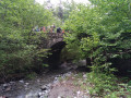

 Difficult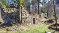
 Moderate
 Very difficult
 Extremely difficult
  Association / Club / Walk leader