The Ruisseau des Pavés

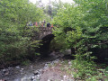
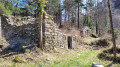
Come and discover this little stream hidden away in a large forest above Cordéac. A short trail with several information points will help you understand the history of this little stream. Mountain torrents have always been difficult to control during snowmelt or heavy rainfall. They can be destructive. This engaging trail invites you to discover how people have managed to control these watercourses. You’ll also learn how the unusual Ruisseau des Pavés was formed.

Details

n°91245780
Creation:
Last update:
Last review:
–
  • Walking
    Activity: Walking
  • ↔
    Distance: 2.21 mi
  • ◔
    Average duration: 1h 55 
  • ▲
    Difficulty: Moderate

  • ⚐
    Back to start: Yes
  • ↗
    Ascent: + 1,056 ft
  • ↘
    Descent: - 1,079 ft

  • ▲
    Highest point: 4,245 ft
  • ▼
    Lowest point: 3,163 ft

Description of the walk

Park at the car park for the Ruisseau des Pavés trail, located at the top of the village of Cordéac (hamlet of Les Guions). To get there, you’ll need to take an unpaved track which leads to the car park after a few hundred metres.

(S/E) Look out for the first sign for the ‘Sentier du Ruisseau des Pavés’ and head straight up along the stream on your left. Further up, this path narrows into a smaller track branching off to the right. A series of information panels explains the history of the area. You will then join a forest track.

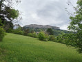
(1) Take this to the right to enjoy a beautiful view of the surrounding peaks.

(2) Leave the track and take the path leading down to the right: take care, as it can be slippery. Enter a magnificent forest and continue to a junction.

(3) Take the path continuing down to the right: a sign will help you find your way. This lovely path offers views of the peaks. You’ll reach the “La Chalanne” hiking marker.

(4) Head towards Le Châtel by taking the wide track that climbs to the right, and return to the car park (S/E).

Waypoints

  1. S/E : mi 0 - alt. 3,287 ft - Ruisseau des Pavés car park - Chalanne (ruisseau) - Affluent du Drac
  2. 1 : mi 0.86 - alt. 4,157 ft - Forest track
  3. 2 : mi 0.98 - alt. 4,206 ft - Leave the track – take the path on the right
  4. 3 : mi 1.56 - alt. 3,507 ft - Junction
  5. 4 : mi 2.03 - alt. 3,176 ft - Return via the track – to the right
  6. S/E : mi 2.21 - alt. 3,287 ft - Ruisseau des Pavés car park

Notes

Cordéac:

Fountain in the village centre.

Bus shelter.

Community centre – open on weekdays.

Other walks in the area

For more walks, use our search engine .

The GPS track and description are the property of this route's author. Please do not copy them without permission.