The Chapeau de l’Evêque circular walk, returning via Les Auberges

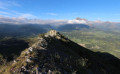
Set amongst the rocks and the Sapet forest , this circular route takes you to the Chapeau de l’Évêque promontory , offering a fine view of the entrance to the Valgaudemar, the foothills of the Dévoluy, the Drac valley and the western part of the Ecrins massif. Only a short section requires you to use your hands to reach this small summit, also known as the Pic du Glaizil.

Details

74999729
Creation:
Last update:
Last review:
  • Walking
    Activity: Walking
  • ↔
    Distance: 6.19 mi
  • ◔
    Average duration: 4h 55 
  • ▲
    Difficulty: Moderate

  • ⚐
    Back to start: Yes
  • ↗
    Ascent: + 2,421 ft
  • ↘
    Descent: - 2,418 ft

  • ▲
    Highest point: 5,039 ft
  • ▼
    Lowest point: 2,999 ft

Photos

Description of the walk

On the N85 road from Gap to Grenoble, between La Guinguette and Chauffayer, take the D57 to reach Le Glaizil and arrive 200 metres south of the village, at the hamlet of Le Clot. Turn left onto the Route de Lachaud (signposted ‘Pouillardencq’ and ‘Salle polyvalente’). Follow the track uphill and park in the car park by the community hall, near a picnic table and the start of the track.

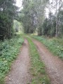
(S/E) Take the track heading south-west and enter the forest. You’ll reach a junction at the second hairpin bend (elevation 976).

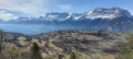
(1) Continue to the right along the track, which climbs steadily for just under a kilometre, overlooking the Glaizil ravine. Viewpoint over the village of Glaizil and its old tower. You’ll reach a junction.

(2) Leave the track and head up the signposted ‘Chapeau de l’Évêque’ path to the left, heading south-west, through a dense beech forest.

(3) Turn left to follow the main path. Climb the steep slope, via the numerous hairpin bends, to the Col du Sapet (elevation 1,497).
Gaps in the canopy offer views of the valley. Go through a cattle fence and descend slightly.

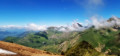
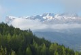
(4) Continue to the left, heading south-east, and climb towards the rocks (sign: Le Chapeau de l’Évêque). Follow the path marked by cairns. Caution: a small ledge, which presents no major difficulty, requires you to use your hands to reach the ridge and then the summit of Le Chapeau de l’Évêque. Enjoy the beautiful view over the entrance to the Valgaudemar, the foothills of the Dévoluy, the Drac valley and the peaks of the Écrins.

(5) Turn back to return to the Col du Sapet (elevation 1,497).

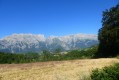
(4) Turn left, heading south-west, to descend towards ‘Pouillardencq’, between the forest and the mountain pastures, following the yellow markings on the tree trunks. Emerge into mountain pastures with Mediterranean vegetation (lavender, carline thistle, meadow melampyrum, etc.). To the west, admire the Brèche de Faraut, a gigantic W-shaped gorge nearly 250 metres high. Return to the forest and cross the Ruisseau de Rivet. After a wide hairpin bend, you’ll emerge at the turning area of a forest track.

(6) Turn right onto the Chemin des Auberges, heading south-west, to reach the bottom of the valley, and fords the Ruisseau des Auberges. Follow it along the right bank. Descend the path, which turns into a track and makes two hairpin bends, until you reach a junction (picnic table, elevation 1077).

(7) Leave the track to cross the Ruisseau des Auberges again, and follow the path to the left, heading north-west. Follow it up the left bank before leaving it to the right.

(8) Turn right, heading north-east, to climb diagonally up the side of the ravine, then cross the Ruisseau de Rivet again. Cross the forest along the eastern slope. The landscape opens out onto the valley. Then rejoin the original track at the hairpin bend (elevation 976).

(1) Head down the track to the right to reach the car park (S/E).

Waypoints

  1. S/E : mi 0 - alt. 3,002 ft - Car park at the community hall
  2. 1 : mi 0.43 - alt. 3,199 ft - Hairpin bend junction (altitude 976)
  3. 2 : mi 0.98 - alt. 3,533 ft - Junction with the Draye du Sapet (signpost)
  4. 3 : mi 1.16 - alt. 3,835 ft - Junction in the forest
  5. 4 : mi 2.25 - alt. 4,918 ft - Col du Sapet (signpost – elevation 1,497)
  6. 5 : mi 2.41 - alt. 5,033 ft - Chapeau de l’Evêque (elevation 1,559)
  7. 6 : mi 3.39 - alt. 4,285 ft - Junction with the Chemin des Auberges
  8. 7 : mi 4.62 - alt. 3,527 ft - Hairpin bend (signpost – elevation 1,077). Ford
  9. 8 : mi 4.72 - alt. 3,648 ft - Junction with the hillside path
  10. S/E : mi 6.19 - alt. 3,002 ft - Car park at the community hall

Notes

No drinking water points along the route. There is a fountain in the village of Le Glaizil.

Picnictables (S/E) near the Clot community hall , and at the junction (7) located after the descent from the Vallon des Auberges.

A fairly shadedwalk , particularly on the ascents through the Sapet forest .

Please note: a small ledge, which presents no major difficulty, requires you to use your hands to reach the ridge and then the summit of the Chapeau de l’Evêque (5). This section is short but may be daunting for walkers unaccustomed to rocky terrain . It is, however, optional.

Shops, restaurants and accommodation in Saint-Firmin, Chauffayer and Saint-Bonnet-en-Champsaur.

Worth a visit

(5) The Chapeau de l’Évêque, also known as the Pic du Glaizil, is a small peak rising to an altitude of 1,559 metres, overlooking the village of Le Glaizil and the Sapet forest.

(S/E) Le Glaizil: its name is thought to derive from the Occitan word ‘gleisa’ (‘church’) and the suffix ‘-il’: ‘little church’. The village is first mentioned in the 8th century in Abbon’s will under the name Galiscum, and was also known as Eglesia, in connection with the presence of the Cluniac Order. Its Romanesque tower is the remnant of a 12th-century Romanesque church and a watchtower, built by the Cluniac Order. The church burnt down in the 19th century, and the tower was demolished in 1960 as it was in danger of collapsing; only the base remains today. The Church of Saints James and Ambrose was rebuilt in 1850 following the fire that destroyed the original.

The hamlet of Lesdiguières, visible from the summit, is home to the ruins of the castle of the last Constable of France, François de Bonne, Duke of Lesdiguières. Built from 1571 onwards by the man who was the leader of the Protestants in the Dauphiné, it was ravaged in 1692 by the troops of the Duke of Savoy. It is worth noting that a small museum housed in the former communal bakery traces the life of the duke. Guided tours are available (enquire at the tourist office).

At the foot of the Chapeau de l’Évêque flows the Drac, the iconic torrent of the Champsaur as it winds its way to Grenoble. Its name comes fromthe Occitan word ‘drac’, meaning a dragon or a legendary water creature . Once feared for its devastating floods , its sparkling course now winds its way through the fertile woodlands of the Champsaur.

To the east, the Écrins Massif frames the horizon with its high peaks. However, a wide opening provides access to the Valgaudemar Valley, often nicknamed the ‘little Himalayas’ due to its steep and spectacular terrain . It is dominated by several peaks over3,000 metres, such as the Olan, the Sirac and the Pic des Souffles.

Clearly visible during the descent between points (4) and (6), the Brèche de Faraut is a spectacular natural gorge carved into the limestone cliffs of the Dévoluy. Standing some 250 metres high , it is one of the most remarkable landscapes in the area.

Other walks in the area

For more walks, use our search engine .

The GPS track and description are the property of this route's author. Please do not copy them without permission.