Country:

 City:
City:


Park in the centre of Cordéac, near the town hall.
(S/E) Follow the departmental road towards Corps to reach the bridge over the Ruisseau de Chalanne. Turn right before crossing the bridge and continue along the Chemin de la Louine. Carry on straight ahead until you leave the built-up area and reach Les Fossés.
(1) Cross the ford over the stream on your left and follow the signs for Côte Belle (signpost).
(2) At the first three-way junction, turn right. Walk for a few dozen metres, then turn left at the next junction: the Yellow Cross. Follow the moderately steep stony path (running parallel to the signposted one). Walk uphill for about 500 m.
(3) At the first three-way junction, take the path on the left. Follow this path through the beautiful beech forest of the Forêt de Pierre Grosse, keeping to the left at all times.
(4) At the junction with the forest track, turn left and head down to the junction with the RD66, which you should cross with care.
(5) On the other side, take the path leading down to the left (back to Cordéac). You’ll come out onto a wide path; follow it to the left.
(6) Turn left and follow the small road straight on to rejoin the D66.
(7) Turn right and walk carefully along the road until you reach the car park near the town hall (S/E).
 Visorando Member
 Difficult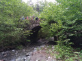
 Average
 Very difficult