The Puits des Bans from Saint-Disdier

A shaded path starting from the church at Saint-Disdier, which runs along the banks of the Souloise to the Puits des Bancs. After crossing the torrent via footbridges, part of the route is somewhat steep but secured by cables and rungs to reach the top of the gorges.
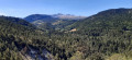
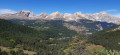
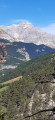
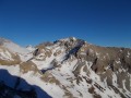
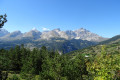
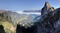
A true natural gem in the heart of the Dévoluy, the luckiest visitors may spot brown trout and red-legged frogs, not to mention stunning views of the Dévoluy peaks.

Details

38482875
Creation:
Last update:
Last review:
  • Walking
    Activity: Walking
  • ↔
    Distance: 3.39 mi
  • ◔
    Average duration: 2h 00 
  • ▲
    Difficulty: Easy

  • ⚐
    Back to start: Yes
  • ↗
    Ascent: + 512 ft
  • ↘
    Descent: - 512 ft

  • ▲
    Highest point: 3,865 ft
  • ▼
    Lowest point: 3,353 ft

Photos

Description of the walk

In Saint-Disdier, leave the D937 and head down to the hamlet of La Ribière, then cross the bridge opposite the church. Park in the car park where the signposts for the walks are located.

(S/E) Head towards Puits des Bans and follow the Souloise along the right bank for 1.4 km, first on the road, then along a footpath.
''Note that there are several shaded areas along the riverbank where you can have a picnic.
The path also features information boards on the geology, flora and fauna (great for children).'' You’ll reach the tarmac road.

(1) Turn right onto it and cross the bridge. Immediately afterwards, turn left onto the path that runs alongside the river as far as the signpost for the Béal walking routes.
Continue to the ‘Bois des Bans’ signpost. * See: practical information.

(2) At the ‘Bois des Bans’ signpost, take the path down to the left towards the Puits des Bans. Please note, the descent is quite steep and slippery. This is where the more challenging part of the route begins!
Note that at the bottom, the riverbank is a lovely spot for a picnic or to cool off.
Take the steep path on the left bank, which overlooks the torrent by a few metres; however, a safety cable secures this exposed section. Cross the Souloise over large, fallen boulders fitted with sturdy rungs (a rather fun first section). Climb back up to the Puits des Bans. Walk along its right-hand side, then cross a rocky ledge via a cable-assisted passage. This first short climb leads to a cave-like platform. * see: during the hike or nearby
Continue along the path, which comes to an abrupt end, but fortunately the rock face on the right is equipped with rungs and cables (a second fun section). Continue the climb to the Haut Puits des Bans junction.

(3) Take the path on the left, which continues on level ground towards La Cerise and Saint-Disdier, and carry on to the next junction.

(4) Turn left here too to follow the path marked with yellow lines. The path soon climbs through a Scots pine forest, then crosses an area of marl. It then descends to the Cerise farm (private access) and joins a tarmac road. Follow this down until you return to the La Cerise bridge and the original junction.

(1) Turn right to return to Saint-Disdier by retracing your steps to the car park (S/E).

Waypoints

  1. S/E : mi 0 - alt. 3,353 ft - La Ribière hamlet – Saint-Disdier - Mère Église
  2. 1 : mi 0.88 - alt. 3,474 ft - Crossroads of the circular route – Route de la Cerise
  3. 2 : mi 1.52 - alt. 3,589 ft - Bois des Bans - Le Puits des Bans
  4. 3 : mi 1.67 - alt. 3,698 ft - Top of Puits des Bans - Le Puits des Bans
  5. 4 : mi 1.78 - alt. 3,737 ft - Crève-Cœur junction
  6. S/E : mi 3.39 - alt. 3,353 ft - La Ribière hamlet – Saint-Disdier - Mère Église

Notes

  • Alternative route to avoid the technical section at Puits des Bans:

Before or at the Puits des Bans, turn back towards (2).

Fountain in the centre of St Disdier (hamlet of La Ribière).

Warnings and recommendations.
Whilst the first part of the path is easy and shaded, the section at Puits des Bans can prove tricky for children and those with a fear of heights, and is impossible for dogs (dogs must be carried). This route should also be avoided on rainy days (risk of flooding and slippery sections).
A simpler alternative is available by taking a straightforward return route (alternative route).

Worth a visit

  • The ‘Puits des Bans’ signpost shows caving enthusiasts where to enter the mountain’s hidden depths. Curious visitors without equipment (though a head torch is compulsory) can venture into the first few metres of the cave, as far as the small underground lake, which is then crossed by inflatable dinghy. This spot is well suited to an introduction to caving, reaching a depth of 70 metres below ground (must be accompanied by a certified guide).

The Souloise is home to a rich variety of wildlife, including brown trout and common frogs (part of the ‘brown’ frog group).

The Puits des Bans for caving.

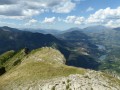
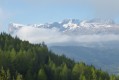
The end of the route offers magnificent views of the Ferrand-Obiou mountain range.

It is possible to climb up to Mère Église from Saint-Disdier.

Reviews and comments

5 / 5
Based on 2 reviews

Reliability of the description
5 / 5
Ease of following the route
5 / 5
Route interest
5 / 5
User 26263265

Overall rating : 5 / 5

Date of your route : Jul 04, 2026
Reliability of the description : ★★★★★ Very good
Ease of following the route : ★★★★★ Very good
Route interest : ★★★★★ Very good
Very busy route : No

A lovely walk. Do take care on a section where you’re a bit exposed...

Machine-translated

JulieFJ
JulieFJ

Overall rating : 5 / 5

Date of your route : Aug 17, 2025
Reliability of the description : ★★★★★ Very good
Ease of following the route : ★★★★★ Very good
Route interest : ★★★★★ Very good
Very busy route : No

A very pleasant short loop along the Souloise river in the forest. A few technical sections that are quite enjoyable and not very difficult.

Machine-translated

Other walks in the area

For more walks, use our search engine .

The GPS track and description are the property of this route's author. Please do not copy them without permission.