Pic Gazonné via the Col des Vachers

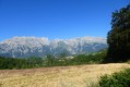
A superb hike in the magnificent Valgaudemar massif, starting from the charming and picturesque hamlet of Brudour. The well-signposted route is easy to follow and features numerous remarkable landmarks along the way.
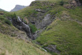
From the very first steps, we are immersed in a sea of tall, green, fresh and lush grass. The path then runs alongside the rushing Brudour torrent, whose roar cheerfully accompanies our progress.
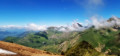
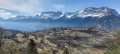
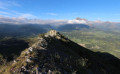
Once on the ridge, the view is breathtaking. The surrounding mountain ranges reveal themselves in all their splendour. A hike that is both straightforward and spectacular, perfect for filling your lungs with fresh air and your mind with unforgettable memories.

Details

75302009
Creation:
Last update:
Last review:
  • Walking
    Activity: Walking
  • ↔
    Distance: 7.33 mi
  • ◔
    Average duration: 6h 25 
  • ▲
    Difficulty: Difficult

  • ⚐
    Back to start: Yes
  • ↗
    Ascent: + 3,527 ft
  • ↘
    Descent: - 3,543 ft

  • ▲
    Highest point: 6,949 ft
  • ▼
    Lowest point: 3,428 ft

Photos

Description of the walk

From Aspres-lès-Corps or Saint-Firmin, head to the small hamlet of Brudour and park in the car park at the entrance to Brudour.

(S/E) With your back to the car park, head left. Walk through the hamlet and continue along the path that runs alongside the Torrent de Brudour. Keep to the right bank. After just over 1 km, the path veers away from the stream and reaches a crossroads of tracks.

(1) Carry on straight ahead northwards until you reach the Maison forestière des Vachers. A water source, tables and a barbecue are available for your use.

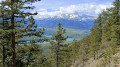
(2) Then continue northwards along the wide forest track towards the Col des Vachers. A few hundred metres after a series of hairpin bends, you’ll reach a junction.

(3) When you reach the caravan, take the track branching off to the left towards the north-west to reach the Col des Vachers. 

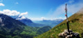
(4) Enjoy the panoramic view, then turn left and follow the ridge line, which climbs quite steeply in places, towards Pic Gazonné. Reach the cairn at the summit and admire the magnificent 360-degree panorama.

(5) Begin your descent, keeping well on the ridge line. After a junction of paths, head for the two small buildings of the Bergerie de Sambus.

(6) Take the stony track that descends to the right towards Les Sambucs. At the crossroads (elevation 1363 on the IGN map), do not head towards Brudour (a longer route), but carry on straight ahead until you reach a junction marked by a signpost reading ‘La Fautèle’.

(7) Turn left and follow the signs for Brudour. At the junction with the road, turn left to reach the car park (S/E).

Waypoints

  1. S/E : mi 0 - alt. 3,445 ft - Car park at the entrance to the hamlet of Brudour
  2. 1 : mi 0.99 - alt. 4,022 ft - Crossroads of tracks
  3. 2 : mi 1.84 - alt. 4,977 ft - Maison forestière des Vachers
  4. 3 : mi 3.08 - alt. 5,807 ft - Crossroads – Caravan
  5. 4 : mi 3.58 - alt. 6,253 ft - Col des Vachers
  6. 5 : mi 4.48 - alt. 6,949 ft - Summit cairn
  7. 6 : mi 5.97 - alt. 5,013 ft - Sambus Sheepfold
  8. 7 : mi 6.64 - alt. 4,065 ft - ‘La Fautèle’ signpost – Towards Brudour
  9. S/E : mi 7.33 - alt. 3,451 ft - Car park

Notes

At the Vachers forest lodge,a water source, tables and a barbecue are available for your use.

Reviews and comments

4.8 / 5
Based on 4 reviews

Reliability of the description
4.8 / 5
Ease of following the route
4.8 / 5
Route interest
4.8 / 5
Bibi et Gre
Bibi et Gre

Overall rating : 5 / 5

Date of your route : Jul 05, 2026
Reliability of the description : ★★★★★ Very good
Ease of following the route : ★★★★★ Very good
Route interest : ★★★★★ Very good
Very busy route : No

A superb walk, with no particular difficulties. Three or four places to get water (rivers) at the start, and none towards the end. Stunning 360° views!

Machine-translated

Elorac7021
Elorac7021

Overall rating : 5 / 5

Date of your route : May 16, 2026
Reliability of the description : ★★★★★ Very good
Ease of following the route : ★★★★★ Very good
Route interest : ★★★★★ Very good
Very busy route : No

A magnificent hike with breathtaking views. The scenery is varied, and the path was quiet in May. Although classified as ‘difficult’, the hike presents no particular difficulties. However, there are a few tricky sections if you’re prone to vertigo. If the ridge is snow-covered, the path may be obscured, but with Visorando, no worries!

Machine-translated

Monique AMIC
Monique AMIC

Overall rating : 4 / 5

Date of your route : Jul 07, 2025
Reliability of the description : ★★★★☆ Good
Ease of following the route : ★★★★☆ Good
Route interest : ★★★★☆ Good
Very busy route : No

A hike to do in spring, when the fields and ridges are in bloom.
Beautiful views of La Salette, Lake Sautet and the mountains.

Machine-translated

Jeanloic
Jeanloic

Overall rating : 5 / 5

Date of your route : Jun 08, 2025
Reliability of the description : ★★★★★ Very good
Ease of following the route : ★★★★★ Very good
Route interest : ★★★★★ Very good
Very busy route : No

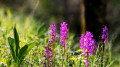
An easy hike, the path is easy to follow. Lots of flowers at this time of year. I encountered fog from the Col des Vachers and over much of the grassy peak. I made a few detours to make the hike more challenging. I didn't encounter any problems with livestock that day, but judging by the tracks, this may not be the case every day.
The path is not easy to walk on the grassy peak despite its gentle appearance.
Thanks to the author.

Machine-translated

Other walks in the area

For more walks, use our search engine .

The GPS track and description are the property of this route's author. Please do not copy them without permission.