The hedgerow trail

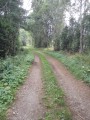
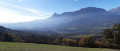
This circular walk allows you to discover one of the Champsaur’s treasures: one of the few remaining preserved bocage landscapes. As you follow the educational information boards, the trail winds its way through hedgerows, canals and sunken lanes…

Details

139792
Creation:
Last update:
Last review:
  • Walking
    Activity: Walking
  • ↔
    Distance: 1.67 mi
  • ◔
    Average duration: 0h 55 
  • ▲
    Difficulty: Easy

  • ⚐
    Back to start: Yes
  • ↗
    Ascent: + 144 ft
  • ↘
    Descent: - 144 ft

  • ▲
    Highest point: 3,474 ft
  • ▼
    Lowest point: 3,340 ft

Photos

Description of the walk

The trail starts on the D23 between Les Costes and Chauffayer, at the junction for Beaurepaire.
There are few parking spaces, but you may be able to ask the farmer right next to the start of the trail.

(S/E) Head for the start sign, which is at the crossroads just above a farm shed.

Yellow markings
Take the path that runs alongside the shed, following the various information signs.
Further on, ignore a path on the right at the sign marked ‘Un boisement de protection’ and carry straight on.

(1) At the “Le Loubet” junction, turn right onto a path until you reach the next junction, “Le Vernet”. Turn right; the path slopes down slightly at first, then curves to the left and crosses a stream via a ford. Continue along a lovely, slightly narrower path where the ash hedges form a tunnel. Turn right at the end and join a tarmac road.

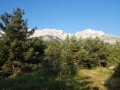
(2) Turn right onto the road, admiring the Montagne de Faraut on your left.
Head towards the hamlet of Beaurepaire and the signpost of the same name. Walk through the hamlet towards La Valgaude, pass a path on your left, then reach a junction marked by a cross.

(3) Turn right and head back up onto the road. At the next junction, turn left to reach the car park (S/E).

Waypoints

  1. S/E : mi 0 - alt. 3,451 ft - Car park beside the D23
  2. 1 : mi 0.44 - alt. 3,474 ft - Turn right at the Le Loubet junction
  3. 2 : mi 0.89 - alt. 3,402 ft - Turn right onto the tarmac road
  4. 3 : mi 1.47 - alt. 3,360 ft - Turn right in front of the cross
  5. S/E : mi 1.67 - alt. 3,451 ft - Car park beside the D23

Worth a visit

The discovery trail on agriculture and the bocage landscape invites you on a walk through the hedgerows. Dotted with educational and entertaining information boards, it takes you into the heart of the fascinating world of agriculture in the Champsaur and Valgaudemar regions, inviting you to listen, smell, touch, observe and pick.

Reviews and comments

4 / 5
Based on 4 reviews

Reliability of the description
4.3 / 5
Ease of following the route
4 / 5
Route interest
3.8 / 5
chtimi
chtimi

Overall rating : 4.7 / 5

Date of your route : Sep 15, 2025
Reliability of the description : ★★★★★ Very good
Ease of following the route : ★★★★★ Very good
Route interest : ★★★★☆ Good
Very busy route : No

Easy hike with signs that explain very well the reasons for and maintenance of the bocage. Interesting and educational.

Machine-translated

BAMX
BAMX

Not done

Machine-translated

JCPR05
JCPR05
• Edited:

The trail is interesting and educational; unfortunately, the signposting is in poor condition and needs updating, or even a complete overhaul.

Machine-translated

CRISCAT
CRISCAT

Overall rating : 4 / 5

Date of your route : Sep 18, 2023
Reliability of the description : ★★★★☆ Good
Ease of following the route : ★★★★☆ Good
Route interest : ★★★★☆ Good
Very busy route : No

A walk taken on a gloomy day, but an interesting one through the bocage of Champ Saur
The information boards along the route provide a good overview of the importance of the bocage
Half the route is along the road, but this isn’t a problem as the road is narrow and there isn’t much traffic

Machine-translated

JCPR05
JCPR05

Overall rating : 3 / 5

Date of your route : Apr 04, 2022
Reliability of the description : ★★★☆☆ Average
Ease of following the route : ★★★☆☆ Average
Route interest : ★★★☆☆ Average
Very busy route : No

Nice, family-friendly. The main attraction is the information boards placed along the route, though they could do with an update.
Route designed for sightseeing and observation, so it’s best enjoyed at a leisurely pace

Machine-translated

zaviegrow
zaviegrow

Overall rating : 4.3 / 5

Date of your route : Nov 25, 2017
Reliability of the description : ★★★★★ Very good
Ease of following the route : ★★★★☆ Good
Route interest : ★★★★☆ Good

It’s more of a short stroll than a proper hike, but it’s well worth it.

Machine-translated

Other walks in the area

For more walks, use our search engine .

The GPS track and description are the property of this route's author. Please do not copy them without permission.