Notre-Dame de la Salette: from the Col de l’Homme to the summit of the Gargas

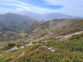
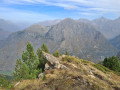
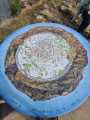
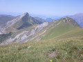
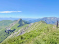
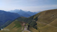
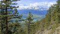
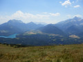
The Sanctuary of La Salette is set amidst lush greenery and steep mountains. The suggested route will take you to the summit of Gargas (2,208 m), where an orientation board will help you identify the Dévoluy, the Obiou and the peaks of the Barre des Écrins, amongst dozens of other peaks. The view in fine weather is superb.
Please note: the 600-metre climb is covered over the first four kilometres. This hike is best suited to experienced walkers.

Details

64775486
Creation:
Last update:
Last review:
  • Walking
    Activity: Walking
  • ↔
    Distance: 4.85 mi
  • ◔
    Average duration: 3h 50 
  • ▲
    Difficulty: Moderate

  • ⚐
    Back to start: Yes
  • ↗
    Ascent: + 1,880 ft
  • ↘
    Descent: - 1,854 ft

  • ▲
    Highest point: 7,218 ft
  • ▼
    Lowest point: 5,427 ft

Photos

Description of the walk

Access by car from Corps, then pass through La Salette-Fallavaux and head up towards the sanctuary. You can start the walk from the sanctuary, but the car park is often full. We recommend starting from the Col de L’Homme, 1,200 metres before the sanctuary: there is a clearly recognisable hard-packed earth car park.
Starting from this pass will give you a good warm-up before the rather steep climb. On the way back, you’ll take a detour to the sanctuary!

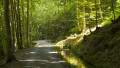
(S/E) Cross the departmental road and take the Col de l’Homme path opposite: signposted “Col de l’Homme Alt. 1,670 m” – “Notre-Dame de la Salette 0h30, 1.2 km”. At the fork in the road that appears straight away, turn right, climb a short, steep slope straight away and follow the path with the cliff face on your left. The path soon turns eastwards towards the sanctuary, which is clearly visible from the start. Join theGR®50, marked in white and red.

(1) Follow it to the right.

(2) Look out for the return path on the left and continue straight on: signpost “Notre-Dame de la Salette, alt. 1780 m” – “Col de l’Éterpat 30 mins and 1.3 km”. Turn left onto the path laid with interlocking paving stones, heading north-east, go round the site and you’ll find yourself facing the entrance to the basilica.

(3) Turn your back on the basilica and head northwards, passing close to the White Cross and then in front of the entrance to the site’s cemetery: a lovely view of the sanctuary. Go round the cemetery on the left, turn right to go over the top and reach the junction at the 1843-metre mark: the yellow markings are faint.

(4) Turn left towards the west, heading for the Col de l’Éterpat. The path, which is straightforward to follow, winds its way through the undergrowth and reaches the pass.

(5) Head left, towards the west: the face of the Gargas mountain ahead of you is a real inspiration!

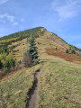
(6) Take the main path, which seems to veer slightly to the right as it climbs, covering the first few metres of elevation gain. The path then winds its way up to the summit: some bends are doubled or even tripled to allow for a quicker passage; stick to the one that seems easiest to you, as the climb is long. Watch out for the very short metal stakes driven into the path to prevent erosion. Reach the summit of Gargas, where you’ll find the orientation table listing the names of the peaks in this beautiful panorama.

(7) Descend via the same route.

(6) Before reaching the Col de l’Éterpat, turn right towards the south onto a well-marked path. Continue the descent to theGR®50.

(2) Turn right towards the west and follow theGR®50, which takes you back to the Col de l’Homme.

(1) Leave theGR® and turn left towards the south, heading for the Col de l’Homme. Cross the county road to return to the car park (S/E).

Waypoints

  1. S/E : mi 0 - alt. 5,427 ft - Col de l’Homme car park
  2. 1 : mi 0.5 - alt. 5,810 ft - GR junction°°®°°
  3. 2 : mi 0.85 - alt. 5,833 ft - Return path junction
  4. 3 : mi 0.94 - alt. 5,794 ft - Notre-Dame Sanctuary
  5. 4 : mi 1.2 - alt. 6,053 ft - Junction, turn left
  6. 5 : mi 1.67 - alt. 6,394 ft - Col de l’Éterpat
  7. 6 : mi 1.73 - alt. 6,427 ft - Gargas junction
  8. 7 : mi 2.48 - alt. 7,215 ft - Le Gargas
  9. S/E : mi 4.85 - alt. 5,427 ft - Col de l’Homme car park

Notes

Water point and toilets at the Salette site.
No water along the route.
Hiking boots with crampons and walking poles are recommended.

Between (6) and (7), watch out for the iron stakes driven into the ground to stabilise the terrain. They protrude far enough from the ground to injure you, yet not far enough for you to instinctively step round them. They are sometimes connected by a mesh of wire, which you may trip over.

(7) Don’t even think about heading westwards to reach the Col d’Hurtières: this is a restricted area.

Avoid hiking around 15 August and 19 September, as the site is very busy with pilgrims.

Worth a visit

Do visit the La Salette sanctuary, of course.

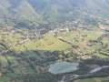
In particular, walk round the site to the east towards the Chapelle de la Rencontre (which has two beautiful stained-glass windows). Cross a simple passageway from north to south, keeping the chapel on your left. You’ll find yourself back outside. Climb to the 1803-metre mark further south, where there’s a lovely view of La Salette-Fallavaux at the foot of a very large cross.

The Canadian cemetery at La Salette-Fallavaux, following the aeroplane crash in the 1950s.

Corps and its legendary past as a Napoleonic town. Napoleon I is said to have stayed there.

Always be cautious and plan ahead when you're outdoors. Visorando and the author of this route cannot be held responsible for any accidents occurring on this route.

The GR® and PR® markings are the intellectual property of the Fédération Française de Randonnée Pédestre.

Reviews and comments

5 / 5
Based on 3 reviews

Reliability of the description
5 / 5
Ease of following the route
5 / 5
Route interest
5 / 5
SYLALA
SYLALA

Overall rating : 5 / 5

Date of your route : Jun 16, 2026
Reliability of the description : ★★★★★ Very good
Ease of following the route : ★★★★★ Very good
Route interest : ★★★★★ Very good
Very busy route : No

We walked the route in the opposite direction to the description. A stunning 360° view from the summit. The ‘direct’ ascent from point 2 to point 6 is a bit steep but can be managed without difficulty. However, this path is indeed not recommended (as mentioned in a previous comment). There is no warning sign at the bottom, but there is a sign at the pass. The highest section is in poor condition in places, very narrow and appears to be less well-maintained; it is best avoided. The path starting from the cemetery, on the other hand, is much safer.

Machine-translated

FO
FO

Overall rating : 5 / 5

Date of your route : Sep 08, 2025
Reliability of the description : ★★★★★ Very good
Ease of following the route : ★★★★★ Very good
Route interest : ★★★★★ Very good
Very busy route : Yes

The ascent was perfectly described. On the descent, we set off on the path described, but a sign indicated that it was partially destroyed and dangerous to use, so we descended via the ascent route.

Machine-translated

cathybme
cathybme

Overall rating : 5 / 5

Date of your route : Jul 28, 2025
Reliability of the description : ★★★★★ Very good
Ease of following the route : ★★★★★ Very good
Route interest : ★★★★★ Very good
Very busy route : No

Thanks for the route, a beautiful hike to discover the area, ND des Salettes and Gargas.
Starting from the Col de l'Homme is a good idea to warm up.
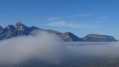
Personally, when I arrived at the top of Gargas in the mist for a picnic, it gradually cleared up, revealing a beautiful panorama.
Be careful on the way down, back at point 6, there is a sign on the ground saying "not recommended" because the vegetation on the first few metres encroaches a little on the path, but then you can find the trail again without any problems.

Machine-translated

Other walks in the area

For more walks, use our search engine .

The GPS track and description are the property of this route's author. Please do not copy them without permission.