Country:

 City:
City:


Access via La Mûre and Valbonnais; at Entraigues, turn right towards Valjouffrey; at the entrance to La Chapelle, turn left onto the small road to Valsenestre. The car park is on the left bank of the Torrent le Béranger.
(S/E) Leave the car park and follow the track to the right towards the Col de la Muzelle. You will come to a junction.
(1) Ignore the sign for Combe Oursière on your right – this is the return route – and carry on straight ahead. You’ll come to a second junction.
(2) Take the Col de Côte Belle path straight ahead. At the foot of the Combe des Écharennes, the slope becomes steeper and you quickly emerge from the woods. A long south-westerly traverse leads to the final slopes beneath the rock formations.
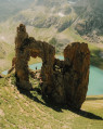
(3) Admire this natural wonder and carry on to the nearby Col de Côte Belle. The view opens up onto the Olan and the southern part of the Écrins Massif.
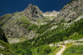
(4) Climb up the hump to the right, from where a path sets off, following the contour line to avoid the final rocks descending from the Pic de Valsenestre.
(5) Take the track that heads off into the rocks. If you miss it, a steep grassy gully allows you to rejoin it once you’ve passed the rocks. You can also head for the centre of the Combe Ourselaire and climb straight up the slope. Continue in this way through the centre of the Combe and then along the right-hand side to reach La Table, a grassy plateau on a ridge.
(6) From here, the path branches off north-north-west to reach a gap in the ridge descending from the Pic.
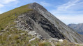
(7) Follow the enjoyable ridge as long as the climbing is not exposed, then cross over to the northern slope to climb up a scree slope. Avoid the rock steps as far as possible on the northern slope. Just below the summit, you’ll reach a rocky slab, above the Cros de la Laisse, which is easy to negotiate. Then, after climbing over some large boulders, you’ll easily reach the summit,offering a magnificent 360° panorama.
(8) Note the start of the return route. Heading towards the Pointe de la Chalp, the ridge is wide and straightforward. Follow it to an easy ledge that descends to the right.
(9) The difficult sections begin a little further down. The ‘extremely difficult’ rating is due to this section involving small, exposed downclimbs, particularly those at the bottom of the slope. By moving in a loop from north to south, then from south to north, reach the top of the scree slope of the Vallon de la Chalp, choosing the safest route. There is no proper path, only animal tracks. The final section follows the contour line to reach the exit couloir. Take great care above the rock outcrops and ensure you have a firm footing.
(10) Reach the scree slope and descend on either side of the gully, then begin the long and arduous traverse of the Vallon de la Chalp scree slope, following the contour line roughly. Try to stay as high up as possible beneath the rocks to make crossing the gullies easier. After a short climb, you’ll emerge onto the Crête de la Rache.
(11) Take the ledge heading north, then the path running alongside the rocks to the volcanic formations of La Rache.
(12) Explore the site and begin the descent. Please note: the path is barely visible and is situated at the top of the site. Descend to Pré Chrétien.
(13) The path is difficult to find; it is lost amongst the grass on the mountain pastures. From this point, it is possible to head eastwards straight down the very steep slope of grass and dwarf pine and come across the clearly visible track further down. The app is very useful here. The main difficulties are now behind you. Follow an easy, gently sloping path to reach the Cabane de l’Oursière.
(14) Continue the rest of the descent, which is easy, until you reach the junction from the outward journey.
(1) Take the track on the left back to the starting point (S/E).
 Visorando Member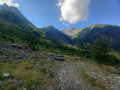
 Moderate
 Very difficult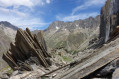
 Difficult