La Demoiselle and Les Prêtres

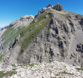
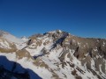
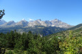
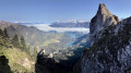
A hike with no significant difficulty, although it is a little steep in the upper section and mainly off-track. It ends at a curious little summit perched in the middle of the upper cirque to the south of the Tête de l’Aupet. It offers a superb view. Griffon vultures are often seen here.

Details

583562
Creation:
Last update:
Last review:
  • Walking
    Activity: Walking
  • ↔
    Distance: 7.41 mi
  • ◔
    Average duration: 6h 40 
  • ▲
    Difficulty: Difficult

  • ⚐
    Back to start: Yes
  • ↗
    Ascent: + 3,724 ft
  • ↘
    Descent: - 3,724 ft

  • ▲
    Highest point: 7,654 ft
  • ▼
    Lowest point: 3,967 ft

Photos

Description of the walk

The starting point is at a very distinctive, clearly marked bend on the D127, between Grand Villard and Villard Joli. You can easily park on a small lay-by above the road.

(S/E) Take the path, which is fairly well marked with occasional paint marks and follows closely alongside the bed of the Torrent des Pertusets (generally speaking, calling it a ‘torrent’ is a bit of an exaggeration, as it’s really more of a thin trickle of water!). You’ll reach an altitude of around 1,400 metres, just after crossing a slightly steeper, earthen section.

(1) Turn right and walk for about 300 metres (due east) until you reach a track. Follow this to the left, heading north-west along an easy path, until you reach the vicinity of the point marked 1536m on the IGN map.

(2) Turn left before the sheepfold onto a well-marked path. To find the start easily: turn left just after a small cairn, heading between a Scots pine (on the left) and a spruce (on the right).
Follow the path easily into the Vallon de Truchière, where you’ll be at an altitude of around 1,700 metres.

(3) The route follows the valley floor as it ascends. It gradually becomes steeper without ever becoming steep. Reach a flat area at an altitude of 2,014 metres. Arrive at the foot of the Tête d’Oriol, where today’s destination is clearly visible. Head due north along a ridge and climb it (a 100-metre climb over a distance of approximately 300 metres). Make a slight detour to the left (due west) to avoid a rocky outcrop and reach a new, steeper ridge.

(4) Climb this ridge for another hundred metres or so, then head left towards the north-west. The terrain is a little steeper, grassy and stony, but presents no real difficulty. You will then reach a suspended meadow.
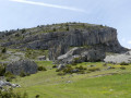
The highest point (2,349 m) is at the top of this meadow. ‘La Demoiselle’ is poorly marked on the map. It appears to be the name of a large, clearly visible rocky outcrop. Whilst this entire summit area is certainly easy, you should only venture there when visibility is good, as it is surrounded by cliffs.

(5) For the descent, retrace your steps for a good hundred metres of descent to reach the junction where you started the ascent.

(4) From this point, it is possible to follow the entire ascent route for the descent.
The route described here takes you all the way round the Tête d’Oriol.
Head north-east down steep but easy slopes. Watch your step and descend as best you can over grassy terraces and scree.
Reach the pass between Les Prêtres and the Tête d’Oriol.

(6) Enter the Vallon des Narrites and follow it as best you can, using the well-trodden but not entirely continuous trail. Reach the bottom of the valley (around 1,700 m).

(7) Head south-east and descend as best you can down the broad, gently sloping hillsides, which lead to the sheepfold and then to the junction you passed on the way up.

(2) Follow the route you took on the way up to return to the car park (S/E).

Waypoints

  1. S/E : mi 0 - alt. 3,967 ft - Median on the D127
  2. 1 : mi 0.58 - alt. 4,564 ft - A short, unpleasant stretch of muddy ground.
  3. 2 : mi 1.52 - alt. 5,138 ft - Turn left before the sheepfold
  4. 3 : mi 1.99 - alt. 5,443 ft - Entrance to the Vallon de la Truchière
  5. 4 : mi 3.47 - alt. 7,277 ft - Crossroads towards La Demoiselle
  6. 5 : mi 3.64 - alt. 7,654 ft - Sommet des Prêtres
  7. 6 : mi 3.96 - alt. 7,116 ft - Pass between Les Prêtres and L’Oriol
  8. 7 : mi 5.37 - alt. 5,692 ft - End of the Narrites valley
  9. S/E : mi 7.41 - alt. 3,967 ft - Median strip on the D127

Notes

There are no water sources or shelters along the route. No equipment is required apart from walking poles, if needed. Of course, if there is snow on the ground, the difficulties are quite different and may require suitable equipment.

Reviews and comments

4.2 / 5
Based on 3 reviews

Reliability of the description
4 / 5
Ease of following the route
4 / 5
Route interest
4.7 / 5
bader
bader

Overall rating : 3.3 / 5

Date of your route : Nov 05, 2024
Reliability of the description : ★★★☆☆ Average
Ease of following the route : ★★★☆☆ Average
Route interest : ★★★★☆ Good
Very busy route : No

Hike completed on 4 November 2024; it was difficult to find the path leading up to the Sommet des Prêtres after point 3; I had to cut across a rather steep section, which I wouldn’t recommend; otherwise, I didn’t encounter or see any animals – a bit disappointed, all the same.

Machine-translated

sabinefebvre
sabinefebvre

Overall rating : 5 / 5

Date of your route : Jul 30, 2024
Reliability of the description : ★★★★★ Very good
Ease of following the route : ★★★★★ Very good
Route interest : ★★★★★ Very good
Very busy route : No

A lovely walk in a wild area.

Machine-translated

Klodeko
Klodeko

Overall rating : 5 / 5

Date of your route : May 28, 2021
Reliability of the description : Not used / Not applicable
Ease of following the route : Not used / Not applicable
Route interest : ★★★★★ Very good
Very busy route : No

I went with my dog. Given the still substantial snow cover, we headed to the Col de Drouillet at the top of the Truchière valley. The whole of the Vercors stretched out before our eyes 🤩 As we circumnavigated the Prêtres in over 1.50 metres of snow in places, there were snow slides coming down from beneath the Demoiselle due to the warmer weather. So we headed back down into the snow-covered Narrites valley, where there were plenty of chamois beneath the cliffs. At the bottom of the valley, we veered right along the hillside to reach the lower part of the Truchière valley, then continued along the hillside to descend directly opposite the Rioux shepherds’ hut. From there, we came across yellow markings that veered left across meadows and entered the forest. We finished on this lovely single track which winds its way through a beech forest and arrives just above the start.
Marmots, chamois and ptarmigans kept us company throughout the route.

Machine-translated

Other walks in the area

For more walks, use our search engine .

The GPS track and description are the property of this route's author. Please do not copy them without permission.