The Crête de La Sciau

A round-trip hike suitable for all. Offering interesting panoramic views, it combines woodland and mountain pastures. It consists mainly of undulating sections, allowing you to tackle the elevation gain in comfortable conditions.

It can also be walked as a circular route, thereby reducing the distance, though the final section involves walking on tarmac for a considerable part of the way.

Details

n°3987345
Creation:
Last update:
Last review:
  • Walking
    Activity: Walking
  • ↔
    Distance: 8.37 mi
  • ◔
    Average duration: 5h 35 
  • ▲
    Difficulty: Moderate

  • ⚐
    Back to start: Yes
  • ↗
    Ascent: + 1,978 ft
  • ↘
    Descent: - 1,962 ft

  • ▲
    Highest point: 4,882 ft
  • ▼
    Lowest point: 3,924 ft

Photos

Description of the walk

Parking is easy at the Place de l’Église in Saint-Michel-en-Beaumont.

The entire walk is very clearly marked in yellow and the directional signs are perfectly clear.

Important: For obvious safety reasons, please ensure you close all the numerous gates you encounter along the route as you pass through them.

(S/E) The walk starts on the path overlooking the car park, which is accessible straight from the car park.
Please note: make sure you take the path heading west on the left. Follow the clearly marked path as it winds its way. You’ll come to a first gate designed to keep livestock in their enclosure whilst allowing walkers free passage.

(1) After passing through another gate, you’ll reach a cattle shed. At the same time, you’ll be crossing an area that may be occupied by cows: be careful not to startle them; ideally, give them a wide berth… To continue, you’ll need to go past the building and round it to the left, passing through another gate situated opposite. You’ll then reach the Soulier crossroads.

(2) Carry on to the right along the track leading to the Combe des Ailes. Always take care to follow the yellow markings, avoiding the Yellow Crosses. Reach the Combe des Ailes.

(3) Here, the track begins to climb more steeply. Follow the signs for Signal Saint-Michel on your right until you reach Les Grands Clos.

(4) Continue along the main ascending track straight ahead; ignore the slightly descending path on your right. You will then reach the Croix de Roche, the highest point of the walk.
Please take care here: the unprotected sheer drop requires caution when approaching it and extra vigilance if children are taking part in this walk.

(5) Resume the path after passing through another gate, which leads you to the final, descending section. After passing the Signal Saint-Michel, you’ll reach the junction with the Route du Col de Pierre Grosse.

(6) Here you have two options:
- you can follow the same route back as on the way there,
- take the tarmac road to the right,
in both cases, this will take you back to the car park at Place de l’Église in Saint-Michel-en-Beaumont (S/E).

Waypoints

  1. S/E : mi 0 - alt. 3,950 ft - Car park at the Church of Saint-Michel-en-Beaumont
  2. 1 : mi 0.97 - alt. 4,259 ft - Livestock protection gate
  3. 2 : mi 1.63 - alt. 4,022 ft - Le Soulier.
  4. 3 : mi 2.14 - alt. 4,137 ft - Combe des Ailes.
  5. 4 : mi 2.84 - alt. 4,587 ft - Les Grands Clos.
  6. 5 : mi 3.34 - alt. 4,879 ft - The Roche Cross.
  7. 6 : mi 4.2 - alt. 4,567 ft - Saint-Michel signpost
  8. S/E : mi 8.37 - alt. 3,957 ft - Car park at the Church of Saint-Michel-en-Beaumont

Worth a visit

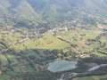
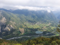
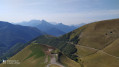
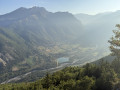
Between (2) and (3) Admire the view to the left of the track of the Obiou Massif and the Drac Valley, with the Eastern Balcons of the Vercors as a backdrop.
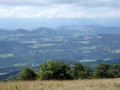
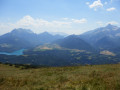
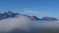
(5) Here, enjoy an exceptional view of the La Bonne Valley, the Valbonnais region and its lake, and much more besides.

Reviews and comments

5 / 5
Based on 2 reviews

Reliability of the description
5 / 5
Ease of following the route
5 / 5
Route interest
5 / 5
geai47
geai47
• Edited:

Overall rating : 5 / 5

Date of your route : Sep 29, 2026
Reliability of the description : ★★★★★ Very good
Ease of following the route : ★★★★★ Very good
Route interest : ★★★★★ Very good
Very busy route : No

Hike completed on 26 September 2026.
Stunning views from this ridge in the first light of autumn.

We returned from the ridge via the small road as we wanted to explore a section of the Beaumont Canal between St Michel and St Laurent.

Machine-translated

Mariechr
Mariechr

Overall rating : 5 / 5

Date of your route : Mar 01, 2025
Reliability of the description : ★★★★★ Very good
Ease of following the route : ★★★★★ Very good
Route interest : ★★★★★ Very good
Very busy route : No

A very pleasant walk, but the elevation gain is much less than stated – closer to 300 metres. The estimated time was well overestimated; it took us 3 hours at a leisurely pace. A lovely afternoon stroll!

Machine-translated

Other walks in the area

For more walks, use our search engine .

The GPS track and description are the property of this route's author. Please do not copy them without permission.