Saint-Firmin Castle Discovery Trail

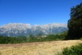
A short walk following the discovery trail around the fortified castle of Saint-Firmin.

Details

39042138
Creation:
Last update:
Last review:
  • Walking
    Activity: Walking
  • ↔
    Distance: 2.19 mi
  • ◔
    Average duration: 1h 35 
  • ▲
    Difficulty: Easy

  • ⚐
    Back to start: Yes
  • ↗
    Ascent: + 643 ft
  • ↘
    Descent: - 636 ft

  • ▲
    Highest point: 3,330 ft
  • ▼
    Lowest point: 2,680 ft

Description of the walk

From Saint-Bonnet-en-Champsaur, take the N85 towards La Mure. Stop at the business park near the junction with the D985a. Park in the car park next to the road, opposite the Maison de Pays du Valgaudemar.

(S/E) Take the road leading into the industrial estate. Keep well to the right, alongside the SAMSE. The start of the path is signposted at the end of the tarmac road, on the left. This is the actual start of the forest walking trail.

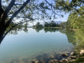
(1) Follow the path to the left. Turn right at the first junction, then left at the second, heading towards the castle. You’ll come to a fork in the path leading to the castle.

(2) Head towards the castle. Take the opportunity to visit it, then continue along the path until you reach the road.

(3) Follow the road to the left for 500 m until you reach the first path on the right.

(4) Take this path, which climbs through the forest. The route is then well signposted. You’ll reach the hamlet of La Villette. Carry on until the second left-hand bend, then turn right onto the descending path. At the road, turn right, then left onto a path. Keep to the left until you reach the canal.

(5) From the canal’s water intake, the path descends particularly steeply to the car park at the Maison de Pays (S/E).

Waypoints

  1. S/E : mi 0 - alt. 2,687 ft - Maison de Pays du Valgaudemar
  2. 1 : mi 0.16 - alt. 2,710 ft - Actual start of the discovery trail
  3. 2 : mi 0.56 - alt. 2,953 ft - Junction for the path to the castle - Château de St-Firmin
  4. 3 : mi 0.69 - alt. 2,982 ft - Junction with the Château Road (tarmac)
  5. 4 : mi 1.01 - alt. 3,087 ft - Junction with the path
  6. 5 : mi 2.11 - alt. 2,874 ft - Intake on the Saint-Firmin Canal
  7. S/E : mi 2.19 - alt. 2,694 ft - Maison de Pays du Vaulgaudemar

Notes

Signposting with yellow signs makes it easy to find your way.
Our route veers off the main path to go via the fortified castle.
A video preview

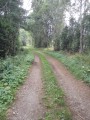
70 per cent of the route is through woodland, so it is shaded.
It is a pity that the descent from the Saint-Firmin Canal intake to the Maison de Pays car park is particularly steep. This may be a problem for some people or young children, although the rest of the route presents no particular difficulties.

Worth a visit

Reviews and comments

4.7 / 5
Based on 3 reviews

Reliability of the description
4.7 / 5
Ease of following the route
4.7 / 5
Route interest
4.7 / 5
BAMX
BAMX

Overall rating : 4.7 / 5

Date of your route : Aug 05, 2025
Reliability of the description : ★★★★☆ Good
Ease of following the route : ★★★★★ Very good
Route interest : ★★★★★ Very good
Very busy route : No

Nice hike, well shaded, with a beautiful view

Machine-translated

User 22961969

Overall rating : 4.7 / 5

Date of your route : Aug 02, 2025
Reliability of the description : ★★★★★ Very good
Ease of following the route : ★★★★★ Very good
Route interest : ★★★★☆ Good
Very busy route : No

After visiting the Valgaudemar spinning mill in Saint Firmin on a Saturday morning and having lunch in the village, we did most of this hike, starting from the village centre and returning via the castle ruins.
The hike was pleasant and shaded, and we hardly saw anyone else!
The ruins are not particularly interesting.

Machine-translated

Gaiaearth
Gaiaearth

Overall rating : 4.7 / 5

Date of your route : Jul 26, 2025
Reliability of the description : ★★★★★ Very good
Ease of following the route : ★★★★☆ Good
Route interest : ★★★★★ Very good
Very busy route : No

A pleasant, shaded hike.
When you reach the irrigation canal, the path downhill is barely visible. It is immediately on the right after you pass the penstock. Do not follow the canal.
The descent is very steep.
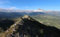
The castle ruins are charming and the view is beautiful.
Dogs are allowed, so it's great for walking with children, although they may complain as some of the paths are steep for their little legs.

Machine-translated

Other walks in the area

For more walks, use our search engine .

The GPS track and description are the property of this route's author. Please do not copy them without permission.