A circular walk around Lake Roaffan from La-Motte-en-Champsaur

A pleasant walk through meadows and woods, starting on aGR®(easy) route and returning via the higher forest path with a slight climb.

Details

2844954
Creation:
Last update:
Last review:
  • Walking
    Activity: Walking
  • ↔
    Distance: 6.44 mi
  • ◔
    Average duration: 4h 05 
  • ▲
    Difficulty: Moderate

  • ⚐
    Back to start: Yes
  • ↗
    Ascent: + 1,247 ft
  • ↘
    Descent: - 1,257 ft

  • ▲
    Highest point: 4,429 ft
  • ▼
    Lowest point: 3,596 ft

Description of the walk

Park in the car park at the entrance to the village, opposite the Town Hall.

(S/E) Take theGR® 50 northwards, towards Lac de Roaffan. The path heads north-west.

(1) Pass through the hamlet of Le Collet and continue along the GR®. After a descent, you’ll reach a crossroads at a place called Le Bruscq.

(2) Carry on straight ahead and, shortly afterwards, leave the road and take a path on the left. After a right-hand bend, rejoin the road and go round Maisseret on your left. Continue along the GR®.

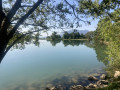
(3) After Maisseret, turn right onto a path that climbs through the forest and leads to the lake.

(4) Walk round the lake and take the same path you came along to return to the Brusq crossroads.

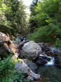
(2) Turn left towards Mallarua. At the crossroads, head uphill to the right. Cross the stream and head uphill to the right into the forest.

(5) At the crossroads, continue climbing to the left, cross a pass and head straight down to the next crossroads.

(6) Take the path on the left, then the track which initially runs level towards the east before descending steeply towards La Motte.

(7) After the cemetery, follow the road to the right, which takes you back to the car park (S/E).

Waypoints

  1. S/E : mi 0 - alt. 3,606 ft - Car park
  2. 1 : mi 0.62 - alt. 3,793 ft - Small pass
  3. 2 : mi 1.37 - alt. 3,766 ft - Crossroads – Le Bruscq
  4. 3 : mi 1.94 - alt. 3,773 ft - Path on the right
  5. 4 : mi 2.54 - alt. 4,009 ft - Lake Roaffan
  6. 5 : mi 4.67 - alt. 4,252 ft - Path on the left
  7. 6 : mi 5.21 - alt. 4,281 ft - Left again
  8. 7 : mi 6.3 - alt. 3,596 ft - After the cemetery
  9. S/E : mi 6.44 - alt. 3,609 ft - Car park

Notes

Sturdy footwear is recommended for the return journey

Worth a visit

The Valgaudemar Valley.

Always be cautious and plan ahead when you're outdoors. Visorando and the author of this route cannot be held responsible for any accidents occurring on this route.

The GR® and PR® markings are the intellectual property of the Fédération Française de Randonnée Pédestre.

Reviews and comments

4.1 / 5
Based on 3 reviews

Reliability of the description
4.7 / 5
Ease of following the route
4 / 5
Route interest
3.7 / 5
romanche
romanche

Overall rating : 4.3 / 5

Date of your route : Mar 18, 2024
Reliability of the description : ★★★★★ Very good
Ease of following the route : ★★★★☆ Good
Route interest : ★★★★☆ Good
Very busy route : No

A lovely walk in stunning mountain scenery, all the more so as we did it in March with all the major peaks covered in snow. I gave it a 4 out of 5 for ‘ease of following the route’ because on the way back, once we’d passed point no. 2 again, we hesitated several times: the first time at the crossroads in Mallarua, the second time when crossing the stream (straight across or much further on?), and the third time because, instead of finding a crossroads that might have been point no. 5, we came across two of them 5 or 10 minutes apart. Fortunately, however, right from the start in Mallarua we found a signpost marked ‘La Motte’, which we followed at every junction – a detail that would have been more helpful to mention in the guidebook. As for crossing the stream, a Yellow Cross dissuaded us from crossing straight away.
I’ve given it 4 out of 5 for the hike’s appeal, thanks to the mountain scenery and the fact that it’s in the national park, but we did find there were a few too many roads. Thank you, in any case, for introducing us to this lovely little lake.

Machine-translated

Nadpelvanh
Nadpelvanh

Overall rating : 3.7 / 5

Date of your route : Aug 10, 2023
Reliability of the description : ★★★★☆ Good
Ease of following the route : ★★★★☆ Good
Route interest : ★★★☆☆ Average
Very busy route : Yes

The main route to the lake is well-trodden but of little interest; it is worth leaving the main route and taking a path to the north-east of the lake to climb up through the forest (quite steep), which continues as a ledge path and rejoins the main route between points 5 and 6.
Taken this way, the route takes on a whole new appeal.

Machine-translated

6roselyne1clem2benji

didn’t go on that walk

Machine-translated

jy05
jy05

Overall rating : 4.3 / 5

Date of your route : Jul 05, 2021
Reliability of the description : ★★★★★ Very good
Ease of following the route : ★★★★☆ Good
Route interest : ★★★★☆ Good
Very busy route : No

A lovely walk; the only difficulty is a fairly long steep climb right from the start

Machine-translated

Other walks in the area

For more walks, use our search engine .

The GPS track and description are the property of this route's author. Please do not copy them without permission.