The rugged Souloise valley, from Les Guillardes to Lac du Sautet via L’Infernet

This magnificent walk, which is easy and accessible to all, immerses you in the heart of lush, unspoilt countryside, where the tumult of the bubbling waters of the Souloise carries you away into a damp and invigorating world. Passing through the old hamlet of Pellafol, nestled in the heart of wild and peaceful countryside, will fill you with wonder and transport you to a soothing world. A perfect adventure for young and old alike, ideal for reconnecting with nature or sharing precious moments with the family.

Details

74560829
Creation:
Last update:
Last review:
  • Walking
    Activity: Walking
  • ↔
    Distance: 9.44 mi
  • ◔
    Average duration: 5h 50 
  • ▲
    Difficulty: Moderate

  • ⚐
    Back to start: Yes
  • ↗
    Ascent: + 1,726 ft
  • ↘
    Descent: - 1,739 ft

  • ▲
    Highest point: 3,350 ft
  • ▼
    Lowest point: 2,513 ft

Photos

Description of the walk

Start your adventure coming from Saint-Disdier. Take the first road on the right after crossing the stream, then park in the large car park beneath Les Voûtes.

The path is well signposted with signs and yellow markings along much of the route.

(S/E) Cross the road and follow the sign for “La Grande Gillarde”. 

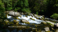
(1) Once you reach the magnificent cascading waterfall – which is particularly spectacular in spring – take a moment to admire it. Then follow the sign for ‘Canyon de l’Infernet variante’. After about 300 metres, cross the stream via the footbridge.

(2) Continue along the right bank, following the stream until you reach the Infernet.

(3) Cross the stream again and take in the impressive sight of the turbulent waters. Then follow the nature trail along the left bank.

(4) At the sign for “Le Café”, turn right towards Grand Cros.

(5) After crossing the road, follow the signs for “Vieux Pellafol”.

(6) Stop off at the viewpoint to admire the lake and the Demoiselles Coiffées. Carry on straight ahead at the next crossroads.

(7) Cross the stream bed and carry on straight ahead towards “Vieux Pellafol”.

(8) Once you reach the old hamlet, enjoy the cool water from the fountain and explore this charming spot. Then carry on, taking care not to join the road straight away; you’ll reach it about 300 metres further on. Follow this road until you carefully cross the D537.

(9) Carry on straight ahead. Further on, ignore a path on the right.

(10) When you reach the farm sheds, turn right. About 300 metres further on, take the track on your left towards the hamlet of La Posterle.

(11) Follow the old canal and cross the mountain for a few metres through a small tunnel carved into the rock (watch your head – it’s low!). Carry on along the canal to the hamlet of La Posterle, which you’ll reach just after a hairpin bend to the left (ignore the path continuing straight ahead). In the hamlet, make the most of the drinking water spring and admire the little chapel situated at the westernmost end of the village.

(12) Cross the D537 with care and then take the path leading down towards “le Café” and “l’Infernet”.

(4) At the edge of the stream, turn right and follow the path back the way you came, returning to a junction you passed on the way out.

(2) Do not cross the footbridge. Continue along the path, straight ahead, on the right bank, until you reach the magnificent Petites Gillardes. At the end of the track, head up onto the road and make your way to the car park, less than 100 m away (S/E).

Waypoints

  1. S/E : mi 0 - alt. 2,894 ft - Car park beneath the Voûte
  2. 1 : mi 0.3 - alt. 2,867 ft - La Grande Gillarde
  3. 2 : mi 0.58 - alt. 2,825 ft - Junction shared by the outward and return legs. Bridge over the - Souloise (rivière)
  4. 3 : mi 1.32 - alt. 2,717 ft - Infernet Canyon
  5. 4 : mi 1.69 - alt. 2,651 ft - Sign for ‘Le Café’. Junction of the circular loop
  6. 5 : mi 2.99 - alt. 2,772 ft - Signposted: follow signs for Vieux Pellafol
  7. 6 : mi 3.53 - alt. 2,566 ft - Observatory on the - Lac du Sautet
  8. 7 : mi 3.75 - alt. 2,569 ft - At the crossroads, follow signs for Vieux Pellafol
  9. 8 : mi 4.44 - alt. 2,979 ft - Vieux Pellafol market
  10. 9 : mi 4.89 - alt. 3,058 ft - D537
  11. 10 : mi 5.38 - alt. 3,143 ft - Agricultural sheds
  12. 11 : mi 6.81 - alt. 3,314 ft - Tunnel cut into the rock for a canal
  13. 12 : mi 7.58 - alt. 3,136 ft - D537
  14. S/E : mi 9.44 - alt. 2,897 ft - Car park beneath the Voûte

Notes

Car park with toilet facilities, several water sources along the route, very clear signposting. Well-maintained and well-documented route.

Worth a visit

Reviews and comments

4 / 5
Based on 3 reviews

Reliability of the description
3.7 / 5
Ease of following the route
3.7 / 5
Route interest
4.7 / 5
Gilloudu13
Gilloudu13

Overall rating : 5 / 5

Date of your route : Aug 27, 2025
Reliability of the description : ★★★★★ Very good
Ease of following the route : ★★★★★ Very good
Route interest : ★★★★★ Very good
Very busy route : No

A beautiful loop for exploring Les Gillardes and enjoying stunning views of Lake Sautet
No particular difficulty and easy to follow with GPS

Machine-translated

lebretondelest
lebretondelest

Overall rating : 2.3 / 5

Date of your route : Aug 23, 2025
Reliability of the description : ★☆☆☆☆ Very disappointing
Ease of following the route : ★★☆☆☆ Disappointing
Route interest : ★★★★☆ Good
Very busy route : No

A beautiful hike with no particular physical difficulties and quite varied, unfortunately marred by very imprecise and even erroneous descriptions and signage. A serious update seems necessary.

A few comments, among others:

- Right from the start, you get lost due to multiple signs that all seem to point in more or less the same direction. You need to be much more precise here, otherwise you'll spend 30 minutes looking for the right route to start the loop. The landmark should be the footbridge that you reach after a maximum of 10 minutes' walk from the waterfall. to do this, go over the waterfall on the left, follow the path above, then at the first three-way junction, go down towards the river and the footbridge is right there. There seems to be a path that leads directly there along the river, but it is impossible to find.

- At point 4, the sign for "Le Café" does not exist. It is "Le Quincet", probably at the Rivardière footbridge.

- At point 5, it is not enough to cross the road; you must first follow it to the left for 50 m before rejoining the path at the end of the bend.

- At point 7, the sign for "Vieux Pellafol" does not exist. In general, ignore this sign, as it hardly ever appears along the route.

- At point 8, "Then, resume your route, avoiding taking the road immediately", this is simply impossible, or else precise instructions must be provided.

- At point 12, as on the way there, "Le Café" still does not exist, unlike "Le Quincet".

- At point 4 on the return journey, it gets even better: the sign "Les Gillardes par la rive gauche" actually indicates the right bank and "Les Gillardes par la rive droite" indicates the left bank. It's complete nonsense!

In the end, it is advisable to bring a good IGN map to find your way around, otherwise it is easy to get lost trying to follow the description.

Machine-translated

User 21711253

Hello, I haven’t visited this hiking website yet.

Machine-translated

Bus-le-nain
Bus-le-nain

Overall rating : 4.7 / 5

Date of your route : Jun 30, 2025
Reliability of the description : ★★★★★ Very good
Ease of following the route : ★★★★☆ Good
Route interest : ★★★★★ Very good
Very busy route : Yes

A very pleasant hike with no difficulties. It was very hot, so remember to bring plenty of water. Most of the hike is in the forest, except after the village, where you can cool off and fill your water bottles at drinking fountains. Accessible to dogs. I recommend it.

Machine-translated

User 21711253

I have not yet completed these hiking routes.

Machine-translated

Other walks in the area

For more walks, use our search engine .

The GPS track and description are the property of this route's author. Please do not copy them without permission.