Tête de l’Aupet and back via the Vallon des Narrites and its sinkholes

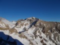
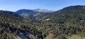
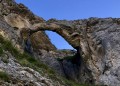
A magical hike in the Dévoluy, with the Grand Ferrand and the Obiou visible for much of the day. The descent crosses the Vallon des Narrites and its sinkholes, which are well worth exploring. In the distance, the Vercors beckons, and the Écrins National Park is very close by.

Details

n°107020049
Creation:
Last update:
Last review:
–
  • Walking
    Activity: Walking
  • ↔
    Distance: 6.67 mi
  • ◔
    Average duration: 7h 20 
  • ▲
    Difficulty: Very difficult

  • ⚐
    Back to start: Yes
  • ↗
    Ascent: + 4,928 ft
  • ↘
    Descent: - 4,954 ft

  • ▲
    Highest point: 8,704 ft
  • ▼
    Lowest point: 4,613 ft

Description of the walk

Access via La Mûre, Pellafol, then the D537 to Saint-Disdier. On leaving the village, at Les Baraques, turn right towards Villard Joly. Carry on to Seresq and take the track on the right between the houses towards the Fontaine de l’Adroit to reach the starting point at an altitude of 1,400 metres. There is no car park, so park carefully at the edge of the fields so as not to inconvenience the farmers.

(S/E) Take the track that passes near the Fontaine de l’Adroit and leads to a junction.

(1) Take the track that climbs to the right and leave it heading west at an altitude of 1,550 m to join the GRP® Tour de l’Obiou a little further up.

(2) Follow the GRP® northwards, keeping to the right for about 200 metres until you reach a cairn.

(3) Head west, to the left, towards a clearly visible gap in the Clape cliff. Climb up this gully to reach the broad, grassy ridge of the Clape.

(4) Climb the very easy Crête de la Clape, then head towards the steep slopes overlooking the Vallon du Mas. Reach a cairn; the Massif de l’Obiou to the north comes into view, as does the Grand Ferrand to the south.

(5) Continue along the ridge, then, after a short descent, reach the 2246-metre mark.

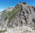
(6) The final 400 metres of ascent are clearly visible. A few tracks help with the climb. Grass-covered and rocky sections follow one another. Take a few stone steps along the ridge, climb some easy rocks and reach the summit.

(7) After treating yourself to a well-deserved snack and taking in the magnificent scenery, it’s time to head back down. Follow the southern ridge towards the Pras d’Oriol, with its spires and mini-canyons, and make your way down the grassy slope until you reach a visible track in the vast scree slope. This leads to the Vallon des Narrites and the Vallon de Truchière.

(8) Leave the path to the left to explore the first sinkholes. Then rejoin the path to reach the Vallon des Narrites. Wander through the valley to discover more sinkholes.

(9) Leave the path to the left if the sheep are further down (see practical information) and then climb down a small rocky outcrop. Continue along the flat section.

(10) Turn left to rejoin the ascent route and descend to the car park via the reverse route of the outward journey (S/E).

Waypoints

  1. S/E : mi 0 - alt. 4,826 ft - Start car park
  2. 1 : mi 0.44 - alt. 4,882 ft - Crossing
  3. 2 : mi 0.74 - alt. 5,322 ft - Common junction (out and back)
  4. 3 : mi 0.92 - alt. 5,394 ft - Cairn
  5. 4 : mi 1.29 - alt. 5,892 ft - Ridge above the scree slope
  6. 5 : mi 2.08 - alt. 7,579 ft - Cairn and ridge
  7. 6 : mi 2.36 - alt. 7,575 ft - Elevation 2246
  8. 7 : mi 2.98 - alt. 8,681 ft - Tête de l'Aupet
  9. 8 : mi 3.51 - alt. 7,746 ft - End of the path
  10. 9 : mi 5.02 - alt. 6,198 ft - End of this section of the path
  11. 10 : mi 5.45 - alt. 5,505 ft - Bend
  12. S/E : mi 6.67 - alt. 4,800 ft - Back to the car park

Notes

There’s no water along the route.

Before starting the ascent, the shepherds from the Vallon des Narrites asked me what route I was taking, as their flock of sheep might be at the bottom of the valley. They told me that their dogs were neither vicious nor aggressive, but that they were simply doing their job. That is why you must turn left at (9) so as not to disturb them. The sheepdogs may stay close to the flock or block the descent route near the 1719 mark. One came to meet me and accompanied me for 100 metres, moving alternately to my right and left. You must stay calm, talk to him and cross your walking sticks behind you so as not to tempt him to take a bite out of your calves.

Worth a visit

Chamois on the Crête de la Clape.

The magnificent landscape at the summit: Tête de la Cavale, Bonnet de l’Évêque and Obiou on one side, and Petit and Grand Ferrand on the other. In the distance, Pic and Plateau de Bure, Grand Veymont and Mont Aiguille (with its rather unattractive profile)...

Other walks in the area

For more walks, use our search engine .

The GPS track and description are the property of this route's author. Please do not copy them without permission.