Country:

 City:
City:


Park along the main road.
(S/E) At the far end of the village, take the path that climbs north-north-west and follow it to the point with an altitude of 1278. In its second section, it descends slightly (ignore the paths branching off to the left)
(1) Shortly after the 1278-metre altitude, the path veers to the left. Follow it to the junction at the 1486-metre altitude (signpost indicating only ‘Pierre Baudinard’ and ‘Pierre Orcel’).
(2) Take the path branching off to the right, which climbs steeply towards the Clos du Mounard (not signposted). Since the creation of the Tour de l’Obiou, from point 2 to point 5, follow the yellow-red-yellow markings.
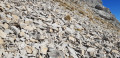
(3) Once you reach the entrance to the meadow, with the hut in sight, climb the embankment on the left and follow the edge of the meadow to a small gate. There is no marked path on this section for about 150 m. From the gate, the path – which is sometimes a little narrow – winds its way through the broom and fir trees, cutting a line through the grass straight up the slope; follow it to the 1,705-metre mark. Follow a few cairns and finish on the small scree slope.
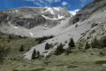
(4) Now follow the flat path towards the Pivallon valley (north-west). Follow a wide bend to reach the shoulder on the opposite side of the valley, at the 1700-metre mark.
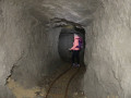
(5) From the ridge, follow the path heading due north, following the contour line. Take the path where the GRP® marker cross is located (ignore the main GRP® path, which descends). At the end of this path lies the entrance to the tunnel (200 m), visible only at the last moment, on the left, at the level of the platform.
(6) Whilst exploring the main tunnel, you’ll come across several short side tunnels. After your visit, retrace your steps in the opposite direction to elevation 1705.
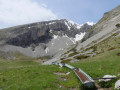
(4) Keep to the right, on the path (more like an animal track) which continues through the broom and fir trees. Follow the clearest track, which tends to climb slightly and leads to the drinking troughs.
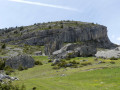
(7) Now head, by sight, across the mountain pasture to reach the Baudinard rocks, clearly visible in the distance.
(8) At the Pierre Baudinard hut, take the clearly visible path (north of the rocks) and follow it all the way down to the 1,278-metre point, where it turns to the right, keeping to the path that leads back to the village of Villard Joli (S/E).
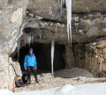

 There, you need to take the level path marked ‘X’ in yellow and red and yellow!
 Visorando Member
 Difficult

 Easy
Easy 
 Very difficult
 Association / Club / Walk leader