


 Country:

 City:
City:


Access is by car. On the Plaine des Péllissiers, you can park in the 90° bend at the end of the straight stretch, at the start of the Chemin des Gachets. Please take care not to obstruct traffic, as this is a turning area for coaches.
(S/E) With your back to the Chemin des Gachets, cross the departmental road with care and follow the track straight ahead, heading due south, along the edge of the woods. Walk along the fields to the end, enter the woods and you’ll come to a three-way junction.
(1) Head towards Les Roussins by taking the track on the right.
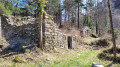
(2) Pass through the hamlet (which sheltered members of the Resistance during the Second World War) and continue along an uphill track. An old canal lies below on the right.
(3) When you reach the water intake, take the track on the left and continue along the mountainside. Carry on to a logging landing where the path turns 90° to the right.
(4) A small castle once stood here. Continue along the wide track.
(5) Ford the Ruisseau la Laisse.
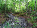
(6) Do not take the path leading uphill to the right; continue to follow the track alongside the stream.
(7) Do not take the path leading uphill to the right; continue to follow the track alongside the stream.
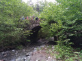
(8) Cross the county road and take the path on the other side along the Ruisseau de la Croix de la Pigne as far as the Pont de Bagarre.
(9) Leave the bridge on your right and head towards Les Pélissier. Join the access road to the hamlet.
(10) Follow this road up to the left, then turn right at the corner of the farm building to reach the D66 and the car park (S/E).


 Visorando Member
 Moderate
 Difficult
 Very difficult
 Extremely difficult
