The Désert en Vajouffrey via the Col de Côte Belle

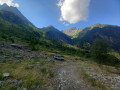
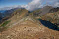
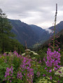
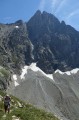
When you’re in the Valbonnais region, as you move from one valley to another, this walk allows you to gain a little altitude and discover the many peaks in this part of the Écrins massif. These peaks overlook both Valsenestre (suggested starting point) and the Désert in Valjouffrey (finish). Of course, you’ll need the weather to be on your side!

Details

n°607128
Creation:
Last update:
Last review:
  • Walking
    Activity: Walking
  • ↔
    Distance: 6.61 mi
  • ◔
    Average duration: 6h 05 
  • ▲
    Difficulty: Difficult

  • ⚐
    Back to start: No
  • ↗
    Ascent: + 3,458 ft
  • ↘
    Descent: - 3,547 ft

  • ▲
    Highest point: 7,523 ft
  • ▼
    Lowest point: 4,150 ft

Photos

Description of the walk

The route starts from the car park on the right-hand side as you arrive in Valsenestre.

(S) Look out for the blue ‘Le Béranger’ sign and follow theGR®54B, which climbs gently from where the sign is located. Continue to the junction with theGR®54.

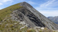
(1) Leave the path leading up to the Col de la Muzelle on your left. Continue to the right on theGR®54, which will take you to the Col de Côte Belle, some 800 metres higher up, without any risk of getting lost. Along the way, just before the pass, you’ll walk past some old slate quarries.

(2) At the pass, do not head straight down in front of you. TheGR®54has been rerouted as the original path was quite steep and unsafe, but the old track still exists and can be followed. It is preferable to take the well-marked path on your left, which winds its way down in several hairpin bends to join the old route at an altitude of around 2,000 metres.

Continue along the clearly visibleGR®54path. Ignore the start of the tracks on your left (which you may not even notice) heading towards the Combe des Marmes (these tracks are not shown on some 1:25,000 IGN maps). Stay on theGR®54. You will then rejoin theGR® route at the junction with the Combe de l’Ourselaire path.

(3) Leave this path on your right and continue left along theGR®54. Descend the Combe de Cognet. Stay on theGR®54and follow the Ruisseau de la Laisse. Further down, as you approach the Désert en Valjouffrey, you’ll come to a point where the path veers away from the stream.

(4) Continue along theGR® to easily reach the Désert en Valjouffrey (E).

Waypoints

  1. S : mi 0 - alt. 4,239 ft - Starting point: the Valsenestre car park
  2. 1 : mi 1.11 - alt. 4,895 ft - Muzelle Pass junction
  3. 2 : mi 3.72 - alt. 7,323 ft - Col de Côte Belle
  4. 3 : mi 4.67 - alt. 6,906 ft - Start the trail towards Combe d’Ourselaire
  5. 4 : mi 6.07 - alt. 4,551 ft - Route away from the Laisse stream
  6. E : mi 6.61 - alt. 4,160 ft - Arrival at Le Désert in Valjouffrey. Near the - Bonne (rivière)

Notes

This hike requires at least two vehicles, as the finish is not at the starting point, unless you are hiking theGR®54.
You must set off with a sufficient supply of water as there are no water sources along the route.
This walk has been classified as ‘Difficult’ due to its length and elevation gain, but in no way because of technical difficulties.
This walk, which follows theGR®54long-distance footpath in its entirety, presents no navigation difficulties. It can be undertaken starting from Le Désert in Valjouffrey. Personally, I prefer to do it in the direction suggested.

You’ll be hiking in the heart of the Écrins National Park.

The Écrins massif is an exceptional area, open to all, with a natural, cultural and scenic heritage that is truly unique. To protect these treasures, the heart of the park is marked by blue, white and red flags, and certain regulations must be observed within this area. Please familiarise yourself with these regulations when planning your hike, to help preserve this shared heritage, at https://www.ecrins-parcnational.fr.

Worth a visit

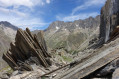
Be sure to take a look at the slate quarries you’ll come across before reaching the Col de Côte Belle.

Always be cautious and plan ahead when you're outdoors. Visorando and the author of this route cannot be held responsible for any accidents occurring on this route.

The GR® and PR® markings are the intellectual property of the Fédération Française de Randonnée Pédestre.

Reviews and comments

5 / 5
Based on 1 review

Reliability of the description
Not used
Ease of following the route
5 / 5
Route interest
5 / 5
JFauche
JFauche

Overall rating : 5 / 5

Date of your route : Aug 20, 2019
Reliability of the description : Not used / Not applicable
Ease of following the route : ★★★★★ Very good
Route interest : ★★★★★ Very good

A wonderful walk

Machine-translated

Other walks in the area

For more walks, use our search engine .

The GPS track and description are the property of this route's author. Please do not copy them without permission.