Mont Pellegrin via Lesdiguières Castle

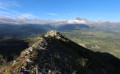
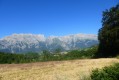
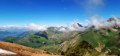
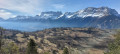
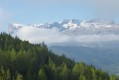
Beneath the iconic Faraut mountain and above the ruins of Lesdiguières Castle, this circular route through the Souvestre and Sapet forests takes you to Mont Pellegrin, which offers a magnificent view of the entrance to the Valgaudemar, the foothills of the Dévoluy, the Drac valley and the western part of the Écrins massif.

Details

n°53242819
Creation:
Last update:
Last review:
–
  • Walking
    Activity: Walking
  • ↔
    Distance: 6.98 mi
  • ◔
    Average duration: 5h 45 
  • ▲
    Difficulty: Moderate

  • ⚐
    Back to start: Yes
  • ↗
    Ascent: + 2,904 ft
  • ↘
    Descent: - 2,907 ft

  • ▲
    Highest point: 5,177 ft
  • ▼
    Lowest point: 2,785 ft

Description of the walk

On the N85 road from Gap to Grenoble, between La Guinguette and Chauffayer, take the D57 to reach Le Glaizil. Take Rue du Pont towards the church and then the cemetery. Park in the car park near the cemetery (Rue de la Tour).

(S/E) From the car park, take Rue de la Tour eastwards, then Rue de l’Église and finally Rue du Chapeau de l’Évêque.

(1) Cross the D57L road to Gap, and continue straight ahead along Rue le Long du Riou, heading east-north-east, towards La Condamine and Les Meilières. Pass the first hairpin bend and stay on the main track, ignoring the turnings to the left and right. Pass a second hairpin bend, then reach a junction of dirt tracks.

(2) Take the Chemin des Meilières on the left, heading north-west. Continue until you reach the D57L road at the Torrent des Amars.

(3) Turn right, heading north-west, and walk carefully along the D57L road to reach the hamlet of Lesdiguières.

(4) Continue straight on along Rue du Château, which runs alongside the ruins of Lesdiguières Castle, marked by the passage under the south gate. Then pass through the north gate.

(5) Turn left onto the Chemin de la Vialette, heading west then north-west, to reach the forest.

(6) Head uphill straight ahead, ignoring the paths to the right and left. Pass a few small hairpin bends, then cross the Torrent de Lesdiguières twice. Take the path that bends sharply to the left to join a forest track.

(7) Take the track to the left, heading south-east, leaving behind the path that climbs to the Pic de Chauvet. Walk through the Souvestre forest along its eastern flank and cross the Torrent des Amars in a ravine. Climb back up to follow the eastern flank of the Sapet des Amars as far as the Mont Fort bend.

(8) Walk down the slope to the Ravin du Glaizil, cross the stream, then climb 50 metres to reach the start of a small path on the right.

(9) Take the path on the right, heading south-west, to leave the forest track and continue through the woodland. Winding its way up in a series of hairpin bends, this path climbs nearly 300 metres in altitude before turning north-west to cross the torrent just above the Pellegrin waterfall. Continue the ascent, heading north-north-east, to reach a path junction just before a rocky outcrop.

(10) Take the path on the left, heading north-west, to go round the rocks on the left and climb via a series of gentle switchbacks. The path then turns north-east to climb the rocky spur. Reach the summit of Mont Pellegrin and the Rocher Ferrand hut.

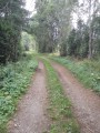
(11) Turn back, pass the waterfall, and descend the numerous hairpin bends to rejoin a forest track at the junction you passed on the way up.

(9) Turn right onto the track, heading south, to cross the Ruisseau du Glaizil and walk up the hillside to a junction with two paths.

(12) Head down to the left, heading north, to cross the Ruisseau du Glaizil once more, then join Rue de la Tour and follow it to the village. Pass under the ruined tower, then walk alongside the cemetery to reach the car park (S/E).

Waypoints

  1. S/E : mi 0 - alt. 3,110 ft - Car park at the Glaizil cemetery
  2. 1 : mi 0.15 - alt. 3,038 ft - Junction of Rue du Chapeau de l’Évêque and the D57L
  3. 2 : mi 0.76 - alt. 2,785 ft - Junction with the Chemin des Meilières - Drac (rivière) - Drac Noir-Drac
  4. 3 : mi 1.38 - alt. 2,894 ft - Junction with the D57L at the Torrent des Amars
  5. 4 : mi 1.58 - alt. 2,854 ft - Rue du Château - Château de Lesdiguières
  6. 5 : mi 1.73 - alt. 2,867 ft - North Gate - Château de Lesdiguières
  7. 6 : mi 1.82 - alt. 2,936 ft - Trail junction (elevation 897)
  8. 7 : mi 2.62 - alt. 4,045 ft - Bois d’Orcier crossroads
  9. 8 : mi 3.76 - alt. 3,812 ft - Mont Fort bend (elevation 1161)
  10. 9 : mi 4.08 - alt. 3,688 ft - Start of the Pellegrin Waterfall trail
  11. 10 : mi 4.85 - alt. 4,783 ft - Trail junction at the foot of Mont Pellegrin
  12. 11 : mi 5.16 - alt. 5,138 ft - Mont Pellegrin
  13. 12 : mi 6.54 - alt. 3,527 ft - Junction of a forest track with two footpaths
  14. S/E : mi 6.98 - alt. 3,107 ft - Car park at the Glaizil cemetery

Notes

Please note: the final section leading up to Mont Pellegrin follows a rocky outcrop. The path remains passable but requires care, particularly in wet conditions.

It is possible to shorten the route by 30 minutes by taking the D57L road between points (1) and (3), rather than via Les Meillières (2).

There are fountains (water quality not checked) in the old streets of the hamlet of Lesdiguières (5), particularly on Rue du Château and at the junction of Impasse de Martinou and Route du Motty. There is another fountain at Les Amars (3).

A small table near the ruins of Lesdiguières Castle (5) provides a pleasant spot for a picnic break.

There are no notable shelters along the route apart from the Cabane de Rocher Ferrand, situated at the summit of Mont Pellegrin (11).

Shops, restaurants and accommodation can be found in Saint-Firmin, Chauffayer and Saint-Bonnet-en-Champsaur.

Worth a visit

(S/E) Le Glaizil: its name is thought to derive from the Occitan word ‘gleisa’ (‘church’) and the suffix ‘-il’: ‘little church’. The village is first mentioned in the 8th century in Abbon’s will under the name Galiscum, and was also known as Eglesia, linked to the presence of the Cluniac Order. The Romanesque tower visible today was the bell tower of the former 12th-century Romanesque church, built by the Cluniac Order. It also served as a watchtower overlooking the valley. The church burnt down in the 19th century, and the tower was demolished in 1960 as it was in danger of collapsing; only the base remains today. The Church of Saints James and Ambrose was rebuilt in 1850 following the fire that destroyed the original church.

(5) Ruins of Lesdiguières Castle: this castle was built by François de Bonne, Duke of Lesdiguières, from 1571 onwards, whilst he was still at the very beginning of his long military career (he died aged 83). At the time, he was one of the leading Protestant leaders in the Dauphiné, embroiled in the Protestant–Catholic disputes and at the heart of the region’s internal strife. This château was, in a sense, his first acquisition, built on the site of a family fortified house. It was ravaged in 1692 by the troops of the Duke of Savoy. It is worth noting that a small museum housed in the former communal bakery traces the Duke’s life. Guided tours are available (enquire at the tourist office or visit http://www.chateau-lesdiguieres.fr).

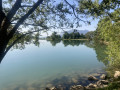
At the foot of Mont Pellegrin flows the Drac (2), the iconic torrent of the Champsaur which continues its course all the way to Grenoble. Its name comes from theOccitan word ‘drac’, meaning a dragon or a legendary water creature . Once feared for its devastating floods , its sparkling course winds its way through the fertile woodlands of the Champsaur.

To the east, the Écrins Massif closes off the horizon with its high peaks. However, a wide opening allows access to the Valgaudemar Valley, often nicknamed the ‘little Himalayas’ due to its steep and spectacular terrain . It is dominated by several peaks over3,000 metres , such as the Olan, the Sirac and the Pic des Souffles. The name Valgaudemar is thought to derive from ‘Vallis Gaudemarii’, meaning ‘Valley of Gaudemar’, in reference to a local lord mentioned in the Middle Ages.

Other walks in the area

For more walks, use our search engine .

The GPS track and description are the property of this route's author. Please do not copy them without permission.