Chalp Valley

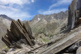
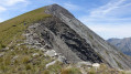
Ascent through the wild and unspoilt Chalp valley. With a bit of luck, you’ll spot plenty of marmots and chamois.
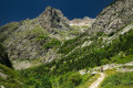
The climb is quite steep. It begins in the forest, then cuts across beneath the rocky ridges of the valley, which the path crosses on the left (as you ascend).

Details

12386572
Creation:
Last update:
Last review:
  • Walking
    Activity: Walking
  • ↔
    Distance: 4.01 mi
  • ◔
    Average duration: 4h 50 
  • ▲
    Difficulty: Difficult

  • ⚐
    Back to start: Yes
  • ↗
    Ascent: + 3,465 ft
  • ↘
    Descent: - 3,465 ft

  • ▲
    Highest point: 6,788 ft
  • ▼
    Lowest point: 3,369 ft

Photos

Description of the walk

Park near the village fountain.

(S/E) With your back to the D117, Route de Prés-Clos, walk up the street that runs between the chapel and the fountain.
At the junction, turn right and follow the road up to the houses at the top of the village. The path starts just to the left of the house on the far left. A sign reads: 3.2 km, 3 hours 20 mins, Vallon de la Chalp.
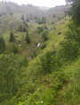
Follow the fairly steep path up a north-facing slope until you reach the banks of the Ruisseau des Roberts, where there is a sign for the Roberts Waterfall (15 mins).

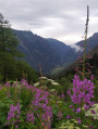
(1) Continue along the path which leads into a wood. Beautiful views over the valley and its villages.

(2) The path turns north, then continues north-east. It is not signposted, but is clearly visible. There are a few sections through fairly dense vegetation (grass, stinging nettles, etc.). On emerging from the forest, you’ll see the valley above you.

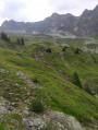
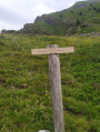
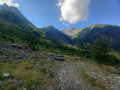
(3) Carry on and cross the stream. The path crosses the rocky ridge on the left. It is less clearly marked, but there are a few cairns. You will reach the sign: Vallon de la Chalp 2020.

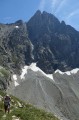
(4) You can head up into the valley beneath the Pics de Valsenestre and the Pics de la Chalp (off the path).

The return journey, downhill, follows the same route in the opposite direction, back to the village fountain (S/E).

Waypoints

  1. S/E : mi 0 - alt. 3,369 ft - The Chalp fountain and chapel, near the - Bonne (rivière)
  2. 1 : mi 0.39 - alt. 3,812 ft - Fork in the path at the waterfall
  3. 2 : mi 0.88 - alt. 4,875 ft - Change of direction and view over the valley
  4. 3 : mi 1.38 - alt. 5,669 ft - Exit from the forest
  5. 4 : mi 1.91 - alt. 6,604 ft - Lower Chalp Valley
  6. S/E : mi 4.01 - alt. 3,369 ft - The Chalp fountain and chapel

Notes

Worth a visit

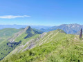
Beautiful views over the valley, then over the neighbouring peaks.
Chamois and marmots (though sightings are not guaranteed).

Reviews and comments

3.7 / 5
Based on 1 review

Reliability of the description
4 / 5
Ease of following the route
3 / 5
Route interest
4 / 5
Gilles Salanou
Gilles Salanou

Overall rating : 3.7 / 5

Date of your route : Oct 09, 2023
Reliability of the description : ★★★★☆ Good
Ease of following the route : ★★★☆☆ Average
Route interest : ★★★★☆ Good
Very busy route : No

A walk that starts at the top of the village and requires a good level of fitness (a 3-hour climb) to reach the Vallon de la Chalp – a very wild valley offering magnificent views of the surrounding peaks, with a lovely little spot to stop for a snack whilst the sun was still out in the early afternoon at the end of September.

Machine-translated

Other walks in the area

For more walks, use our search engine .

The GPS track and description are the property of this route's author. Please do not copy them without permission.