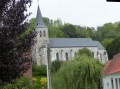
Refine your search for walks in Azincourt
Azincourt walks


 Henry V Trail in Azincourt
 Visorando Member
 7.48 mi
 +167 ft
 -177 ft
 3h 35
3h 35
 Moderate
 Departure from Azincourt (Pas-de-Calais)
A beautiful hike along the Henry V trail around the plain where the Battle of Agincourt took place in 1415.
The Ternoise hills, from Blangy-sur-Ternoise to Rollancourt
7.64 mi
+548 ft
-551 ft
4h 00
Moderate
Departure from Blangy-sur-Ternoise (Pas-de-Calais)
A circular loop on the good paths surrounding Blangy-sur-Ternoise.
The Chevrette Trail in Fressin
6.31 mi
+443 ft
-430 ft
3h 15
Moderate
Departure from Fressin (Pas-de-Calais)
A short walk around Fressin with a few climbs through lovely scenery. Head up through the Fressin woods, cross the Planquette, and walk across the plateau where you can take some lovely photos of Fressin Castle, which you’ll get a closer look at on the way back.
Well-marked yellow trail. Some might say there’s no point in describing marked trails, but for me it’s important to share them with the community.
From La Planquette to Bois de Fressin
 13.20 mi
+958 ft
-942 ft
6h 55
13.20 mi
+958 ft
-942 ft
6h 55
 Difficult
Departure from Fressin (Pas-de-Calais)
Difficult
Departure from Fressin (Pas-de-Calais)
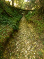
A succession of small roads and paths for a day in the great outdoors.The icing on the cake: a good elevation gain with a superb climb in the Bois de Fressin.
For very experienced hikers, I highly recommend the alternative route described in the practical information section.
The slopes of the Ternoise near Auchy
 10.43 mi
+669 ft
-650 ft
5h 25
Moderate
Departure from Rollancourt (Pas-de-Calais)
10.43 mi
+669 ft
-650 ft
5h 25
Moderate
Departure from Rollancourt (Pas-de-Calais)
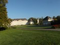
A fairly long but not overly difficult hike offering beautiful views over the Ternoise valley.
May 2025: The Montigny trail (3) has been thoroughly cleared, something that hasn’t happened for ages! It is currently perfectly passable.
The hedgerows
10.90 mi
+374 ft
-354 ft
5h 20
Moderate
Departure from Teneur (Pas-de-Calais)
The old marked trail around Ambricourt is unfortunately poorly maintained or not maintained at all. We have been walking it for 25 years and have encountered difficulties every time (poor signage, paths buried under nettles or difficult to walk on).The start at Teneur allows you to pass (twice) in front of the superb limestone hillside of Teneur. Deer are often visible in or around the Bois de Crépy
The path is in very poor condition between points (2) and (6).
If possible, avoid the period between mid-June and mid-August. The passage after point (3) will be easier if the field is not too far into the growing season or has already been harvested.
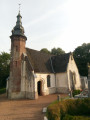
Les coteaux de la Créquoise
 10.53 mi
+709 ft
-719 ft
5h 30
Moderate
Departure from Créquy (Pas-de-Calais)
10.53 mi
+709 ft
-719 ft
5h 30
Moderate
Departure from Créquy (Pas-de-Calais)
Another option, slightly shorter but still quite challenging, offers views of the Créquoise valley.
The route through the Bois de Créquy is the same as on the other walk: ‘The Bois de Créquy’, but the return journey takes you down the other side, offering a lovely view of the valley.
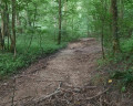
The Créquy Woods
 13.09 mi
+745 ft
-732 ft
6h 40
Difficult
Departure from Créquy (Pas-de-Calais)
13.09 mi
+745 ft
-732 ft
6h 40
Difficult
Departure from Créquy (Pas-de-Calais)
A long route with virtually no roads, making use of three short-distance hiking trails: the Maury, the Têtards and the Fréniaux.It’s best to go during a dry spell, as the paths can be quite poor in wet weather.Three-quarters of the walk takes place on the edge of or within the woods.
The humpback bridge at the start of Équirre
6.95 mi
+256 ft
-256 ft
3h 25
Moderate
Departure from Équirre (Pas-de-Calais)
Starting from Équirre Castle, which was reduced by half following a fire, this walk takes you to the small village of Prédefin and back via the Lisbourg plain. The paths taken by the GRP® Tour du Ternois Nord are partly cultivated between points (8) and (9), but don't hesitate to cross them as they are often used by farmers.
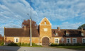
The upper Lys valley
 13.55 mi
+673 ft
-666 ft
6h 50
Difficult
Departure from Lisbourg (Pas-de-Calais)
13.55 mi
+673 ft
-666 ft
6h 50
Difficult
Departure from Lisbourg (Pas-de-Calais)
The source of the Lys, the Lugy Mill and a lovely route across the plateau (beautiful views).This walk can be more difficult in wet weather as some paths are regularly churned up.Some tarmac, but on minor roads.
Please note: the path leading up through the Lugy woods after the (5) can be very difficult in wet weather.
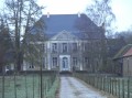
Circular North loop of Bergueneuse
 10.64 mi
+584 ft
-571 ft
5h 25
Moderate
Departure from Bergueneuse (Pas-de-Calais)
10.64 mi
+584 ft
-571 ft
5h 25
Moderate
Departure from Bergueneuse (Pas-de-Calais)
A beautiful circular route north of Bergueneuse with pretty paths and good climbs. Get your calves ready and let's go!
Please note that in wet weather, some paths become difficult (between (1) and (2), between (5) and (6) in particular), which significantly increases the journey time.
The southern circular route from Bergueneuse
 8.80 mi
+554 ft
-571 ft
4h 30
Moderate
Departure from Bergueneuse (Pas-de-Calais)
8.80 mi
+554 ft
-571 ft
4h 30
Moderate
Departure from Bergueneuse (Pas-de-Calais)
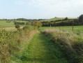
A trail exploring the Ternois region, with paths that are generally in good condition and offering lovely views.
Route amended in April 2023, as the newGRP® route is really rather dull!
The Bliot Trail in Anvin
5.66 mi
+338 ft
-338 ft
2h 55
 Easy
Departure from Anvin (Pas-de-Calais)
Easy
Departure from Anvin (Pas-de-Calais)
A short hike in the Ternois region starting from Anvin. A short climb will take you up to Mont d'Heuchin.
Descend to Bergueneuse and return through the countryside to the starting point.
Beautiful views throughout the walk and some great photo opportunities.
Mont de Fleury
7.88 mi
+361 ft
-338 ft
3h 55
Moderate
Departure from Anvin (Pas-de-Calais)
A pleasant short hike on good paths. Beautiful views of the Ternois.
Hike modified in April 2023 because theGRP® route has changed.
The Maronnes Hills
7.35 mi
+361 ft
-348 ft
3h 40
Moderate
Departure from Humières (Pas-de-Calais)
A lovely hike in the Ternois region starting from the charming village of Humières with its castle and cave.
You’ll be walking mainly on paths and trails that can get muddy in wet weather, but the scenery quickly makes you forget that.
The Ravin de l’Étoile
12.22 mi
+735 ft
-741 ft
6h 15
Difficult
Departure from Monchy-Cayeux (Pas-de-Calais)
We continue our exploration of the Ternois region, culminating in the superb Ravin de l’Étoile.
On the ridges around Bergueneuse
 15.06 mi
+801 ft
-784 ft
7h 35
Difficult
Departure from Fontaine-lès-Boulans (Pas-de-Calais)
15.06 mi
+801 ft
-784 ft
7h 35
Difficult
Departure from Fontaine-lès-Boulans (Pas-de-Calais)
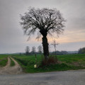
More than 22 km of trails for a nature trail with some nice climbs and descents. Sharpen your calves!Beautiful views, woods and, if you're lucky, a few wild animals. At least, the ones that the hunters don't slaughter, as we recently freed two roe deer caught in snares (fox traps, but any animal can get caught there, and it's legal!).
Where Justice can lead to Hell
 11.27 mi
+686 ft
-692 ft
5h 45
Moderate
Departure from Eps (Pas-de-Calais)
11.27 mi
+686 ft
-692 ft
5h 45
Moderate
Departure from Eps (Pas-de-Calais)
Another lovely route in the Ternois hills. Few roads and, in good weather, beautiful panoramic views.If you're lucky, you may also spot some deer (a herd of six at the end of February 2019).
Eps and Herbeval mountains
 6.36 mi
+548 ft
-545 ft
3h 25
Moderate
Departure from Eps (Pas-de-Calais)
6.36 mi
+548 ft
-545 ft
3h 25
Moderate
Departure from Eps (Pas-de-Calais)
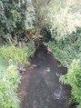
A short but very hilly route (carto-explorer even gives 230m elevation gain) around the village of Eps, unjustly excluded by the marked trails. Beautiful views.Best done on a sunny day - it's magical!
From Turkey to Fond Breton (in less than 10 km!)
5.80 mi
+358 ft
-354 ft
3h 00
Moderate
Departure from Renty (Pas-de-Calais)
A short but fairly strenuous route with a steep hill and some very grassy paths.
On 12/08/2025: the start of the trail is once again very overgrown (brambles and nettles). It's passable but it's best to wear trousers or good gaiters and, of course, bring a walking stick or even a pair of secateurs.
On the plateau between the Lys and the Aa
 15.76 mi
+912 ft
-922 ft
8h 00
Difficult
Departure from Dennebrœucq (Pas-de-Calais)
15.76 mi
+912 ft
-922 ft
8h 00
Difficult
Departure from Dennebrœucq (Pas-de-Calais)
A long route with a significant elevation gain on paths that are generally in very good condition.
From Reclinghem to Mont d'Erny
11.08 mi
+814 ft
-797 ft
5h 50
Difficult
Departure from Reclinghem (Pas-de-Calais)
Three lovely climbs and a long stroll across the plateau make for a walk surrounded by nature. A very hilly first section, followed by a long stretch along the heights before descending to Reclinghem with magnificent views. The icing on the cake is an optional circular loop I suggest, which brings the total elevation gain to over 300 m.
Bois Robert in Œuf-en-Ternois
 5.06 mi
+246 ft
-276 ft
2h 30
Easy
Departure from Œuf-en-Ternois (Pas-de-Calais)
5.06 mi
+246 ft
-276 ft
2h 30
Easy
Departure from Œuf-en-Ternois (Pas-de-Calais)
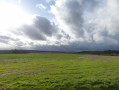
A short walk around and through a village in the Ternois region called Oeuf-en-Ternois. The walk through the village is interesting and the paths are very pleasant. At the Bois Robert crossroads, you may, like me, encounter a few deer.
Route des sources de Bomy
7.13 mi
+423 ft
-436 ft
3h 40
Moderate
Departure from Bomy (Pas-de-Calais)
A route that allows you to discover Bomy’s heritage: the Rotonde des Tilleuls, the castle, Saint-Vaast Church, the restored vicarage, the mill, as well as the source of the Laquette, the Sainte-Frévisse Fountain and its oratory (picnic spots).
This route is signposted in red, starting from the Rotonde des Tilleuls on the village square.
Around Bomy
 3.48 mi
+102 ft
-112 ft
1h 40
Easy
Departure from Bomy (Pas-de-Calais)
3.48 mi
+102 ft
-112 ft
1h 40
Easy
Departure from Bomy (Pas-de-Calais)
A short walk in the Artois region, particularly pleasant in autumn.
An uphill battle
 15.98 mi
+1,371 ft
-1,365 ft
8h 35
Difficult
Departure from Fauquembergues (Pas-de-Calais)
15.98 mi
+1,371 ft
-1,365 ft
8h 35
Difficult
Departure from Fauquembergues (Pas-de-Calais)
It's a route that will delight altitude enthusiasts (Carto exploreur and the Visorando app suggest it's as high as 500m). What's more, the views are stunning.
Route slightly modified in November 2019.
All trails are very good as of May 14, 2020 (even if some are very grassy).
Le Puits sans Fond stream
 7.28 mi
+361 ft
-354 ft
3h 40
Moderate
Departure from Fléchin (Pas-de-Calais)
7.28 mi
+361 ft
-354 ft
3h 40
Moderate
Departure from Fléchin (Pas-de-Calais)
A short walk that takes you up to the ridge before descending and going along the Puits sans Fond stream. More pleasant in dry weather, as some paths can be very wet.
Le Champ de l'Épine
11.83 mi
+732 ft
-725 ft
6h 05
Difficult
Departure from Fillièvres (Pas-de-Calais)
This route was inspired by the "Contour des bois" trail suggested by the 7 Vallées Tourist Office. I removed a few tarmac sections and added a few paths. Get ready for a day in the great outdoors.
Hills and valleys in Coyecques
9.64 mi
+991 ft
-991 ft
5h 20
Moderate
Departure from Coyecques (Pas-de-Calais)
From the Lys Valley to Noir Mont and discovery of the hidden valley of Maisnil.
The route is almost entirely off-road, either on good grassy paths or vaguely paved paths.
Do not look for markings, as there are none.