Route des sources de Bomy

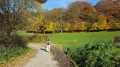
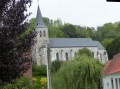
A route that allows you to discover Bomy’s heritage: the Rotonde des Tilleuls, the castle, Saint-Vaast Church, the restored vicarage, the mill, as well as the source of the Laquette, the Sainte-Frévisse Fountain and its oratory (picnic spots).
This route is signposted in red, starting from the Rotonde des Tilleuls on the village square.

Details

43457217
Creation:
Last update:
Last review:
  • Walking
    Activity: Walking
  • ↔
    Distance: 7.13 mi
  • ◔
    Average duration: 3h 40 
  • ▲
    Difficulty: Moderate

  • ⚐
    Back to start: Yes
  • ↗
    Ascent: + 423 ft
  • ↘
    Descent: - 436 ft

  • ▲
    Highest point: 584 ft
  • ▼
    Lowest point: 312 ft
  • ⚐ Country: France
  • ⚐ City: Bomy (62960)
  • ⚑
    Start/End: N 50.574256° / E 2.235291°
  • ❏
    IGN map(s): Ref. 2305O
  • Hour-by-hour weather

Description of the walk

The starting point is at Place de la Mairie. A map of the route is available on the Place de Bomy. The route is signposted in red. Parking is easy.

(S/E) From Place de la Mairie, walk past the chancel of the church and join the Grand Rue (D130).

(1) Follow it as it turns left. You’ll reach Rue du Moulin.

(2) Turn left onto this street, pass La Laquette and the mill, walk alongside a pond on your left and reach the bend in the street.

(3) Leave the street and turn onto an uphill path which joins another street.

(4) Turn left and follow this street to the next junction. Turn right onto Chemin de Rupigny, which runs alongside a stream, pass the hamlet of Rupigny and continue straight on until you reach a grassy path on the left.

(5) Take this path and it will lead onto a stony track, signposted GR®127.

(6) Take the path on the right and head uphill to a junction.

(7) At a bush, turn left onto the tarmac road and, 500 m further on, turn left again. The road leads to the hamlet of Grœuppe.

(8) Take the D130 to the right, as far as the square in Grœuppe.

(9) The source of the Laquette is at the bottom of the square, below the picnic tables. After seeing the source, continue along the D130 to the bend at the end of the hamlet.

(10) At the bend in the road, take the path on the left, between the last two houses in the hamlet, and walk up to the top of the woodland.

(11) At the top of the woodland, follow the dirt track on the left. The track runs alongside the woodland, then descends to the Laquette, which you cross via a footbridge. Join the D130.

(12) Follow it to the right until you reach the first road on the right

(13) Go down the road to the right, then take Rue des Marais on the right, until you reach the Sainte-Frévisse spring (picnic area).

(14) Turn round and head up the first path on the right. At the top of the woods, go down the tarmac road, turning left, until you reach the bakery.

(15) Head up to the right towards the wayside cross and turn left onto the path through the woods overlooking the houses.

(16) At the end of the path, head back down to the left, towards the village.

(1) Head left towards the castle and its avenue, following it to the end.

(17) Take the road on the right, with the town hall in sight, and you’ll arrive on the right at the Place de la Mairie (S/E).

Waypoints

  1. S/E : mi 0 - alt. 335 ft - Place de la Mairie
  2. 1 : mi 0.19 - alt. 318 ft - Crossroads at the end of the circular loop
  3. 2 : mi 0.34 - alt. 312 ft - Junction with Rue du Moulin - Laquette (rivière)
  4. 3 : mi 0.44 - alt. 315 ft - Junction on the path
  5. 4 : mi 0.61 - alt. 341 ft - Junction with Rue
  6. 5 : mi 1.59 - alt. 374 ft - Fork in the grassy path
  7. 6 : mi 1.89 - alt. 440 ft - Gr127
  8. 7 : mi 2.42 - alt. 528 ft - Junction on a tarmac road
  9. 8 : mi 3.37 - alt. 384 ft - The hamlet of Groeuppe
  10. 9 : mi 3.64 - alt. 397 ft - Source: A-R - Laquette (rivière)
  11. 10 : mi 3.82 - alt. 410 ft - Path on the left at the bend
  12. 11 : mi 4.11 - alt. 584 ft - Top of the woods
  13. 12 : mi 5.14 - alt. 387 ft - D130 on the right
  14. 13 : mi 5.36 - alt. 384 ft - Crossroads
  15. 14 : mi 5.77 - alt. 351 ft - Fontaine Sainte-Frévisse (Bomy)
  16. 15 : mi 6.56 - alt. 331 ft - Bakery
  17. 16 : mi 6.76 - alt. 387 ft - At the fork, turn left towards the village
  18. 17 : mi 7.02 - alt. 322 ft - Opposite the castle
  19. S/E : mi 7.13 - alt. 335 ft - Place de la Mairie

Always be cautious and plan ahead when you're outdoors. Visorando and the author of this route cannot be held responsible for any accidents occurring on this route.

The GR® and PR® markings are the intellectual property of the Fédération Française de Randonnée Pédestre.

Reviews and comments

4.4 / 5
Based on 3 reviews

Reliability of the description
4.7 / 5
Ease of following the route
4.3 / 5
Route interest
4.3 / 5
Ginoutaktou
Ginoutaktou
• Edited:

Overall rating : 4.7 / 5

Date of your route : Oct 25, 2024
Reliability of the description : ★★★★★ Very good
Ease of following the route : ★★★★☆ Good
Route interest : ★★★★★ Very good
Very busy route : No

A lovely walk combining exploration, nature and the great outdoors; the only slight downside is the lack of signposting along the way, but you can still find your way with the guide
Best done in dry weather, as the ground can be very slippery on some of the uphill sections, even with suitable footwear.

Machine-translated

Stansalome
Stansalome

Overall rating : 4.7 / 5

Date of your route : Jul 25, 2024
Reliability of the description : ★★★★★ Very good
Ease of following the route : ★★★★★ Very good
Route interest : ★★★★☆ Good
Very busy route : No

A route offering varied scenery, very well signposted.

Machine-translated

minouchon62
minouchon62

Overall rating : 4 / 5

Date of your route : Jun 24, 2024
Reliability of the description : ★★★★☆ Good
Ease of following the route : ★★★★☆ Good
Route interest : ★★★★☆ Good
Very busy route : No

A lovely trail through the hills, woods and along streams. Part of the route through the woods was made difficult by the rain, which made the steep section very slippery.

Machine-translated

Other walks in the area

For more walks, use our search engine .

The GPS track and description are the property of this route's author. Please do not copy them without permission.