Renty Wood

This route, with very little tarmac, follows the Charles Quint trail, to which a short circular loop through unspoilt countryside with lovely views has been added.

Details

3810520
Creation:
Last update:
Last review:
  • Walking
    Activity: Walking
  • ↔
    Distance: 10.46 mi
  • ◔
    Average duration: 5h 15 
  • ▲
    Difficulty: Moderate

  • ⚐
    Back to start: Yes
  • ↗
    Ascent: + 492 ft
  • ↘
    Descent: - 479 ft

  • ▲
    Highest point: 571 ft
  • ▼
    Lowest point: 272 ft
  • ⚐ Country: France
  • ⚐ City: Renty (62560)
  • ⚑
    Start/End: N 50.582572° / E 2.072552°
  • ❏
    IGN map(s): Ref. 2204E, 2205E
  • Hour-by-hour weather

Description of the walk

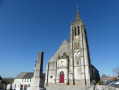
Park in Place de Renty near the town hall and the church.

(S/E) Head towards the church and follow Rue de l’Église to the left. Continue to the three-way junction.

(1) Carry on straight ahead along Rue du Moulin, then turn right into thefirst street. At the end of the street, continue along the footpath. You’ll reach Rue de Vallencheux; turn left onto it. Then ignore a turn-off to the left, followed by three turn-offs to the right, until you reach the Château, a beautiful building on your right.

(2) Carry on in the same direction, ignoring a turn-off to the left, until you find a good path.
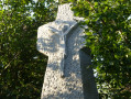
Walk past a distinctive wayside cross and follow the path as it climbs gently to reach the water tower. Just after this, you’ll come to a junction.

(3) Turn right until you reach a T-junction. Turn right again, ignore a hairpin bend on the right and reach another T-junction, under the power line.

(4) Take the hairpin bend to the right, cross the Bois de Saint-Laurent and reach a path that takes a hairpin bend to the left.

(5) Take this track and, from this point, follow the Charles Quint route (a possible alternative route is detailed in the ‘Practical Information’ section).
Head up the Fond Feuillet, then take a right-hand bend to reach the edge of the Bois de Renty.

(6) Follow the edge of the wood on the left as you head up the Vallée Madame. Shortly before the D132, you’ll reach the western tip of the wood.

(7) Continue to the D132 (see the ‘Practical Information’ section) and follow it carefully for several hundred metres. Do not miss the path that branches off to the right between the fields and leads back to the edge of the woods. Follow it to the left and, on leaving the woods, you’ll come to a crossroads.

(8) Take the path straight ahead running alongside the fields; be careful here, as there are many ruts. You’ll reach a T-junction.

(9) Head off to the right towards the Camping de la Tentation. Turn right, then left, and continue to the far end of the campsite.

(10) Take the path on the left and walk through the woods to reach a small road offering a lovely view of the valley.

(11) Follow it straight ahead, continuing downhill, until you reach the D 129. Take this road to the right with care and you’ll come to a business.

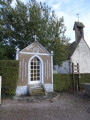
(12) Then leave the D 129 and take the path leading off to the right. Pass the first junction, where there is a wayside cross, and continue to thesecond.
Turn left onto Rue de l’Église and return to the original junction.

(1) Turn left and follow the same route as on the way there for a few metres to return to the junction at Place de Renty (S/E).

Waypoints

  1. S/E : mi 0 - alt. 272 ft - Renty la Place - Aa (fleuve)
  2. 1 : mi 0.09 - alt. 285 ft - Crossroads of the circular loop
  3. 2 : mi 0.77 - alt. 302 ft - Castle
  4. 3 : mi 2.24 - alt. 456 ft - Junction after the water tower
  5. 4 : mi 3.32 - alt. 476 ft - Under the power line
  6. 5 : mi 4.45 - alt. 335 ft - Hairpin bend on the left
  7. 6 : mi 5.03 - alt. 394 ft - Opposite the Bois de Renty
  8. 7 : mi 6 - alt. 525 ft - Western edge
  9. 8 : mi 7.09 - alt. 564 ft - Exit from the woods
  10. 9 : mi 7.5 - alt. 502 ft - T-junction
  11. 10 : mi 7.83 - alt. 558 ft - End of the campsite
  12. 11 : mi 8.94 - alt. 318 ft - Junction with a small road
  13. 12 : mi 9.45 - alt. 282 ft - The challenge: leaving the D 129
  14. S/E : mi 10.46 - alt. 272 ft - Renty la Place - Aa (fleuve)

Notes

Good walking shoes and walking stick(s) seem essential to me.
(7) You can either stay at the edge of the woodland,
- either along the edge of the fields (outside the growing season),
- or slightly inside the woods, where there’s a lovely path along the edge. The trickiest bit is then crossing back over to rejoin the path.
Between (1) and (2) Obvious shortcut: You can easily reach (5) by turning right before (2) to bring the walk back down to 11 km.

Worth a visit

Castle and wayside cross at Renty (on the route).
Renty Mill (nearby).

Reviews and comments

4.7 / 5
Based on 2 reviews

Reliability of the description
5 / 5
Ease of following the route
4.5 / 5
Route interest
4.5 / 5
joorange
joorange

Was the Calvary visible this time?

Machine-translated

MAMIEJO
MAMIEJO

Overall rating : 4.7 / 5

Date of your route : Jul 17, 2025
Reliability of the description : ★★★★★ Very good
Ease of following the route : ★★★★☆ Good
Route interest : ★★★★★ Very good
Very busy route : No

I thoroughly enjoyed doing this hike again with friends who really liked the varied route with its beautiful contrasting colours (green forest and yellow wheat fields)
At number 7, this time I entered the edge of the forest to avoid the main road. It is indeed more pleasant than the main road.

Machine-translated

joorange
joorange

The first wayside cross was still there in the spring.
But it must be somewhat hidden by the vegetation.
Unless a burly hiker has taken it off and put it in their rucksack!

Machine-translated

MAMIEJO
MAMIEJO

Overall rating : 4.7 / 5

Date of your route : Jul 21, 2023
Reliability of the description : ★★★★★ Very good
Ease of following the route : ★★★★★ Very good
Route interest : ★★★★☆ Good
Very busy route : No

A lovely walk alternating between woodland and countryside. I didn’t see the wayside crosses – have they been removed???
It’s a shame there isn’t a place to stop for a picnic.

Machine-translated

Other walks in the area

For more walks, use our search engine .

The GPS track and description are the property of this route's author. Please do not copy them without permission.