In the footsteps of Charles V, starting from Vieil-Hesdin

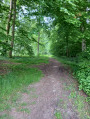
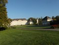
Following in the footsteps of Charles V (1500–1558) from Vieil-Hesdin, you’ll pass an old convent and cross the River Canche. The path will take you up to the heights of Le Quesnoy-en-Artois, and the return journey is all downhill via the Chemin des Morts. You’ll be treated to some lovely views of the Hesdin Forest, and if, like me, you’re lucky, you might spot a few roe deer.

Details

6534742
Creation:
Last update:
Last review:
  • Walking
    Activity: Walking
  • ↔
    Distance: 8.05 mi
  • ◔
    Average duration: 4h 05 
  • ▲
    Difficulty: Moderate

  • ⚐
    Back to start: Yes
  • ↗
    Ascent: + 404 ft
  • ↘
    Descent: - 377 ft

  • ▲
    Highest point: 433 ft
  • ▼
    Lowest point: 112 ft

Description of the walk

Park in the church car park.

(S/E) Leave the car park via Rue de la Prison, heading west.

(1) At the former convent, turn left. About a hundred metres further on, turn right into Rue de Paternité. At the end of the street, take the path on the left.

(2) Cross the Canche via the Pont Saint-Martin. At the first junction, turn right onto Rue du Voyeux. When the street bends to the left, follow the path opposite. At the end, turn left. Join the main road and follow it to the right.

(3) After 50 m, turn onto the grassy path on the left between houses nos. 1 and 3 and, at the end of the path, turn right onto Rue Verte. At the next junction, cross over and continue straight ahead along Rue Verte, leaving Rue du Bois on your right.

(4) At the crossroads, turn left onto the road between two embankments, heading south, and follow this road – which turns into a track – for about 4 km until you reach the junction with the D124.

(5) At the wayside cross, cross the road with care and continue straight ahead along the Chemin de Dompierre.

(6) At the first crossroads near Brailly, turn left onto Rue de Brailly (D122E1) and, at the next junction, turn left into Le Quesnoy-en-Artois. At the next crossroads (school), turn right.

(7) Ride past the school and turn left onto Rue Saint-Georges. At the next junction, turn right onto Rue d’Auxi. At the Fork in the road, turn left and follow the D122.

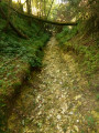
(8) At the cemetery, take the path on the left. Follow this path (Chemin des Morts) for about 4 km, heading north-east then north-north-east.

(9) At the end, turn right onto Rue de Beaumont. At the next junction, turn left.

(10) At the junction immediately ahead, cross the D340 carefully and follow it to the left for a few dozen metres. Then turn right onto Rue de la Mairie. Pass the town hall and cross the Canche. Cross Rue Sainte-Colette on the left-hand side and you’ll soon reach the church (S/E).

Waypoints

  1. S/E : mi 0 - alt. 118 ft - Car park - Église Sainte-Marie-Madeleine (Vieil-Hesdin)
  2. 1 : mi 0.14 - alt. 115 ft - Former Convent
  3. 2 : mi 0.37 - alt. 112 ft - Pont Saint-Martin - Canche (fleuve)
  4. 3 : mi 0.7 - alt. 128 ft - Crossroads: main road, path on the left
  5. 4 : mi 1.05 - alt. 125 ft - Y-junction: take the left-hand path
  6. 5 : mi 3.19 - alt. 387 ft - Junction with the D124 and the wayside cross
  7. 6 : mi 3.57 - alt. 367 ft - Y-junction
  8. 7 : mi 4.23 - alt. 417 ft - Église Saint-Vaast (Le Quesnoy-en-Artois)
  9. 8 : mi 4.97 - alt. 433 ft - Cemetery
  10. 9 : mi 7.4 - alt. 157 ft - End of the Chemin des Morts
  11. 10 : mi 7.69 - alt. 144 ft - Junction with the D340, Rue d’Hesdin
  12. S/E : mi 8.05 - alt. 118 ft - Car park - Église Sainte-Marie-Madeleine (Vieil-Hesdin)

Notes

Sturdy footwear and walking poles will come in handy.

Worth a visit

If you still have a bit of time and energy to spare, I suggest you visit the ruins of the old castles: at point (1), turn right, continue for about 600 metres and take a path on the right. I cannot guarantee that these ruins are accessible, as they are not maintained.

Reviews and comments

4.8 / 5
Based on 2 reviews

Reliability of the description
4.5 / 5
Ease of following the route
5 / 5
Route interest
5 / 5
Bouli62
Bouli62

Thank you for your very positive comment.

Machine-translated

rinder
rinder

Overall rating : 5 / 5

Date of your route : Mar 07, 2026
Reliability of the description : ★★★★★ Very good
Ease of following the route : ★★★★★ Very good
Route interest : ★★★★★ Very good
Very busy route : No

A lovely walk through pretty little villages, plateaus and woods. Varied landscapes.

Machine-translated

Tarja44
Tarja44

Overall rating : 4.7 / 5

Date of your route : Apr 18, 2021
Reliability of the description : ★★★★☆ Good
Ease of following the route : ★★★★★ Very good
Route interest : ★★★★★ Very good
Very busy route : No

A lovely walk. Enjoyable and easy to manage in any season.
We did take a bit of a shortcut at waypoint 6, as the signposted path was just too tempting.
We highly recommend this walk.

Machine-translated

Other walks in the area

For more walks, use our search engine .

The GPS track and description are the property of this route's author. Please do not copy them without permission.