Hillsides of La Laquette

A long journey around Enquin-les-Mines that will take you across the northern and southern slopes of Laquette.

Details

3829995
Creation:
Last update:
Last review:
  • Walking
    Activity: Walking
  • ↔
    Distance: 13.45 mi
  • ◔
    Average duration: 6h 55 
  • ▲
    Difficulty: Difficult

  • ⚐
    Back to start: Yes
  • ↗
    Ascent: + 810 ft
  • ↘
    Descent: - 830 ft

  • ▲
    Highest point: 558 ft
  • ▼
    Lowest point: 194 ft

Photos

Description of the walk

Church car park in Enquin-les-Mines.

(S/E) Head towards the church and find a path on your left. At the three-way junction, keep right and head up into the woods until you reach a wide track (Sentier de la Vallée). Follow it to the left until you reach a junction.

(1) Turn right and join the D77. First turn right then left to take the Chemin de Delettes. It passes between the houses and reaches a T-junction.

(2) Turn left. Ignore the first path on the right. Shortly afterwards, take the grassy path on the right, running alongside the hedge on your left. After a steep descent, you’ll reach a T-junction.

(3) Take the steeply ascending path on the right and join a wider track (with a wayside cross on the right). Follow it to the right (Chemin d’Erny) and keep heading in the same direction until you reach the D130 (the end of the track is very grassy and dotted with ruts). Cross the road to take the track opposite and you’ll immediately come to a three-way junction.

(4) Carry on straight ahead, then turn right onto the first track. You’ll reach a junction near Enguinegatte.

(5) Turn left. Ignore the road on the right and take the first track on the left to reach a three-way junction.

(6) Turn right. At the next three-way junction, turn left onto the track. At the next junction, carry on straight ahead. The track turns left at a right angle and reaches a T-junction. Turn right to quickly reach a crossroads.

(7) Turn left until you reach the D193. Follow it to the left and, at the junction, turn right onto the D130 for 200 m.

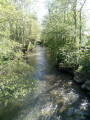
(8) Turn left onto the wide track, which very quickly turns into a lovely footpath. Walk gently downhill to reach the Laquette, which you cross via a lovely footbridge (the old one was more rustic). Continue for a few more metres.

(9) Turn left onto the first path to reach Erny-Saint-Julien. It’s a lovely path that runs alongside the Laquette, though we found it very wet a few years ago. You’ll reach a tarmac road.

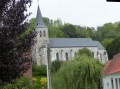
(10) Follow it to the right, pass beneath the church and take the first street on the right towards the village hall (and its mobile phone mast). After the chapel (on the right), carry on straight ahead to pass between the farm buildings. Keep going in the same direction until you reach a T-junction.

(11) Turn left and find a path on the left.

(12) See practical information 1. Ignore this and head down the road opposite to the first houses in Bomy, where you’ll find a three-way junction.

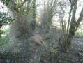
(13) Take the street on the left and, immediately after the house, don’t miss the narrow path that climbs steeply to the left. Veer to the right to quickly reach a metal gate (on the left). Continue along this very beautiful path until you reach the road. (see practical information 2)

(14) Follow it to the left. Now continue along the GR®127 for 1 km along an unpleasant tarmac stretch (see practical information 3) until you reach a junction near the cemetery.

(15) Turn right (GR®) onto the ‘Sentier des Paysages à Énergies’, which, with its attractive Blue Arrows, will take you back to Enquin. Enter the woods and stay firmly on the main path. This path is in poor condition, but a very pleasant track has formed on the right, running alongside it. Leave the woods and continue for a few more metres until you come to a path that winds sharply to the left.

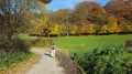
(16) Follow this path, skirting the woods, until you reach a magnificent picnic area (with a lovely view and an information board).

(17) Carry on straight ahead (leaving the GR® on your right) until you reach a T-junction. Turn left and, 200 metres further on, take the path on the right to reach the D 77.

(18) Follow it to the left, pass the farm and, at the bend, turn right onto the grassy path (it had disappeared a few years ago but the local council managed to restore it. Well done!).
Join Rue du Calvaire and follow it to the D 158 (calvary on the right).

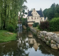
(19) Opposite, take Rue Adam, which leads down to La Laquette. Cross it, taking a moment to admire the Moulin Espagnol. Then take the steps (or the path running alongside them) to reach the church and its car park (S/E).

Waypoints

  1. S/E : mi 0 - alt. 223 ft - Enquin-les-Mines Church
  2. 1 : mi 0.3 - alt. 262 ft - Three-way junction
  3. 2 : mi 1.3 - alt. 312 ft - T-junction
  4. 3 : mi 2.06 - alt. 262 ft - T-junction near Erny
  5. 4 : mi 2.73 - alt. 292 ft - Three-way junction after the D 130
  6. 5 : mi 3.58 - alt. 289 ft - Crossroads near Enguinegatte
  7. 6 : mi 3.87 - alt. 295 ft - Three-way junction
  8. 7 : mi 5.25 - alt. 279 ft - Crossroads
  9. 8 : mi 6.1 - alt. 420 ft - Path on the left
  10. 9 : mi 6.62 - alt. 279 ft - Crossroads just after crossing Laquette
  11. 10 : mi 7.32 - alt. 249 ft - Erny-Saint-Julien
  12. 11 : mi 8.4 - alt. 328 ft - T-junction
  13. 12 : mi 8.53 - alt. 354 ft - Path on the left
  14. 13 : mi 8.96 - alt. 318 ft - A three-way junction leading to the first houses in Bomy
  15. 14 : mi 9.27 - alt. 374 ft - Junction with a small road
  16. 15 : mi 9.97 - alt. 358 ft - Cemetery
  17. 16 : mi 10.98 - alt. 531 ft - Hairpin bend after leaving the woods
  18. 17 : mi 11.68 - alt. 502 ft - Picnic spot
  19. 18 : mi 12.54 - alt. 354 ft - Junction with the D 77
  20. 19 : mi 13.21 - alt. 253 ft - Calvary
  21. S/E : mi 13.45 - alt. 223 ft - Enquin-les-Mines Church

Notes

Good walking shoes and at least one walking stick are essential.
For the alternative routes, it’s best to wear trousers.

  1. You can follow this path all the way to the road. Then follow it to the left to reach point (15).

2) Opposite, there’s a very good path with a chain. Markings on the ground encourage you to take it. Which I did, of course. It’s an excellent, straight path (I think it’s the old GR® route) that cuts through the woods to rejoin the GR®.

3) To avoid part of it, I regularly walk along the edge of the woods via the hamlet known as ‘Le Maolier’. It’s a bit muddy at times, but you eventually come across a lovely grassy track that leads back to the path to the cemetery.

And, of course, it’s an obvious shortcut to link the points (9) and (11).

Always be cautious and plan ahead when you're outdoors. Visorando and the author of this route cannot be held responsible for any accidents occurring on this route.

The GR® and PR® markings are the intellectual property of the Fédération Française de Randonnée Pédestre.

Reviews and comments

5 / 5
Based on 2 reviews

Reliability of the description
5 / 5
Ease of following the route
5 / 5
Route interest
5 / 5
joorange
joorange

J'ai toujours un sécateur dans le sac à dos et même une petite scie.
Ça évite parfois de faire demi-tour.
Quant aux bains de pieds, je viens de m'y remettre.
L'Ardèche où je suis actuellement à été tellement arrosée ce printemps que les 2 gués que j'ai dû traverser récemment étaient très hauts.
Donc passage pieds nus avec les godasses autour du cou.
En mode "Indiana Jo" en quelque sorte.
Bonne soirée

Machine-translated

BaudouinB
BaudouinB

Would you believe it, when I was writing about Laquette, I suddenly had a doubt because on the sign describing the Spanish mill in Enquin-les-Mines, the owner had written ‘Lacquette’. And a friend from Aire-sur-la-Lys told me this morning that both spellings co-existed. But after a lot of research, she found the 18th-century Cassini map, where ‘Laquette’ is indeed spelled without a ‘c’. ‘Laquette’ with a ‘c’ is therefore clearly a popular corruption. That said, if we’re at the stage of discussing such details, it’s a sign that life is truly wonderful!

As for the rest, this is a walk I’ll certainly never do in autumn or winter. Never mind the little path after point 12 (by the way, do you often go walking with a pair of secateurs in your rucksack?) Foot baths, here or elsewhere, aren’t really my thing when I’m out walking

Machine-translated

joorange
joorange

I really enjoyed reading your blog. It made me rediscover this walk, which I thought I knew by heart.

I took the opportunity to correct the Laquette: I must have been a bit out of it (from Lacq) when I wrote the guide.

It’s a route I mainly walk in autumn and winter, which reduces the risk of encountering brambles and stinging nettles. The path after point 12 can be passable (sometimes after a quick snip with secateurs). On the other hand, the lovely romantic path can turn into a foot bath!!!

The section via Le Maolier is also easier after the harvests, especially as the grassy path is cleared by the hunters.

I’m really looking forward to your next report.

Machine-translated

BaudouinB
BaudouinB
• Edited:

Overall rating : 5 / 5

Date of your route : Jun 07, 2024
Reliability of the description : ★★★★★ Very good
Ease of following the route : ★★★★★ Very good
Route interest : ★★★★★ Very good
Very busy route : No

Here’s another great suggestion. Thanks, Joorange!

A walk which, at first glance, seems to offer nothing more than the chance to spend a few hours in the fresh air and peace and quiet, a little way away from civilisation. And to enjoy some superb scenery, too.

Whilst that is certainly true, the ride also takes on another dimension thanks to the historical significance of some of the places you pass through – from great battles and famous figures of the past to the coal mining industry.

I’ll definitely be back to have a wander here!

That said, between waypoints 12 and 13, I was unable to follow the planned route. The narrow path that climbs up through the meadows is completely overgrown with brambles and undergrowth. It’s impossible to get through without protective gear or a brush cutter!

After waypoint 13, I went via Le Maolier, but I did have some qualms about cutting across the fields. I wouldn’t recommend taking this alternative route at all if you’re in a group, as you risk damaging the crops. Once past the field, you’ll find yourself in grassy terrain, but you’ll have to make your own way as the path has completely disappeared.

You can find the full account of this walk and lots of photos on my blog:
https://nomdunrandonneur.com/2024/06/07-...

Machine-translated

michel tout court
michel tout court

I walked along the edge of the woods

Machine-translated

joorange
joorange

Between 13 and 14, did you follow the road or walk along the edge of the woods?

Machine-translated

michel tout court
michel tout court

Overall rating : 5 / 5

Date of your route : Sep 06, 2020
Reliability of the description : ★★★★★ Very good
Ease of following the route : ★★★★★ Very good
Route interest : ★★★★★ Very good
Very busy route : No

Another superb walk through beautiful and varied countryside, along paths that are wide, narrow, stony, grassy and steep – making us forget the few short stretches of tarmac. A truly enjoyable route. Thank you

Machine-translated

Other walks in the area

For more walks, use our search engine .

The GPS track and description are the property of this route's author. Please do not copy them without permission.