Country:
 City:
City:


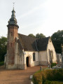
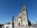
Park at Place de l’Église in Verchocq.
(S/E) With your back to the church, head left onto the D129. After about a hundred metres, leave the D129 and turn left into Rue de la Salle des Fêtes. Shortly after a junction, the tarmac gives way to grass. A little further on, you’ll return to the tarmac and reach a T-junction.
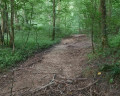
(1) Turn left onto Rue de Bas. Just after a path on the right, turn left onto a wide track. Stay on this track.
(2) Cross the River Aa, then walk through the Bois de Fasquelle. Ignore the paths to the left and right and, continuing uphill, reach a T-junction.
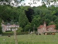
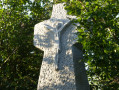
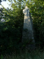
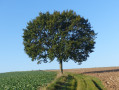
(3) Turn right, first passing a beautiful solitary oak tree, then under a power line. After a lovely descent, turn right, then left, before passing a curious wayside cross, somewhat hidden on the right-hand side of the path. Shortly afterwards, pass the Château (lodges) before coming to a path branching off to the left.
(4) Take this path and you’ll reach a T-junction. Turn left and you’ll come to a Fork in the road.
(5) Keep to the left (see § Practical information). The correct path climbs up to the Bois Chêneau, which you cross (the path is a bit muddy). At the other end, carry on in the same direction until you reach a power line.
(6) Immediately afterwards, ignore the path that winds sharply to the left and carry on straight ahead. Turn right onto the first track and pass under the power line to reach the edge of the Bois de Renty, which you’ll reach after a right-hand bend, followed by a left-hand bend.
(7) Follow the edge of the woodland on the left until you reach the D132. Cross the road and take the track opposite.
Ignore a path on the left and continue to a Fork in the road.
(8) Turn left, pass under the power line again and reach the small wood of Vieux Frescotte. On leaving the wood, you’ll reach a Fork in the road.
(9) Turn left. Ignore the path on the left (or take it – it’s a shortcut) and head to a T-junction. Turn left, heading slightly downhill. Almost at the bottom of the dip, look out for the grassy path branching off to the left.
(10) Take this grassy path and you’ll reach a T-junction. Turn right, then ignore a path on the left and another on the right, and you’ll reach a Fork in the road at the entrance to Beaussart.
(11) Turn right to head down the valley. At the bottom, the path bends to the left (you’re near the River Aa, and according to the map, it seems possible to make a round trip to get closer to it, but I haven’t tried it...). You’ll come to a few houses.
(12) Take the path on the left which climbs gently, then turns right and joins the D132.
(13) Follow it for a few metres to the right, then turn left onto the first path which goes downhill and then uphill again before veering to the left and joining a wider path.
(14) Turn left. After about 200 m, turn right towards the water tower. Ignore a path on the left and continue to a T-junction (the water tower is on the left).
(15) Turn right, then immediately left onto theGRP® du Haut Pays d’Artois. This path and theGRP® will take us back to Verchocq. Just after crossing the River Aa, you’ll reach the departmental road. Follow it to the left and you’ll arrive back at the Place de l’Église in Verchocq (S/E).


 Visorando Member
 Difficult