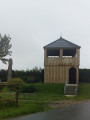
The Mont Galant trail starting from Auchy-lès-Hesdin

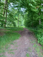
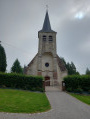
A lovely walk starting from the church in Auchy-lès-Hesdin, taking you across the Mont Galant plateau with its beautiful panoramic views. You’ll walk along the edge of the Hesdin State Forest, with a view of the Ferme du Bois-Saint-Jean, a former commandery of the Order of Hospitallers. The only challenging bit is a hill as you leave the village of Auchy.

Details

2785589
Creation:
Last update:
Last review:
  • Walking
    Activity: Walking
  • ↔
    Distance: 6.97 mi
  • ◔
    Average duration: 3h 35 
  • ▲
    Difficulty: Moderate

  • ⚐
    Back to start: Yes
  • ↗
    Ascent: + 436 ft
  • ↘
    Descent: - 440 ft

  • ▲
    Highest point: 374 ft
  • ▼
    Lowest point: 95 ft

Photos

Description of the walk

Park in the church square in Auchy-lès-Hesdin.

(S/E) Follow the road heading west-south-west; you’re on theGRP®®121ATour du Ternois Sud, marked with yellow and red signposts. Follow it for about 1.2 km. You’ll reach a junction in the Bellevue district.

(1) Turn right almost directly opposite onto the road heading north, which becomes a track as you leave the village, and follow it for about 2.5 km.
When you reach the end of the track, continue on the D108 heading west-north-west and enter the village of Wamin.

(2) Turn right, leaving the D108, and head towards the church square and the castle.

(3) Take the small road on the left heading west-south-west to reach a junction with the D108.

(4) Cross the road and make a quick first turn right then left to follow the path southwards towards the Hesdin State Forest. You’ll soon reach the edge of the forest.

(5) Turn left onto the footpath. Walk alongside the forest until you reach a crossroads with four paths running almost perpendicular to one another.

(6) Enter the forest by turning right onto the forest track heading west for about 300 metres, until you reach a crossroads of footpaths.

(7) Turn left onto this forest path, which joins another forest track.

(8) Turn left onto it, heading east. You will then reach a roundabout on the edge of the forest.

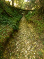
(9) Take the path on the right, which descends towards the south-east. Be careful: there are a few difficult, muddy sections. After passing a statue of the Virgin Mary, you’ll reach the junction of theGR®®121AandGRP®® du Ternois Sud footpaths. This junction is at the entrance to the village of Grigny.

(10) Turn left onto this path and follow the red and white markings heading east-northeast. At the end of the path, before entering the village, take the path on the left. You’ll rejoin the Chemin de la Muraille; turn right onto it and return to the original junction.

(1) Follow the same route as on the way out to return to the car park at the church in Auchy-lès-Hesdin (S/E).

Waypoints

  1. S/E : mi 0 - alt. 108 ft - The square in front of the church in Auchy-lès-Hesdin
  2. 1 : mi 0.5 - alt. 112 ft - Crossroads of the circular loop
  3. 2 : mi 2.03 - alt. 236 ft - D108 junction
  4. 3 : mi 2.43 - alt. 308 ft - Wamin Church Square
  5. 4 : mi 2.61 - alt. 269 ft - D108 junction
  6. 5 : mi 3.06 - alt. 308 ft - Edge of the forest
  7. 6 : mi 3.45 - alt. 308 ft - Route Forestière junction
  8. 7 : mi 3.7 - alt. 361 ft - Forest track
  9. 8 : mi 3.98 - alt. 367 ft - Forest track
  10. 9 : mi 4.38 - alt. 335 ft - Roundabout
  11. 10 : mi 4.94 - alt. 115 ft - GR121A and GRP Ternois
  12. S/E : mi 6.97 - alt. 105 ft - The square in front of the church in Auchy-lès-Hesdin

Notes

Hiking boots are essential and walking poles are recommended.
Don’t forget a small bottle of water and a snack.

Worth a visit

(S/E) Auchy-lès-Hesdin:
A beautiful church built between the13th and15th centuries, featuring an organ case dating from the late17th to early18th century.

(3) Wamin:
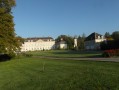
E17th-century castle, listed as a historic monument
(6) Ferme du Bois-Saint-Jean, a former commandery of the Order of Hospitallers, listed as a historic monument.

Always be cautious and plan ahead when you're outdoors. Visorando and the author of this route cannot be held responsible for any accidents occurring on this route.

The GR® and PR® markings are the intellectual property of the Fédération Française de Randonnée Pédestre.

Reviews and comments

4.7 / 5
Based on 1 review

Reliability of the description
5 / 5
Ease of following the route
5 / 5
Route interest
4 / 5
Yves D
Yves D

Overall rating : 4.7 / 5

Date of your route : Jul 22, 2024
Reliability of the description : ★★★★★ Very good
Ease of following the route : ★★★★★ Very good
Route interest : ★★★★☆ Good
Very busy route : No

A walk estimated to take 3 hours and 35 minutes, completed in 2 hours and 45 minutes at a leisurely pace...

Machine-translated

Other walks in the area

For more walks, use our search engine .

The GPS track and description are the property of this route's author. Please do not copy them without permission.