Country:
 City:
City:


Fressin, car park by the Planquette, at the junction of the Grand Rue and the Rue du Mont Hulain.
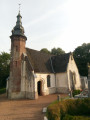
(S/E) Join the D 154 and follow it to the left. Walk past the church. Shortly afterwards, the street turns left and you’ll reach a Fork in the road. Turn left, cross the Planquette and reach another Fork in the road. Continue straight ahead to reach a right-angled bend.
(1) Leave the road and take the path opposite (note: it’s the one furthest to the right). After a steep climb, you’ll reach a wider track which you follow to the right. Ignore two turn-offs on the right and you’ll arrive at the edge of the woods (elevation 114).
(2) Take the path branching off to the left (connection arrow). This path runs alongside the woodland, then seems to disappear into the fields.
(3) Then turn right at the edge of the woodland, then very quickly left between two plots to join a wider track. Follow it to the right to reach the D 928 (elevation 113).
(4) Cross it carefully and take the small road opposite. 200 m further on, turn right towards Wamin. Ignore a turn-off to the left, pass a farm on your left and reach a chapel at the crossroads.
(5) Turn left onto Rue du Château and, 100 m further on, turn right onto Rue Noire. At the T-junction, turn left to reach the school. Continue straight on to join the D 108.
(6) Follow it briefly to the right, then turn left into Rue de Beuvry, which bends to the right and then becomes a grassy track that climbs up to the edge of the Forest of Hesdin. Carry on straight ahead through the forest towards the D 928 (noisier than an army of wind turbines). Just before the D-road, the path – which is a bit overgrown – turns left. A good hundred metres further on, you’ll reach a crossing point allowing you to cross the D 928.
(7) Cross it carefully and take the path through the undergrowth opposite. After about 200 metres, you’ll come to a path on the left. (9)
(8) Follow this path. You’ll reach a T-junction where you turn right onto a tarmac road to reach the “Carrefour du Commandeur”
(9) You then leave the tarmac and take the uphill path furthest to the left (narrow and unmarked).
You’ll reach a T-junction where you’ll join theGRP® Canche-Authie.
(10) Follow it to the right until you reach a tarmac road.
(11) Turn left onto the path which runs alongside the road for a while before joining it. At this point, you’ll join theGR®121. Follow it straight ahead. It crosses the forest, heading roughly west (see practical information). Just before reaching a T-junction, it’s worth leaving theGR® for a moment to take a signposted path on the right. A steep climb takes you to a tarmac road.
(12) Turn left, then immediately right. Head downhill (along a slightly worn path) to reach the edge of the woodland, where you turn right. You’ll soon reach a junction.
(13) Stay on theGR® which takes a hairpin bend to the left. A lovely path with views over the Planquette Valley. Ignore a track coming from the right, pass in front of some sheds and reach a small road near the Chapelle Ségard.
(14) Follow Rue de la Chapelle Ségard to the left until you reach the D 154. Follow it for a few metres to the right, then turn left into Rue du Stade. When you reach the stadium, walk alongside it and, at the end, turn left (picnic table) to cross the Planquette and reach a T-junction.
(15) Turn right onto the path that runs alongside the river. You’ll come to a small road. Follow it for about a hundred metres to the left, then turn right onto Rue d’Embry. Just after the junction with Rue des Carmes, look out for the path that branches off to the right.
(16) Take this path (marked in yellow), which joins a small road that you follow to the left. About a hundred metres further on, just past a farm, take the marked path branching off to the right. It descends to the river, crosses it via a footbridge and reaches Rue de la Rivière.
(17) Follow it to the left. Shortly afterwards, before the bend to the right, leave the tarmac and follow the path along the riverbank. You’ll reach Rue de la Mairie. Cross La Planquette and then follow the path leading off to the right on the opposite bank. You’ll come to a junction where you continue straight on until you reach a T-junction, near a farm.
(18) Turn right to join the D 154. Follow it to the left. At the junction with the D 108, carry on straight ahead, staying on the
D154. Ignore Rue du Château on the left, then Rue du Point du Jour on the right. A good hundred metres past the latter, a path branches off to the left.
(19) Follow this path down to La Planquette, then cross it before heading back up to Wambercourt church.
(20) Turn right to rejoin the D154. Follow it to the left. Ignore Rue de Lebiez on the left and continue until you reach a Fork in the road.
(21) Turn left onto Rue de Sains, which climbs up to the Bois de Fressin. At the edge of the woods (information sign on the right), ignore the path coming from the left and carry on straight ahead for about fifty metres.
(22) Turn right to enter the woods (large metal gate). You’ll come to a wide, uphill path. You then have a choice:
- The easiest option is to take this path: the gradient is steady and not too difficult. At the top, turn right to continue along the edge of the woodland (PR® and mountain bike markings).
- For the more adventurous (this is the route I’ve marked on the map), look for mountain bike markings on a tree at the foot of the slope, indicating a turn to the right (fairly visible in September 2023). Follow them to reach a narrow but clearly defined track along the edge of the woodland (this is the old signposted route). This track is very quickly blocked by two fallen trees, which you go round on the right (a path has formed there) to rejoin the track. After another 300 metres or so on level ground, you’ll come to a steep, spectacular climb. It’s blocked by two tree trunks (one in the middle and the other at the top), which you can get past without too much difficulty. At the top, head right to stay along the edge of the woodland.
The path is uneven but in good condition (the GPS route differs slightly from the IGN trail). You’ll reach a junction of short-distance hiking trails (signposted).
(23) Head straight ahead, go through the gate and join the D 154. Follow it for about a hundred metres to the right and, at the Fork in the road, turn left onto Rue du Godiamont. Cross La Planquette and reach a Fork in the road.
(24) Turn left. At the next Fork in the road, keep to the right. Shortly afterwards, the path turns right. Leave it here and follow the path leading straight ahead. It turns right and joins the wide path you took at the start. Follow it for 50 metres to the left and look out for the path branching off to the left.
(25) Take this path, which descends to Rue d’Enfer. Follow it briefly to the right, then turn left and continue downhill to La Planquette. Shortly afterwards, you’ll reach the D 154 opposite the ruined castle.
Turn right. 150 metres further on, turn left onto Rue du Bois and continue to a junction.
(26) Turn right onto Rue du Paradis (Phew! … After ‘Enfer’). At the end, turn right and, at the junction, take Rue de l’Avocat opposite. This leads to the D 155, which you follow to the right to return to the car park (S/E).
(E) Fressin, car park on the banks of the Planquette, at the junction of the Grand Rue and Rue du Mont Hulain.

 Visorando Member
 Moderate