Country:
 City:
City:


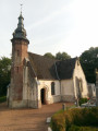
Start from the square opposite Créquy church.
(S/E) Opposite the church, head left. Just past the church, take the street on the right and continue until you reach a Fork in the road. Take the right-hand fork. Follow this long path, loosely marked in yellow, through the Bois des Trois Treillages to a T-junction at the edge of the woods.
(1) Turn right, then immediately left to reach the edge of the Bois de Créquy at the Carrefour des Quatre Sapins.
(2) Turn left between the two woods. Ignore a path coming from the left and, continuing to follow the edge of the woods, you’ll come close to a wide path.
(3) Turn right into the woodland and you’ll immediately reach a junction. Enter the woodland via the path on the right, which has no gate. You’ll come to a wide path.
(4) Cross this wide path to take the track opposite, which descends northwards. After a left-hand bend, you’ll reach a large, wide track.
(5) Follow it to the left for about 1.5 km. Towards the end, a plot on the left has been cleared and replanted.
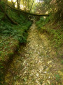
(6) At the end, turn left (the path was in very poor condition in August 2021) and follow the track carefully as it descends to the bottom of the valley. You’ll reach the Sources du Surgeon.
- If there isn’t too much water, walk through the stream. The bed is stony, but with good footwear this isn’t a problem. You’ll reach a large pool. You can go round it:
- either to the left (a very narrow passage, but it’s passable),
- or by climbing the slope on the right and following the edge on the left.
You’ll come to a wide path marked by a signpost.
- If the stream is very full, head into the field on the right – you’ll easily find a gap in the hedge – and follow the edge of the field on the left. At the end of the field, you’ll find a signpost. (It seems the marked path runs along the left bank, but it really isn’t very inviting!)
After the marker post, carry on straight ahead, following the stream.
Ignore the wide path branching off to the right and head for the edge of the woodland after a section that may be (very) wet (sign with hiking arrows).
(7) Carry on straight ahead until you reach a junction.
(8) Turn left and, just after the cemetery, you’ll reach a T-junction.
(9) Take the road on the left, which becomes a track, and head uphill to reach a junction.
(10) Turn right and head downhill to join the D 130.
(11) Follow it to the left. Ignore a path on the left (cross). Cross the Créquoise and, just after, you’ll come to a Fork in the road.
(12) Leave the D130 and turn left onto the Chemin des Prés. Join a small road and follow it straight ahead. Cross the Créquoise again and reach the D130.
(13) Follow it to the left and, 200 m further on, look out for the path that winds sharply to the left.
(14) Follow this path (Chemin de la Cavée) until you reach the entrance to a property. Then turn right and continue along a rough track. Ignore a path on the right (with a footbridge) and head for Torcy Cemetery.
The church is very beautiful, with a bulbous bell tower typically found in Savoie. I’d encourage you to walk through the cemetery both ways; it’s even prettier from the other side.
Join a road.
(15) Follow it to the right until you reach the D130. Cross it carefully and, opposite, slightly to the left, take Rue Blanche. A lovely climb takes you up Mont Louis. At the top of the hill, you’ll reach a four-way junction (roads and paths) at an elevation of 144.
(16) Turn left onto a 1 km trail with panoramic views of the Créquoise Valley and, in the distance, the Bois de Créquy. You’ll reach a T-junction.
(17) Turn left onto a lovely path which can be a bit slippery in wet weather (a descent with flint and limestone slabs). You’ll rejoin the D130. Follow it carefully to the left and, after 100 m, turn right to cross the Créquoise via a small footbridge. Immediately afterwards, turn right and continue straight on to reach the square opposite Créquy Church (S/E).

 Visorando Member
 Difficult