POULIN Gérard

 Visorando Member
 Moderator
 Premium user
Sign up:
Published route(s)
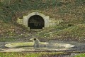
 On the Forterre side, the Moulin Buteau and the Source de la Pisserote
 4.20 mi
 +210 ft
 -190 ft
 2h 05
2h 05
 Easy
Easy
 Departure from Sainte-Colombe-sur-Loing (Yonne)
A historical and cultural route on the border between Puisaye and Forterre, with some beautiful views.
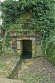
The source of the Loing
 5.17 mi
+348 ft
-328 ft
2h 40
Easy
Departure from Sainte-Colombe-sur-Loing (Yonne)
5.17 mi
+348 ft
-328 ft
2h 40
Easy
Departure from Sainte-Colombe-sur-Loing (Yonne)
Discover the sources of the Seine catchment area, wash houses and scenic viewpoints.
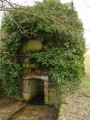
Springs, fountains and wash houses
 9.43 mi
+568 ft
-587 ft
4h 50
9.43 mi
+568 ft
-587 ft
4h 50
 Average
Departure from Sainte-Colombe-sur-Loing (Yonne)
Average
Departure from Sainte-Colombe-sur-Loing (Yonne)
Marked trail No. 7.A hike focusing on springs and wash houses. All these springs feed the Paris Basin via the water table and the Seine via the Loing. Superbly well-marked route (No. 7) with no damage to the natural environment (no more paint on trees, monuments or houses). This route can be done on horseback or by mountain bike (in the opposite direction if possible).
The Clapiers tour from La Molière
 5.11 mi
+1,631 ft
-1,611 ft
3h 45
Average
Departure from Engins (Isère)
5.11 mi
+1,631 ft
-1,611 ft
3h 45
Average
Departure from Engins (Isère)
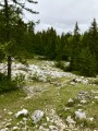
In Vercors, discover sharp limestone pavements, wildlife and flora. Hike from La Molière towards the east via Le Sornin (medium mountain range).
The Montagne des Alouettes as seen from Etais-la-Sauvin
 8.33 mi
+492 ft
-499 ft
4h 15
Average
Departure from Étais-la-Sauvin (Yonne)
8.33 mi
+492 ft
-499 ft
4h 15
Average
Departure from Étais-la-Sauvin (Yonne)
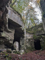
A very pleasant walk in all seasons across the plain and through the woods, climbing to the region’s highest point (363 m). Along the ancient Roman road, discover the old underground limestone quarries, which were used to build the region’s houses and bridges. Magnificent panoramic views stretch out on either side of this road, which once linked Auxerre to Nevers, with Entrains-sur-Nohain as its main junction.
Moutiers en Puisaye and its ponds
 6.93 mi
+394 ft
-387 ft
3h 30
Average
Departure from Moutiers-en-Puisaye (Yonne)
6.93 mi
+394 ft
-387 ft
3h 30
Average
Departure from Moutiers-en-Puisaye (Yonne)
From this old pottery village, discover the ponds and small paths that make Puisaye so charming. If you are keen on wildlife or landscape photography, you will be delighted. If you are discreet, you will be able to see many varieties of ducks on the ponds, as well as herons and egrets. Sometimes you may be surprised by the passage of deer or roe deer and even nutria along the Loing.
From Pas de l'Ours to La Molière from Autrans
 7.69 mi
+2,359 ft
-2,359 ft
5h 35
Average
Departure from Autrans (Isère)
7.69 mi
+2,359 ft
-2,359 ft
5h 35
Average
Departure from Autrans (Isère)
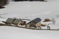
From the hamlet of Le Truc at the north-eastern entrance to the village of Autrans, you can access La Molière mountain and discover the Isère valley and the city of Grenoble through a gap in the mountain. Higher up, you will see all the mountains surrounding Grenoble and its region. Don't look for the "pas" (step) of the bear as a paw print because, here as is often the case in the mountains, "pas" is a diminutive of "passage" (passage).
From the Côte de Labert to the bell tower
 4.14 mi
+312 ft
-240 ft
2h 10
Easy
Departure from Sainte-Colombe-sur-Loing (Yonne)
4.14 mi
+312 ft
-240 ft
2h 10
Easy
Departure from Sainte-Colombe-sur-Loing (Yonne)
From the village, this path follows part of the ridges of the hill separating the two natural regions of Puisaye to the west and Forterre to the east.
Between the Fossés Noirs and the Pierre Noire
 4.30 mi
+262 ft
-194 ft
2h 10
Easy
Departure from Thury (Yonne) (Yonne)
4.30 mi
+262 ft
-194 ft
2h 10
Easy
Departure from Thury (Yonne) (Yonne)
Starting from St Julien church, follow the paths to reach the Moulin de Hausse Côte.
View of the Forterre
 5.12 mi
+486 ft
-495 ft
2h 45
Easy
Departure from Treigny (Yonne)
5.12 mi
+486 ft
-495 ft
2h 45
Easy
Departure from Treigny (Yonne)
Marked route No. 22.
Passing by the cathedral of Puisaye, a tour of the heights to discover vast horizons, alternating landscapes of large-scale farming and forests, dotted with springs. And then, Perreuse, a magnificent village with a rich history.
La Croix Saint-Jean
 3.05 mi
+223 ft
-223 ft
1h 35
Easy
Departure from Treigny (Yonne)
3.05 mi
+223 ft
-223 ft
1h 35
Easy
Departure from Treigny (Yonne)
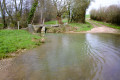
Marked route No. 21.A very pretty route for a short family hike, discovering the Vrille at the very beginning of the route with a ford crossing on the Pont des Canards, then, after the Croix Saint-Jean, another crossing on a stone bridge (the springs are a few hundred metres away). On the way back, you pass in front of the Saint-Symphorien church.
Battle Trail
 2.28 mi
+112 ft
-112 ft
1h 10
Easy
Departure from Fontenoy (Yonne) (Yonne)
2.28 mi
+112 ft
-112 ft
1h 10
Easy
Departure from Fontenoy (Yonne) (Yonne)
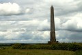
Walk in the footsteps of Charlemagne’s grandsons and discover the battlefield of Fontenoy, where Charlemagne’s empire was divided: this is what awaits you on this short historical trail.
The Sablon Trail
 4.59 mi
+266 ft
-289 ft
2h 20
Easy
Departure from Levis (Yonne)
4.59 mi
+266 ft
-289 ft
2h 20
Easy
Departure from Levis (Yonne)
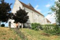
In days gone by, this path was used by the children of Sablon to walk to the local school in Levis.
You can also explore part of the battlefield at the site of the Battle of Fontenoy.
On the wood floaters' trail
 4.60 mi
+256 ft
-246 ft
2h 20
Easy
Departure from Clamecy (Nièvre) (Nièvre)
4.60 mi
+256 ft
-246 ft
2h 20
Easy
Departure from Clamecy (Nièvre) (Nièvre)
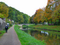
A tour between town and country in the land of the wood floaters.
Les sources - The springs
 6.29 mi
+367 ft
-374 ft
3h 15
Easy
Departure from Lainsecq (Yonne)
6.29 mi
+367 ft
-374 ft
3h 15
Easy
Departure from Lainsecq (Yonne)
Marked hike N°8.
You will see no less than 8 fountains and 6 wash-houses on this rather easy hike, ideal for family walks. A few picnics spots are available here and there, to take a break and enjoy a relaxing moment (Fountain of the Moon, of the Pisserotte .....) Even though there are some hills along the way, it is a very pleasant walk with a lot of historical heritage spots to be discovered.
Also good for mountain biking.
The Moutiers pond
 8.43 mi
+423 ft
-413 ft
4h 15
Average
Departure from Moutiers-en-Puisaye (Yonne)
8.43 mi
+423 ft
-413 ft
4h 15
Average
Departure from Moutiers-en-Puisaye (Yonne)
Marked trail No. 3.From the church with its magnificent murals, pass the Gué Ricart, discover the Moutiers pond via the Marseillaise, then the undergrowth before reaching Saint-Sauveur, Pays de Colette and her birthplace.
The Woods of Legends
 7.14 mi
+417 ft
-436 ft
3h 40
Average
Departure from Treigny (Yonne)
7.14 mi
+417 ft
-436 ft
3h 40
Average
Departure from Treigny (Yonne)
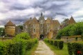
A trail rich in heritage, featuring traditional pottery, Ratilly Castle – a former water tower now converted into an observatory and exhibition centre – and, of course, the sunken paths lined with hedges.
The wash houses
 13.88 mi
+974 ft
-945 ft
7h 15
Average
Departure from Thury (Yonne) (Yonne)
13.88 mi
+974 ft
-945 ft
7h 15
Average
Departure from Thury (Yonne) (Yonne)
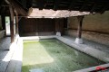
Marked route No. 9.From wash house to wash house, passing close to old underground limestone quarries and ancient Neolithic and Palaeolithic sites, this route circles the commune. At each crossroads, you can head into the village centre. There are beautiful views along much of the route.Please note: this route is reserved for walkers. For mountain bikers, hybrid cyclists or horse riders, this route is designed for you.
From the Col de Rousset to the But de l'Aiglette
 6.14 mi
+1,276 ft
-1,293 ft
3h 55
Average
Departure from Chamaloc (Drôme)
6.14 mi
+1,276 ft
-1,293 ft
3h 55
Average
Departure from Chamaloc (Drôme)
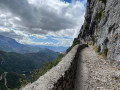
From the Col de Rousset, a panoramic view of the vultures.
From the But de l'Aiglette, close-up view of these beautiful creatures.
Vanneau Mill Trail
 4.77 mi
+207 ft
-194 ft
2h 20
Easy
Departure from Saints (Yonne) (Yonne)
4.77 mi
+207 ft
-194 ft
2h 20
Easy
Departure from Saints (Yonne) (Yonne)
Marked walk No. 18.
Set off along the paths to discover a farm of yesteryear. Explore a botanical trail, a heritage orchard and a museum of agricultural tools.
Water and Woods Hiking Trail
 8.68 mi
+535 ft
-554 ft
4h 25
Average
Departure from Treigny (Yonne)
8.68 mi
+535 ft
-554 ft
4h 25
Average
Departure from Treigny (Yonne)
Marked hike N°24.
Leaving from the fairground, you will walk along paths that have a mysterious past and are steeped in legends.
Guédelon’s Path
 6.07 mi
+269 ft
-256 ft
3h 00
Easy
Departure from Treigny (Yonne)
6.07 mi
+269 ft
-256 ft
3h 00
Easy
Departure from Treigny (Yonne)
Market circuit n°23.
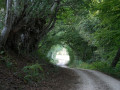
In an hour walking, rendezvous in the 13th century, on a legendary path and meet the middle-age castles builders.
From dyke to dyke in Champoulet
 9.65 mi
+33 ft
-33 ft
4h 30
Average
Departure from Breteau (Loiret)
9.65 mi
+33 ft
-33 ft
4h 30
Average
Departure from Breteau (Loiret)
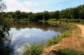
The route goes from pond to pond around the village of Champoulet. There is wildlife to discover.
Colette Trail
 3.69 mi
+292 ft
-318 ft
1h 55
Easy
Departure from Saint-Sauveur-en-Puisaye (Yonne)
3.69 mi
+292 ft
-318 ft
1h 55
Easy
Departure from Saint-Sauveur-en-Puisaye (Yonne)
Marked Trail No. 1.This trail, dedicated to Colette, was opened in 1993 by pupils from the Collège Colette in Saint-Sauveur-en-Puisaye.All along this path, everything evokes the stories of this writer, who was born in Saint-Sauveur-en-Puisaye in 1873. She described her native region so vividly – even though she used different names for the villages and characters – that every nook and cranny exudes the spirit of her literature.Saint-Sauveur-en-Puisaye is listed among the ‘Cités de caractères de Bourgogne – Franche-Comté’ villages.
Chemin de Bel-Air
 6.28 mi
+144 ft
-144 ft
3h 00
Easy
Departure from Étais-la-Sauvin (Yonne)
6.28 mi
+144 ft
-144 ft
3h 00
Easy
Departure from Étais-la-Sauvin (Yonne)
Marked walk No. 26.
A lovely route between the Yonne and Nièvre departments, taking in farmland and wooded areas.
This route has been surveyed and marked out by members of the local walking club.
It can be tackled on horseback or by mountain bike, but in the opposite direction.
Chemin des Plots
 4.05 mi
+121 ft
-125 ft
2h 00
Easy
Departure from Étais-la-Sauvin (Yonne)
4.05 mi
+121 ft
-125 ft
2h 00
Easy
Departure from Étais-la-Sauvin (Yonne)
Marked walk No. 27.
A short, family-friendly walking or mountain-biking route that is enjoyable and accessible all year round.
This route has been surveyed and marked out by members of the local association A Travers Champs. It is fully signposted with yellow signs, black lettering and yellow arrows on a red background.
Chemin du Puits
 4.62 mi
+102 ft
-102 ft
2h 15
Easy
Departure from Étais-la-Sauvin (Yonne)
4.62 mi
+102 ft
-102 ft
2h 15
Easy
Departure from Étais-la-Sauvin (Yonne)
Marked trail No. 29.
A pleasant walk or mountain bike ride in all weathers.
This route has been surveyed and marked out by members of the local association À Travers Champs. It is fully signposted with yellow signs, black lettering and yellow arrows on a red background.
From Thury to Lainsecq via the Montagne des Alouettes
 9.19 mi
+699 ft
-617 ft
4h 50
Average
Departure from Thury (Yonne) (Yonne)
9.19 mi
+699 ft
-617 ft
4h 50
Average
Departure from Thury (Yonne) (Yonne)
Pass by the Moulery wash house and the Roman road with panoramic views of Puisaye, Forterre, Frétoy Forest and Druyes Castle.
Around the village of Sougères-en-Puisaye
 4.64 mi
+305 ft
-295 ft
2h 25
Easy
Departure from Sougères-en-Puisaye (Yonne)
4.64 mi
+305 ft
-295 ft
2h 25
Easy
Departure from Sougères-en-Puisaye (Yonne)
Explore the hamlets on the outskirts of the village of Sougères-en-Puisaye.
The Marquise du Deffand Trail
 7.04 mi
+325 ft
-322 ft
3h 30
Average
Departure from Saints (Yonne) (Yonne)
7.04 mi
+325 ft
-322 ft
3h 30
Average
Departure from Saints (Yonne) (Yonne)
Marked walk No. 20.A historic route featuring, close to the start, the Cross of Saint-Prix (martyred in 274), the village of Le Deffand where the Marquise du Deffand stayed inthe 18th century, and the monument to Alfred Saison – a republican activist – who fought in 1852 against Louis Napoleon Bonaparte’s coup d’état of 2 December 1851.
The Moulin de Hausse Côte Trail
 7.04 mi
+364 ft
-364 ft
3h 35
Average
Departure from Saints (Yonne) (Yonne)
7.04 mi
+364 ft
-364 ft
3h 35
Average
Departure from Saints (Yonne) (Yonne)
Marked walk No. 19.
Winding through the lush green landscapes of the woods and meadows of Puisaye and the cultivated fields of Forterre, this trail passes from one natural region to another and offers beautiful panoramic views from the Hausse Côte hill.
Les Quatre Arpents
 4.03 mi
+295 ft
-121 ft
2h 05
Easy
Departure from Sainpuits (Yonne)
4.03 mi
+295 ft
-121 ft
2h 05
Easy
Departure from Sainpuits (Yonne)
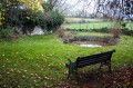
A pleasant route in all weathers, with plenty of springs at the end of the route. This route partly follows the path once taken by the ox-herders to drive the oxen from the Morvan to Paris.
 L'Orme du Pont from Moutiers-en-Puisaye
 5.69 mi
+371 ft
-351 ft
1 hr
Easy
Departure from Moutiers-en-Puisaye (Yonne)
5.69 mi
+371 ft
-351 ft
1 hr
Easy
Departure from Moutiers-en-Puisaye (Yonne)
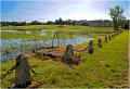
An all-season trail in this region of Puisaye amid hedges (bouchures), heritage, and legends.
Ratilly Castle and the headwaters of the Vrille
 6.95 mi
+558 ft
-538 ft
3h 40
Average
Departure from Treigny (Yonne)
6.95 mi
+558 ft
-538 ft
3h 40
Average
Departure from Treigny (Yonne)
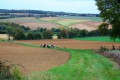
Local heritage and springs make this a delightful route.
Three Lakes Route
7.45 mi
+338 ft
-344 ft
3h 45
Average
Departure from Moutiers-en-Puisaye (Yonne)
Marked trail No. 44.Through woods and farmland, passing by ponds, discover the environments where the earth is shaped into artistic creations and pottery.
On the heights of La Pisserote
 6.65 mi
+502 ft
-492 ft
3h 30
Average
Departure from Sainte-Colombe-sur-Loing (Yonne)
6.65 mi
+502 ft
-492 ft
3h 30
Average
Departure from Sainte-Colombe-sur-Loing (Yonne)
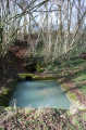
Suitable for walking, mountain biking or horse riding on the border between the Puisaye and Forterre regions. Beautiful heritage sites and interesting views.
 The wash houses and thatched roofs of Thury by mountain bike
13.72 mi
+1,004 ft
-991 ft
2.5 hrs
Average
Departure from Thury (Yonne) (Yonne)
A mountain bike route for hiking enthusiasts, featuring natural and built heritage. A real treat! But do stay safe!
From the Church to Le Sully via the Cèdres de la Lavière
 8.21 mi
+404 ft
-417 ft
4h 05
Average
Departure from Sougères-en-Puisaye (Yonne)
8.21 mi
+404 ft
-417 ft
4h 05
Average
Departure from Sougères-en-Puisaye (Yonne)
Marked trail No. 10.
Discover the local heritage: ponds and old drinking troughs, crosses and calvaries, the Sully lime tree, and the cedars of La Lavière. Beautiful views of varied, rolling countryside punctuate this route, the length of which can be adapted to suit.
Although classified as a walking route, this route is also one of the most beautiful routes for mountain biking, hybrid cycling and horse riding.
The pond and heritage of Moutiers-en-Puisaye
 5.71 mi
+217 ft
-233 ft
2h 50
Easy
Departure from Moutiers-en-Puisaye (Yonne)
5.71 mi
+217 ft
-233 ft
2h 50
Easy
Departure from Moutiers-en-Puisaye (Yonne)
Starting from the village of Moutiers-en-Puisaye, cross the Loing, pass through woods, enjoy a beautiful view of the ruins of the old abbey and the pond, whilst discovering the local heritage.
Pollarded trees and Puisaye cedars
 6.40 mi
+459 ft
-472 ft
3h 20
Average
Departure from Saint-Sauveur-en-Puisaye (Yonne)
6.40 mi
+459 ft
-472 ft
3h 20
Average
Departure from Saint-Sauveur-en-Puisaye (Yonne)
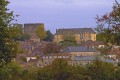
Another way to explore Colette’s homeland: follow the paths shaped by agriculture, the work of the hedges (landmarkers) and the local heritage.
Walk in Sainpuits in the Forterre valleys towards the Roman road
 11.38 mi
+479 ft
-476 ft
5h 40
Average
Departure from Sainpuits (Yonne)
11.38 mi
+479 ft
-476 ft
5h 40
Average
Departure from Sainpuits (Yonne)
Marked trail No. 5.
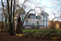
At the crossroads of Puisaye, Forterre and the banks of the Nohain, this village invites you to discover its heritage and landscapes.
Sentier de la Folie
 7.28 mi
+289 ft
-262 ft
3h 35
Average
Departure from Saint-Sauveur-en-Puisaye (Yonne)
7.28 mi
+289 ft
-262 ft
3h 35
Average
Departure from Saint-Sauveur-en-Puisaye (Yonne)
Marked hike N°2.
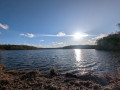
A hike in the heart of the birthplace of Colette. Through woods and passing by ponds, often described in her work.
The Test-Milon hill
5.75 mi
+390 ft
-367 ft
3h 00
Average
Departure from Lain (Yonne)
Marked walk No. 59.
Route from Lain around Test-Milon, including a section along the Roman road.
Between Levis and Fontenoy: the Battle sites
 7.77 mi
+505 ft
-486 ft
4h 00
Average
Departure from Levis (Yonne)
7.77 mi
+505 ft
-486 ft
4h 00
Average
Departure from Levis (Yonne)
Marked trail No. 43.
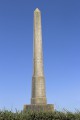
A historical journey back to the time of Charlemagne's succession. His grandsons fought over the kingdom. This division was settled by a battle and... discover the places and history of this epic story.
L'étang de Moutiers depuis Saint-Sauveur-en-Puisaye
6.01 mi
+253 ft
-269 ft
3h 00
Easy
Departure from Saint-Sauveur-en-Puisaye (Yonne)
From Colette's birthplace, discover the greenways, the village of Moutiers and the Moutiers pond, where a few water chestnuts still float.Saint-Sauveur-en-Puisaye is listed as one of the "Cités de caractères de Bourgogne - Franche-Comté" (villages of character in Burgundy-Franche-Comté).
La Marlée wash house, orientation board and source of the Loing
5.93 mi
+364 ft
-341 ft
3h 05
Easy
Departure from Treigny (Yonne)
From the hilltop village of Perreuse (in the commune of Treigny), this walk will have you dreaming of the Atlantic or the English Channel. The waters of the two springs on this route, though so close to one another, will only mix once they reach the ocean!
Entrains - Ouanne via the Roman road
15.69 mi
+1,234 ft
-1,033 ft
2 hrs
Average
Departure from Entrains-sur-Nohain (Nièvre)
Route along part of the Roman road linking Bourges to Auxerre, starting from Entrains-sur-Nohain (formerly Intaranum in Gallo-Roman times) in the Nièvre department to Ouanne (Odoana) in the Yonne department.From the vast expanses of woods and forests and the large plains of cultivated land, passing through two of the highest points in this region (367m and 368m), discover new spaces, views, fauna and flora on these limestone plateaus and hills.
Fougilet wash house and leisure trail
4.21 mi
+226 ft
-249 ft
2h 10
Easy
Departure from Sougères-en-Puisaye (Yonne)
Route closed by municipal order of 9 July 2021.
A short family walk featuring a few pieces of play equipment along the leisure trail. A really enjoyable outing for everyone.